
| Memorials | : | 7 |
| Location | : | Beloit, Mitchell County, USA |
| Coordinate | : | 39.3574982, -98.0594025 |
frequently asked questions (FAQ):
-
Where is Shiloh Cemetery?
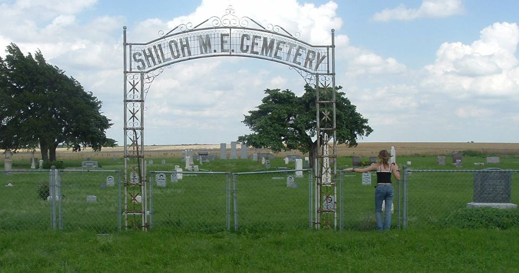
Shiloh Cemetery is located at 1051 330 Road Beloit, Mitchell County ,Kansas ,USA.
-
Shiloh Cemetery cemetery's updated grave count on graveviews.com?
5 memorials
-
Where are the coordinates of the Shiloh Cemetery?
Latitude: 39.3574982
Longitude: -98.0594025

Nearby Cemetories:
1. New Hope Cemetery
Beloit, Mitchell County, USA
Coordinate: 39.3502998, -98.0875015
2. Green Mound Cemetery
Asherville, Mitchell County, USA
Coordinate: 39.3203011, -97.9858017
3. Pleasant View Cemetery
Beloit, Mitchell County, USA
Coordinate: 39.3360939, -98.1519852
4. Coursen Grove Cemetery
Simpson, Mitchell County, USA
Coordinate: 39.3060989, -97.9792023
5. Bell-Bogardus Cemetery
Asherville, Mitchell County, USA
Coordinate: 39.4242410, -97.9919970
6. Simpson Cemetery
Simpson, Mitchell County, USA
Coordinate: 39.3633003, -97.9471970
7. Asherville Cemetery
Asherville, Mitchell County, USA
Coordinate: 39.4205000, -97.9672900
8. Saltville Cemetery
Beloit, Mitchell County, USA
Coordinate: 39.2695389, -98.1082611
9. Smith Cemetery
Asherville, Mitchell County, USA
Coordinate: 39.4516690, -98.0098850
10. Saint Johns Cemetery
Beloit, Mitchell County, USA
Coordinate: 39.4667015, -98.1018982
11. Elmwood Cemetery
Beloit, Mitchell County, USA
Coordinate: 39.4693985, -98.1014023
12. Hopewell Cemetery
Beloit, Mitchell County, USA
Coordinate: 39.3800011, -98.2097015
13. Beloit Industrial School Cemetery
Beloit, Mitchell County, USA
Coordinate: 39.4755000, -98.1105810
14. Pleasant Valley Cemetery
Beloit, Mitchell County, USA
Coordinate: 39.4555900, -98.1722200
15. McBride Cemetery
Beloit, Mitchell County, USA
Coordinate: 39.4808006, -97.9907990
16. Elmira Cemetery
Beloit, Mitchell County, USA
Coordinate: 39.3498640, -98.2422790
17. West Asher Cemetery
Scottsville, Mitchell County, USA
Coordinate: 39.4815000, -97.9661600
18. Milo Cemetery
Barnard, Lincoln County, USA
Coordinate: 39.2005997, -98.0160980
19. Honey Creek Cemetery
Solomon Rapids, Mitchell County, USA
Coordinate: 39.4328003, -98.2517014
20. Glasco Cemetery
Glasco, Cloud County, USA
Coordinate: 39.3574000, -97.8265000
21. Saint Marys Catholic Cemetery
Glasco, Cloud County, USA
Coordinate: 39.3574000, -97.8245000
22. Bohemian National Cemetery
Ada, Ottawa County, USA
Coordinate: 39.2193870, -97.9054030
23. Union Valley Cemetery
Barnard, Lincoln County, USA
Coordinate: 39.1749992, -98.0980988
24. Round Springs Cemetery
Round Springs Township, Mitchell County, USA
Coordinate: 39.2485352, -98.2560043