
| Memorials | : | 0 |
| Location | : | Alliance, Pamlico County, USA |
| Coordinate | : | 35.1449100, -76.8141900 |
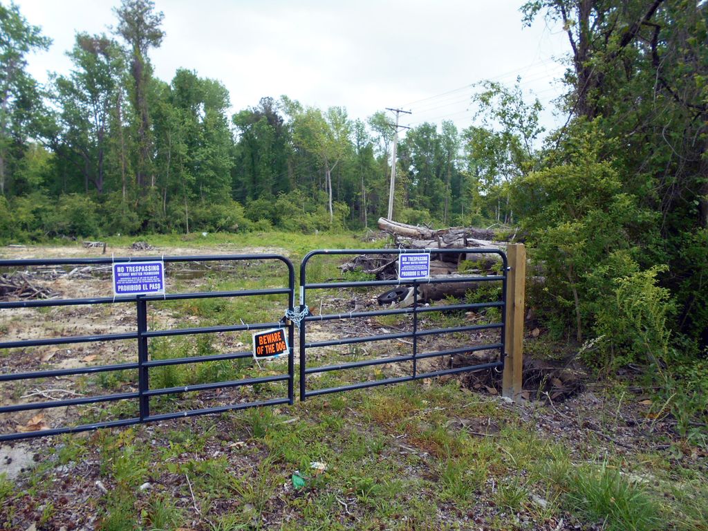
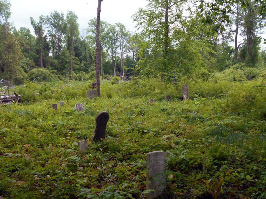
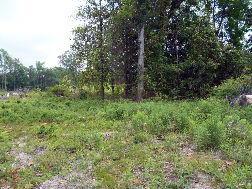
| Description | : | This cemetery is located on Courtland Drive, right off of Main St (old Hwy 55) at Riggs Rd. At the intersection, turn right onto Courtland Drive. Cemetery will be on the left side at the beginning of the curve. Courtland Dr turns into Old Bay River Rd. which continues to Hwy 306 (Point Rd). At this point, if you turn right, it's a short distance to Hwy 55. The cemetery is old and not well-maintained. The cemetery is on private property, marked w/"No Trespassing" signs. Permission from owner is required. The area of the West Cemetery was part of the original West farm. Many... Read More |
frequently asked questions (FAQ):
-
Where is West Cemetery?
West Cemetery is located at Courtland Rd/Old Bay River Road Alliance, Pamlico County ,North Carolina ,USA.
-
West Cemetery cemetery's updated grave count on graveviews.com?
0 memorials
-
Where are the coordinates of the West Cemetery?
Latitude: 35.1449100
Longitude: -76.8141900
Nearby Cemetories:
1. James Arthur Tingle Family Cemetery
Alliance, Pamlico County, USA
Coordinate: 35.1452600, -76.8121500
2. Campen Cemetery
Alliance, Pamlico County, USA
Coordinate: 35.1452300, -76.8115900
3. McCotter Cemetery
Alliance, Pamlico County, USA
Coordinate: 35.1460700, -76.8119400
4. Rice Family Cemetery
Grantsboro, Pamlico County, USA
Coordinate: 35.1376000, -76.8222200
5. Dixon Cemetery
Alliance, Pamlico County, USA
Coordinate: 35.1377910, -76.8243460
6. Tyndall Cemetery
Alliance, Pamlico County, USA
Coordinate: 35.1397900, -76.8007200
7. Alliance Holy Church of God Cemetery
Alliance, Pamlico County, USA
Coordinate: 35.1545760, -76.8047310
8. Cowell Cemetery
Alliance, Pamlico County, USA
Coordinate: 35.1400850, -76.7965680
9. Williams Family Plot
Alliance, Pamlico County, USA
Coordinate: 35.1436810, -76.7900450
10. Grantsboro Cemetery
Grantsboro, Pamlico County, USA
Coordinate: 35.1361400, -76.8412900
11. West Branch Missionary Baptist Church Cemetery
Bayboro, Pamlico County, USA
Coordinate: 35.1429440, -76.7837170
12. Paul Cemetery
Silver Hill, Pamlico County, USA
Coordinate: 35.1676520, -76.8429820
13. Potter's Field
Bayboro, Pamlico County, USA
Coordinate: 35.1441470, -76.7693640
14. Miller Cemetery #2
Bayboro, Pamlico County, USA
Coordinate: 35.1442130, -76.7693600
15. Masonic Cemetery
Bayboro, Pamlico County, USA
Coordinate: 35.1445000, -76.7690300
16. Miller Cemetery #1
Bayboro, Pamlico County, USA
Coordinate: 35.1404900, -76.7692200
17. Dixon #1 Cahoon Cemetery
Grantsboro, Pamlico County, USA
Coordinate: 35.1124200, -76.8386700
18. Saint Mark A.M.E. Zion Church Cemetery
Bayboro, Pamlico County, USA
Coordinate: 35.1540430, -76.7679270
19. Greenhill Missionary Baptist Church Cemetery
Bayboro, Pamlico County, USA
Coordinate: 35.1500960, -76.7655210
20. Bell Family Cemetery
Bayboro, Pamlico County, USA
Coordinate: 35.1494600, -76.7649500
21. Sawyer Family Cemetery
Bayboro, Pamlico County, USA
Coordinate: 35.1590400, -76.7552300
22. Gatlin Cemetery
Stonewall, Pamlico County, USA
Coordinate: 35.1373700, -76.7529200
23. Jewell Family Cemetery
Bayboro, Pamlico County, USA
Coordinate: 35.1514500, -76.7515000
24. Lane Cemetery
Stonewall, Pamlico County, USA
Coordinate: 35.1385570, -76.7506210