| Memorials | : | 0 |
| Location | : | West Hill, East Devon District, England |
| Coordinate | : | 50.7383140, -3.3180440 |
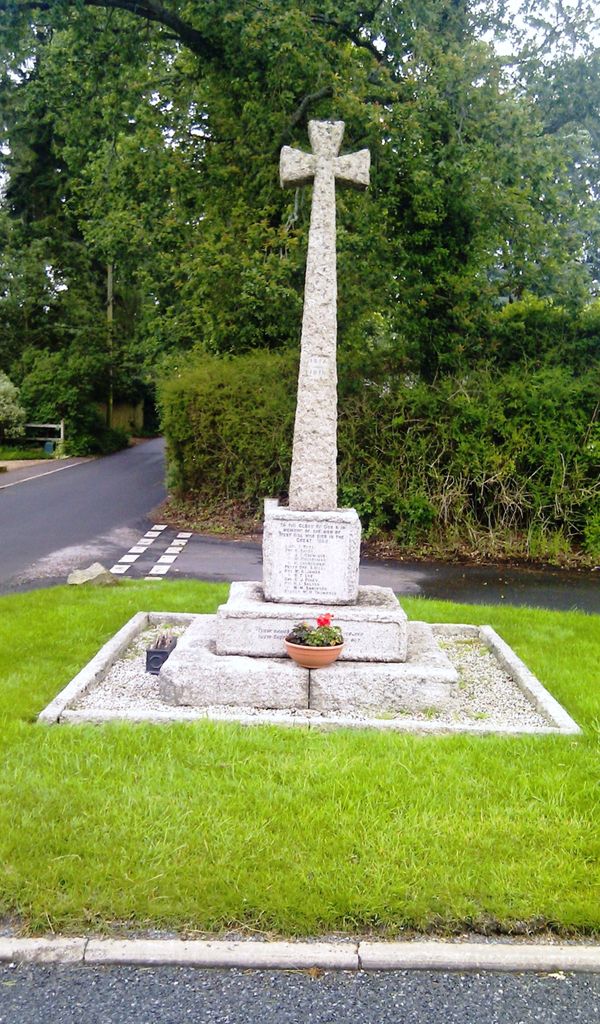
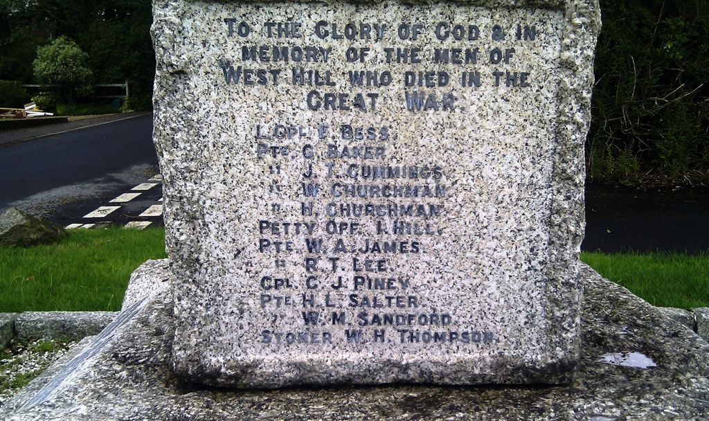
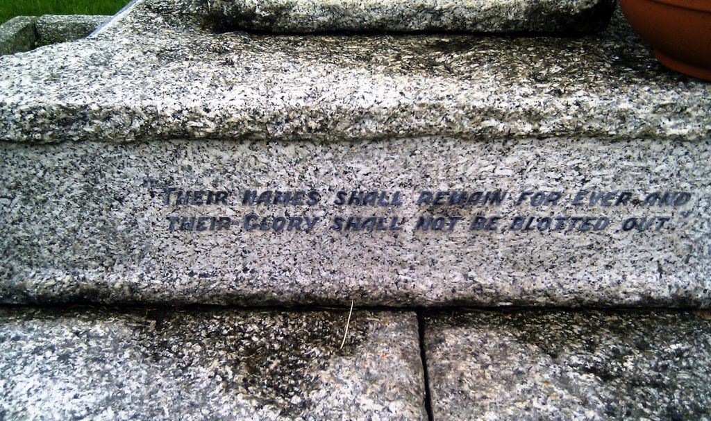
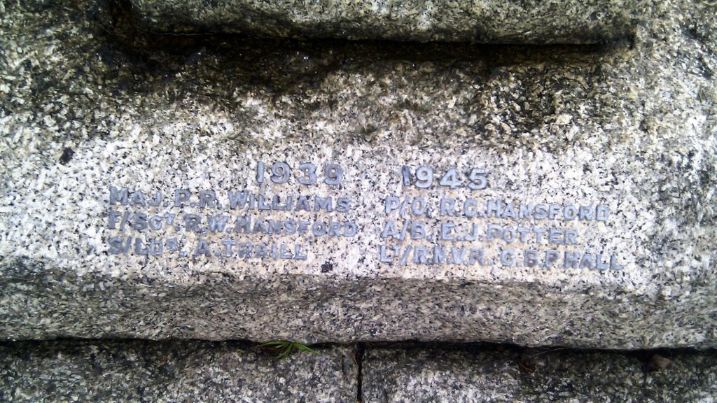
| Description | : | West Hill WAR MEMORIAL UNVEILING CEREMONY The unveiling of West Hill war memorial, which took place Sunday afternoon, was witnessed by a large concourse of people, not only from the village of West Hill, but the neighbouring town of Ottery St. Mary. The Ottery Post of the Comrades of the Great War, headed by the Ottery St. Mary Town Band, under Bandmaster W. Cann, marched to St. Michael's Church, for the short preliminary service. At the conclusion of the service a procession was formed, headed by the Otter Vale Temperance Band conducted by Bandmaster J. Sparkes and the surpliced choir, which marched... Read More |
frequently asked questions (FAQ):
-
Where is West Hill War Memorial?
West Hill War Memorial is located at West Hill Road & School Lane, (jnct. of) West Hill, East Devon District ,Devon ,England.
-
West Hill War Memorial cemetery's updated grave count on graveviews.com?
0 memorials
-
Where are the coordinates of the West Hill War Memorial?
Latitude: 50.7383140
Longitude: -3.3180440
Nearby Cemetories:
1. St Michael Churchyard
West Hill, East Devon District, England
Coordinate: 50.7400000, -3.3190900
2. Ottery St. Mary Parish Churchyard
Ottery St Mary, East Devon District, England
Coordinate: 50.7528310, -3.2787800
3. Whimple Cemetery
Whimple, East Devon District, England
Coordinate: 50.7647600, -3.3483400
4. St Philip and St James Escot
Ottery St Mary, East Devon District, England
Coordinate: 50.7690100, -3.2952900
5. Ottery St Mary Cemetery
Ottery St Mary, East Devon District, England
Coordinate: 50.7552300, -3.2707400
6. St. Mary's Churchyard
Aylesbeare, East Devon District, England
Coordinate: 50.7189744, -3.3644634
7. St. Mary's Churchyard
Whimple, East Devon District, England
Coordinate: 50.7665800, -3.3568700
8. St Mary with St Andrews Churchyard
Rockbeare, East Devon District, England
Coordinate: 50.7486700, -3.3902500
9. Church of St Petrock and St Barnabus
Farringdon, East Devon District, England
Coordinate: 50.7120900, -3.3926240
10. St. Andrew's Churchyard
Feniton, East Devon District, England
Coordinate: 50.7872510, -3.2660760
11. St John the Baptist Churchyard
Colaton Raleigh, East Devon District, England
Coordinate: 50.6771200, -3.3010200
12. Saint Giles Churchyard
Sidbury, East Devon District, England
Coordinate: 50.7189430, -3.2200740
13. Clyst St Lawrence Parish Church
Clyst St Lawrence, East Devon District, England
Coordinate: 50.7942820, -3.3764350
14. Convent of the Assumption
Sidmouth, East Devon District, England
Coordinate: 50.6851600, -3.2507840
15. Sidbury Cemetery
Sidbury, East Devon District, England
Coordinate: 50.7123800, -3.2184900
16. St. Michael's Churchyard
Gittisham, East Devon District, England
Coordinate: 50.7785700, -3.2301300
17. Holy Trinity Churchyard
Woodbury Salterton, East Devon District, England
Coordinate: 50.6928900, -3.3997900
18. Sidmouth Cemetery
Sidmouth, East Devon District, England
Coordinate: 50.6892010, -3.2371800
19. St Michael Churchyard
Clyst Honiton, East Devon District, England
Coordinate: 50.7320900, -3.4339100
20. St Mary & St Giles Churchyard
Buckerell, East Devon District, England
Coordinate: 50.7960300, -3.2450500
21. Bicton, St Mary's Church
Budleigh Salterton, East Devon District, England
Coordinate: 50.6639870, -3.3130370
22. St Giles and St Nicholas Churchyard
Sidmouth, East Devon District, England
Coordinate: 50.6793390, -3.2391480
23. St Swithun's Church Burial Ground
Woodbury, East Devon District, England
Coordinate: 50.6786900, -3.4014000
24. St Michaels Churchyard
Otterton, East Devon District, England
Coordinate: 50.6588750, -3.3029790


