
| Memorials | : | 0 |
| Location | : | Ogwell, Teignbridge District, England |
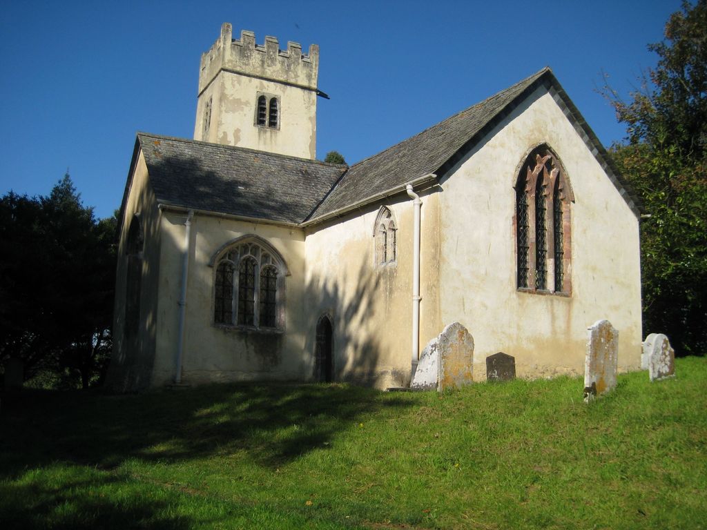
| Description | : | Recorded burials date between 1635 and 1916. The parish register was begun in 1613, but the first burial listed took place in 1635. There may or may not have been burials before 1613, but they were not recorded. This is a very small parish. In 1850, there were 51 "souls" living in the 1,000-acre West Ogwell. West Ogwell Church in Ogwell, Devon, England was built in the 13th century and stands in the grounds of Ogwell House (the Manor House). It is recorded in the National Heritage List for England as a designated Grade I listed building, and is now a... Read More |
frequently asked questions (FAQ):
-
Where is West Ogwell Parish Churchyard?
West Ogwell Parish Churchyard is located at No GPS information available Add GPSNewton Abbot Ogwell, Teignbridge District ,Devon , TQ12 6EWEngland.
-
West Ogwell Parish Churchyard cemetery's updated grave count on graveviews.com?
0 memorials
Nearby Cemetories:
1. St Mary the Virgin Churchyard
Abbotskerswell, Teignbridge District, England
Coordinate: 50.6252000, -3.4497800
2. St. Thomas a Becket Churchyard
Bridford, Teignbridge District, England
Coordinate: 50.7379630, -3.6041590
3. St. Mary's Churchyard
Cofton, Teignbridge District, England
Coordinate: 50.6505730, -3.6193410
4. St Mary Churchyard
Dunsford, Teignbridge District, England
Coordinate: 50.5441800, -3.8070600
5. St. Ida's Churchyard
Ide, Teignbridge District, England
Coordinate: 50.5052300, -3.5649700
6. Kingsteignton Cemetery
Kingsteignton, Teignbridge District, England
7. St Michael's Churchyard
Kingsteignton, Teignbridge District, England
Coordinate: 50.6799770, -3.4930130
8. Church of St John the Baptist
Newton Abbot, Teignbridge District, England
Coordinate: 50.6795000, -3.4938000
9. Newton Abbot Cemetery
Newton Abbot, Teignbridge District, England
10. Saint Augustine's Priory Cemetery
Newton Abbot, Teignbridge District, England
11. St John the Baptist Churchyard. Leusdon
Newton Abbot, Teignbridge District, England
Coordinate: 50.6148900, -3.7172400
12. St Mary the Virgin Churchyard
Newton Abbot, Teignbridge District, England
Coordinate: 50.6183700, -3.7188600
13. St. Paul's Churchyard
Starcross, Teignbridge District, England
Coordinate: 50.6252000, -3.4497800
14. St. Catherine's Churchyard
Whitestone, Teignbridge District, England
Coordinate: 50.7379630, -3.6041590
15. St John The Baptist
Ashton, Teignbridge District, England
Coordinate: 50.6505730, -3.6193410
16. St. Peter's Churchyard
Buckland-in-the-Moor, Teignbridge District, England
Coordinate: 50.5441800, -3.8070600
17. St Bartholomew's Churchyard
Coffinswell, Teignbridge District, England
Coordinate: 50.5052300, -3.5649700
18. Exminster Asylum Cemetery
Exminster, Teignbridge District, England
19. Exminster Parish Cemetery
Exminster, Teignbridge District, England
Coordinate: 50.6799770, -3.4930130
20. St Martin of Tours Churchyard
Exminster, Teignbridge District, England
Coordinate: 50.6795000, -3.4938000
21. Ilsington
Ilsington, Teignbridge District, England
22. St. Michael's Churchyard
Ilsington, Teignbridge District, England
23. Lustleigh Cemetery
Lustleigh, Teignbridge District, England
Coordinate: 50.6148900, -3.7172400
24. St. John the Baptist Churchyard
Lustleigh, Teignbridge District, England
Coordinate: 50.6183700, -3.7188600