
| Memorials | : | 19 |
| Location | : | Warren County, USA |
| Coordinate | : | 39.2561660, -84.0114110 |
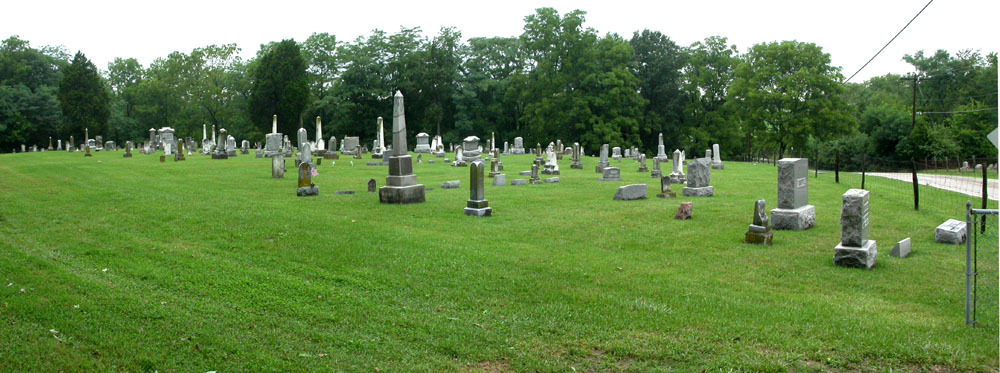
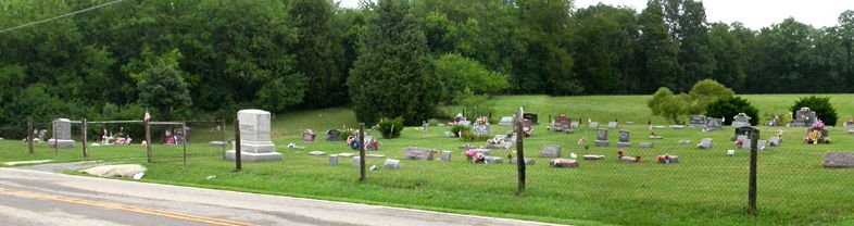
| Description | : | This active cemetery is located in the extreme southeastern corner of Warren County. It straddles Morrow-Woodville Road (County Road 24) just south of Stonelick Creek and just north of the Clermont-Warren County line. It is on the north side of the Village of Woodville (originally West Woodville). The new section of the cemetery is located on the east side of the road, and the old section of the cemetery is located on the west side of the road. The cemetery was originally laid out in 1828. The earliest burial, based upon tombstone inscriptions, occurred in 1827. The cemetery is located in... Read More |
frequently asked questions (FAQ):
-
Where is West Woodville Cemetery?
West Woodville Cemetery is located at 10901 – 10999 Washington Street (County Road 24) Harlan Township, Warren County ,Ohio , 45107USA.
-
West Woodville Cemetery cemetery's updated grave count on graveviews.com?
19 memorials
-
Where are the coordinates of the West Woodville Cemetery?
Latitude: 39.2561660
Longitude: -84.0114110
Nearby Cemetories:
1. Wesley Chapel Cemetery
Pleasant Plain, Warren County, USA
Coordinate: 39.2778015, -84.0355988
2. Garrison Cemetery
Blanchester, Clinton County, USA
Coordinate: 39.2703018, -83.9681015
3. Blanchester IOOF Cemetery
Blanchester, Clinton County, USA
Coordinate: 39.2921982, -83.9957962
4. West Mary Cemetery
Harlan Township, Warren County, USA
Coordinate: 39.3008003, -84.0152969
5. Jordan Cemetery
Edenton, Clermont County, USA
Coordinate: 39.2254180, -84.0587770
6. Edenton Cemetery
Edenton, Clermont County, USA
Coordinate: 39.2216988, -84.0639038
7. New Hope Cemetery
Harlan Township, Warren County, USA
Coordinate: 39.3088989, -84.0239029
8. Engle Cemetery
Perry Township, Brown County, USA
Coordinate: 39.2155991, -83.9569016
9. Osborne Cemetery
Harlan Township, Warren County, USA
Coordinate: 39.3224983, -84.0038986
10. Spurling Cemetery
Pleasant Plain, Warren County, USA
Coordinate: 39.2724991, -84.0952988
11. Templin Cemetery
Pleasant Plain, Warren County, USA
Coordinate: 39.3107986, -84.0622025
12. Rossella Cemetery
Pleasant Plain, Warren County, USA
Coordinate: 39.3244019, -84.0421982
13. Dunham Cemetery
Fayetteville, Brown County, USA
Coordinate: 39.2047005, -83.9421997
14. Shiloh Cemetery
Goshen, Clermont County, USA
Coordinate: 39.2328500, -84.1025500
15. Second Creek Cemetery
Blanchester, Clinton County, USA
Coordinate: 39.3164800, -83.9551600
16. Runyan Cemetery
Butlerville, Warren County, USA
Coordinate: 39.3013992, -84.0883026
17. Carson Cemetery
Pleasant Plain, Warren County, USA
Coordinate: 39.2914505, -84.1027145
18. Edwardsville Cemetery
Edwardsville, Warren County, USA
Coordinate: 39.3333780, -84.0342390
19. Slabs Camp Burial Site
Edenton, Clermont County, USA
Coordinate: 39.1848020, -84.0607910
20. Stiles Cemetery
Pleasant Plain, Warren County, USA
Coordinate: 39.2696991, -84.1153030
21. Craig Cemetery
Pleasant Plain, Warren County, USA
Coordinate: 39.2855988, -84.1113968
22. Long Cemetery
Saint Martin, Brown County, USA
Coordinate: 39.2214012, -83.9135971
23. McCollum Cemetery
Wayne Township, Clermont County, USA
Coordinate: 39.2053980, -84.0968030
24. Pleasant Grove Cemetery
Warren County, USA
Coordinate: 39.3400610, -84.0185430