
| Memorials | : | 0 |
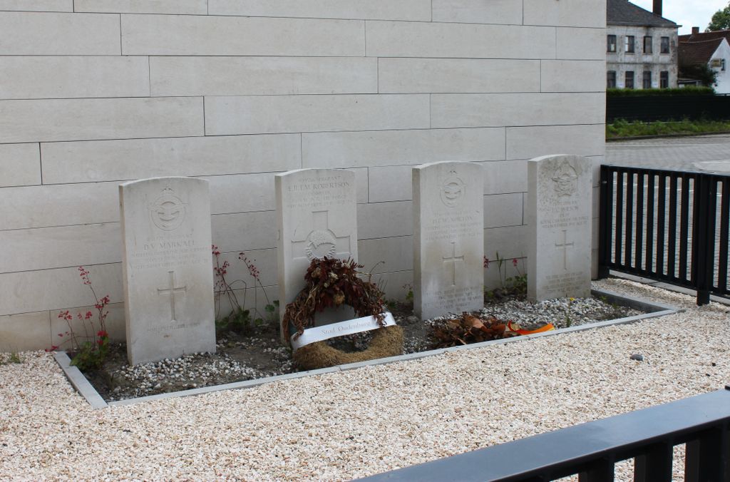
| Location | : | Oudenburg, Arrondissement Oostende, Belgium |
| Coordinate | : | 51.1585500, 3.0192700 |
| Description | : | Location Information: The village of Westkerke is located about 17 kilometres south-west of the town of Brugge (Bruges), on the N367 road which runs between Brugge and Gistel. It is also close to the E40 motorway. From the motorway take junction 6 Jabbeke which is the road N377. When you come into Jabbeke at the junction with the N367 turn right direction Gistel. You go through the village of Roksem and Westkerke is the next village. As you enter the village there is a road junction with the N368 to your right. Go straight on and the church is just... Read More |
frequently asked questions (FAQ):
-
Where is Westkerke Churchyard?
Westkerke Churchyard is located at Oudenburg, Arrondissement Oostende ,West Flanders (West-Vlaanderen) ,Belgium.
-
Westkerke Churchyard cemetery's updated grave count on graveviews.com?
0 memorials
-
Where are the coordinates of the Westkerke Churchyard?
Latitude: 51.1585500
Longitude: 3.0192700
Nearby Cemetories:
1. Westkerke Cemetery
Oudenburg, Arrondissement Oostende, Belgium
Coordinate: 51.1587181, 3.0190193
2. Sint-Amandus Church
Bekegem, Arrondissement Oostende, Belgium
Coordinate: 51.1597600, 3.0457000
3. Gistel Communal Cemetery
Gistel, Arrondissement Oostende, Belgium
Coordinate: 51.1600400, 2.9836700
4. Oudenburg Communal Cemetery
Oudenburg, Arrondissement Oostende, Belgium
Coordinate: 51.1848310, 3.0192660
5. Eernegem Communal Cemetery
Ichtegem, Arrondissement Oostende, Belgium
Coordinate: 51.1307300, 3.0234300
6. Jabbeke Communal Cemetery
Jabbeke, Arrondissement Brugge, Belgium
Coordinate: 51.1710467, 3.0853816
7. Jabbeke Sint-Blasius Churchyard
Jabbeke, Arrondissement Brugge, Belgium
Coordinate: 51.1826300, 3.0930300
8. Snaaskerke Churchyard
Gistel, Arrondissement Oostende, Belgium
Coordinate: 51.1746500, 2.9372700
9. Aartrijke Communal Cemetery
Zedelgem, Arrondissement Brugge, Belgium
Coordinate: 51.1211690, 3.0908700
10. Stalhille Churchyard
Jabbeke, Arrondissement Brugge, Belgium
Coordinate: 51.2144800, 3.0716400
11. Zedelgem Churchyard
Zedelgem, Arrondissement Brugge, Belgium
Coordinate: 51.1433300, 3.1354800
12. Stene Communal Cemetery
Ostend, Arrondissement Oostende, Belgium
Coordinate: 51.2016500, 2.9169000
13. Park begraafplaats Zedelgem
Zedelgem, Arrondissement Brugge, Belgium
Coordinate: 51.1447258, 3.1440562
14. Bredene Churchyard
Bredene, Arrondissement Oostende, Belgium
Coordinate: 51.2350860, 2.9770370
15. Oostende New Communal Cemetery
Ostend, Arrondissement Oostende, Belgium
Coordinate: 51.2093030, 2.9152390
16. Klemskerke Gemeentelijke Begraafplaats
De Haan, Arrondissement Oostende, Belgium
Coordinate: 51.2426300, 3.0243600
17. Sint Andries Abdij
Bruges, Arrondissement Brugge, Belgium
Coordinate: 51.1598800, 3.1587400
18. Torhout Communal Cemetery
Torhout, Arrondissement Brugge, Belgium
Coordinate: 51.0795860, 3.0922008
19. Saint Peter and Saint Paul Church
Ostend, Arrondissement Oostende, Belgium
Coordinate: 51.2296200, 2.9211600
20. Sint-Elooi Cemetery
Zedelgem, Arrondissement Brugge, Belgium
Coordinate: 51.1250990, 3.1604368
21. Sint-Pieters-Kapelle Churchyard
Sint-Pieters-Kapelle, Arrondissement Oostende, Belgium
Coordinate: 51.1267124, 2.8753231
22. Houtave Churchyard
Zuienkerke, Arrondissement Brugge, Belgium
Coordinate: 51.2362700, 3.1104300
23. Oostende Old Communal Cemetery
Ostend, Arrondissement Oostende, Belgium
Coordinate: 51.2188200, 2.8956200
24. Vlissegem Churchyard
De Haan, Arrondissement Oostende, Belgium
Coordinate: 51.2550900, 3.0561100