
| Memorials | : | 0 |
| Location | : | Johns Island, Charleston County, USA |
| Coordinate | : | 32.7206889, -80.0526667 |
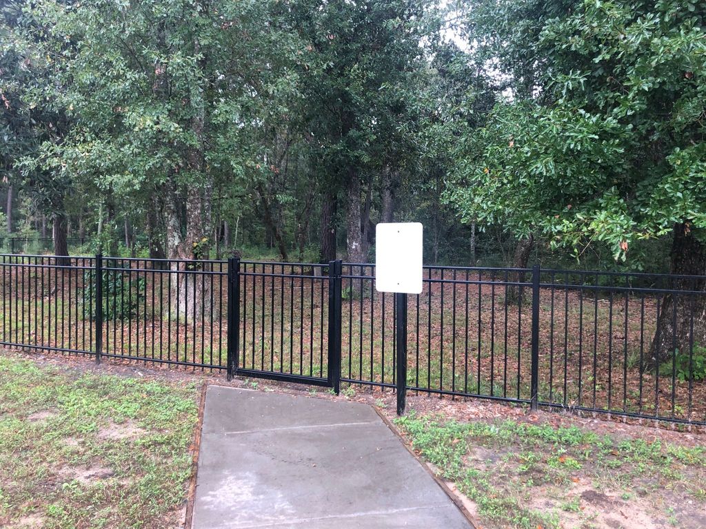
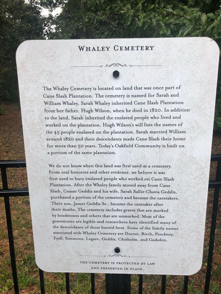
| Description | : | Turn onto Cane Slash Road from River Road. Turn left onto Elvington Road in the new Oakfield/Laurel Glen Subdivision. At the end of Elvington, turn left onto Vincent Astor Drive and then right onto Colson Lane. The new cemetery entrance is located at the end the road, on the left. The Whaley Cemetery is located on land that was once part of Cane Slash Plantation. The cemetery is named for Sarah and William Whaley, Sarah Whaley inherited Cane Slash Plantation from her father, Hugh Wilson, when he died in 1820. In addition to the land, Sarah... Read More |
frequently asked questions (FAQ):
-
Where is Whaley Cemetery?
Whaley Cemetery is located at Colson Lane Johns Island, Charleston County ,South Carolina ,USA.
-
Whaley Cemetery cemetery's updated grave count on graveviews.com?
0 memorials
-
Where are the coordinates of the Whaley Cemetery?
Latitude: 32.7206889
Longitude: -80.0526667
Nearby Cemetories:
1. Cedar Spring Baptist Church Cemetery
Johns Island, Charleston County, USA
Coordinate: 32.7128900, -80.0432400
2. First Baptist Churchyard
Johns Island, Charleston County, USA
Coordinate: 32.7236700, -80.0738200
3. Bethel Presbyterian Church Cemetery
Johns Island, Charleston County, USA
Coordinate: 32.7199260, -80.0781520
4. Saint Stephen AME Church
Johns Island, Charleston County, USA
Coordinate: 32.7421417, -80.0410156
5. Saint Johns Episcopal Parish Cemetery
Johns Island, Charleston County, USA
Coordinate: 32.7175100, -80.0852200
6. Gibbes Family Burial Ground
Johns Island, Charleston County, USA
Coordinate: 32.7516320, -80.0379747
7. Bethlehem United Methodist Church Cemetery
Johns Island, Charleston County, USA
Coordinate: 32.6908226, -80.0743637
8. Wesley United Methodist Church Cemetery
Johns Island, Charleston County, USA
Coordinate: 32.7017700, -80.0157300
9. Calvary AME Church Cemetery
Johns Island, Charleston County, USA
Coordinate: 32.6870260, -80.0779940
10. Johns Island Presbyterian Church Cemetery
Johns Island, Charleston County, USA
Coordinate: 32.6862907, -80.0807877
11. Holy Spirit Catholic Church Cemetery Original Site
Johns Island, Charleston County, USA
Coordinate: 32.6860740, -80.0808920
12. Saint Matthew AME Church Cemetery
Johns Island, Charleston County, USA
Coordinate: 32.7302000, -80.1051800
13. Saint James United Methodist Church Cemetery
Johns Island, Charleston County, USA
Coordinate: 32.7449300, -80.1055900
14. Freer Family Cemetery
Johns Island, Charleston County, USA
Coordinate: 32.6685556, -80.0421479
15. Stanyarne Family Cemetery
Johns Island, Charleston County, USA
Coordinate: 32.6635470, -80.0562280
16. Mount Sinai Evangelistic Cemetery
James Island, Charleston County, USA
Coordinate: 32.7483960, -79.9883470
17. Heavenly Rest Cemetery
Charleston, Charleston County, USA
Coordinate: 32.7494500, -79.9868500
18. Payne RMUE Church Memorial Garden
James Island, Charleston County, USA
Coordinate: 32.7035179, -79.9792328
19. Bethel AME Church Cemetery
James Island, Charleston County, USA
Coordinate: 32.7456100, -79.9813200
20. Saint James AME Church Cemetery
Johns Island, Charleston County, USA
Coordinate: 32.6553850, -80.0482190
21. Saint James Episcopal Church Cemetery
James Island, Charleston County, USA
Coordinate: 32.7350273, -79.9767914
22. Bishop Gadsden Columbarium
Charleston, Charleston County, USA
Coordinate: 32.7341340, -79.9758710
23. Saint James AME Church Cemetery
Johns Island, Charleston County, USA
Coordinate: 32.6539700, -80.0633300
24. Saint James Memorial Gardens
James Island, Charleston County, USA
Coordinate: 32.7049900, -79.9747300