
| Memorials | : | 0 |
| Location | : | Johns Island, Charleston County, USA |
| Coordinate | : | 32.6685556, -80.0421479 |
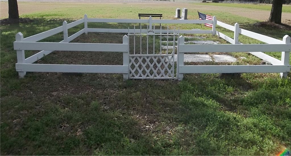
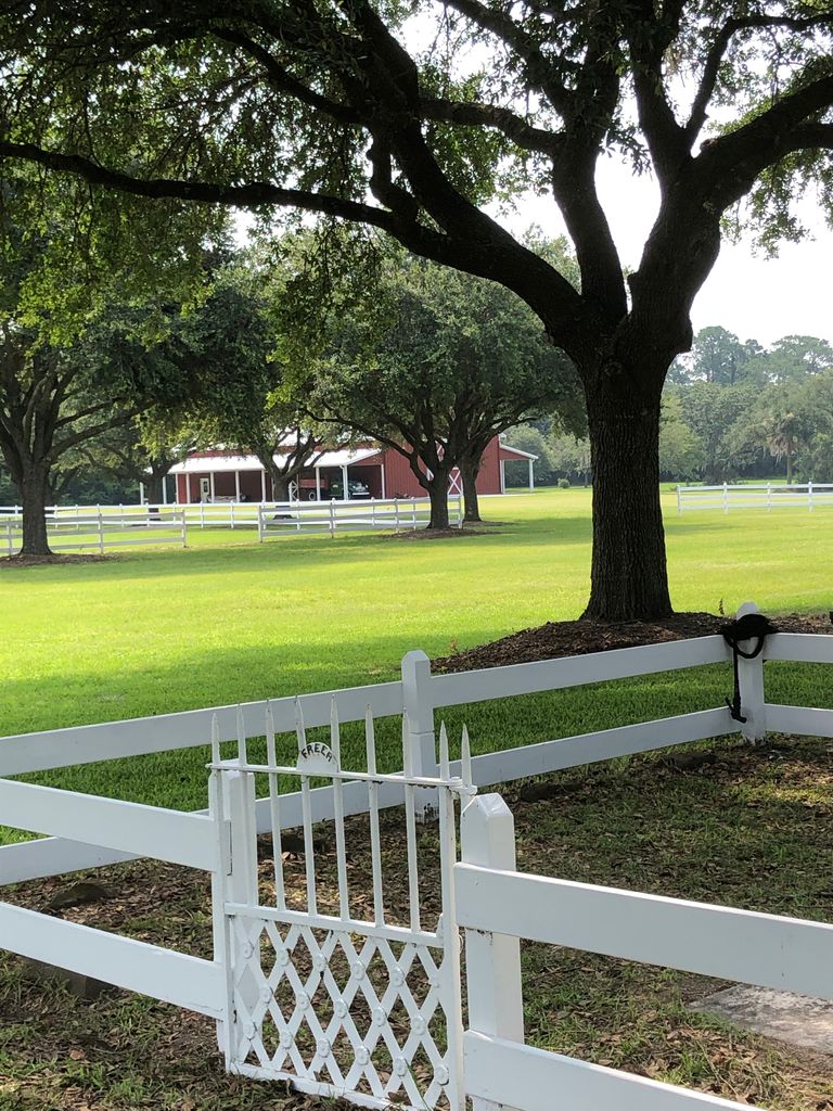
| Description | : | Located on the former Auld Reekie Plantation on Johns Island. Property is now owned by the Walpole family. The cemetery is located off Sunnyside Farm Road. Turn left just past the community mailboxes into the Sunnyside Farm entrance. The cemetery is located in the field on the right, under the four large oak trees. |
frequently asked questions (FAQ):
-
Where is Freer Family Cemetery?
Freer Family Cemetery is located at Sunnyside Farm Road Johns Island, Charleston County ,South Carolina , 29455USA.
-
Freer Family Cemetery cemetery's updated grave count on graveviews.com?
0 memorials
-
Where are the coordinates of the Freer Family Cemetery?
Latitude: 32.6685556
Longitude: -80.0421479
Nearby Cemetories:
1. Stanyarne Family Cemetery
Johns Island, Charleston County, USA
Coordinate: 32.6635470, -80.0562280
2. Saint James AME Church Cemetery
Johns Island, Charleston County, USA
Coordinate: 32.6553850, -80.0482190
3. Saint James AME Church Cemetery
Johns Island, Charleston County, USA
Coordinate: 32.6539700, -80.0633300
4. Bethlehem United Methodist Church Cemetery
Johns Island, Charleston County, USA
Coordinate: 32.6908226, -80.0743637
5. Calvary AME Church Cemetery
Johns Island, Charleston County, USA
Coordinate: 32.6870260, -80.0779940
6. Holy Spirit Catholic Church Cemetery Original Site
Johns Island, Charleston County, USA
Coordinate: 32.6860740, -80.0808920
7. Johns Island Presbyterian Church Cemetery
Johns Island, Charleston County, USA
Coordinate: 32.6862907, -80.0807877
8. Wesley United Methodist Church Cemetery
Johns Island, Charleston County, USA
Coordinate: 32.7017700, -80.0157300
9. Cedar Spring Baptist Church Cemetery
Johns Island, Charleston County, USA
Coordinate: 32.7128900, -80.0432400
10. Whaley Cemetery
Johns Island, Charleston County, USA
Coordinate: 32.7206889, -80.0526667
11. Bethel Presbyterian Church Cemetery
Johns Island, Charleston County, USA
Coordinate: 32.7199260, -80.0781520
12. Saint Johns Episcopal Parish Cemetery
Johns Island, Charleston County, USA
Coordinate: 32.7175100, -80.0852200
13. First Baptist Churchyard
Johns Island, Charleston County, USA
Coordinate: 32.7236700, -80.0738200
14. Payne RMUE Church Memorial Garden
James Island, Charleston County, USA
Coordinate: 32.7035179, -79.9792328
15. Shoolbred Family Cemetery
Kiawah Island, Charleston County, USA
Coordinate: 32.6158028, -80.0883179
16. Evergreen Cemetery
James Island, Charleston County, USA
Coordinate: 32.7027140, -79.9734650
17. Saint James Memorial Gardens
James Island, Charleston County, USA
Coordinate: 32.7049900, -79.9747300
18. Saint Stephen AME Church
Johns Island, Charleston County, USA
Coordinate: 32.7421417, -80.0410156
19. Stem Point Memorial Cemetery
James Island, Charleston County, USA
Coordinate: 32.6872711, -79.9561539
20. Burn Church Cemetery
James Island, Charleston County, USA
Coordinate: 32.7172500, -79.9653300
21. Saint Matthew AME Church Cemetery
Johns Island, Charleston County, USA
Coordinate: 32.7302000, -80.1051800
22. James Island Presbyterian Church Cemetery
James Island, Charleston County, USA
Coordinate: 32.7178917, -79.9642029
23. Gibbes Family Burial Ground
Johns Island, Charleston County, USA
Coordinate: 32.7516320, -80.0379747
24. Bishop Gadsden Columbarium
Charleston, Charleston County, USA
Coordinate: 32.7341340, -79.9758710