| Memorials | : | 0 |
| Location | : | Johnsons Grove, Crockett County, USA |
| Coordinate | : | 35.7815350, -89.1881060 |
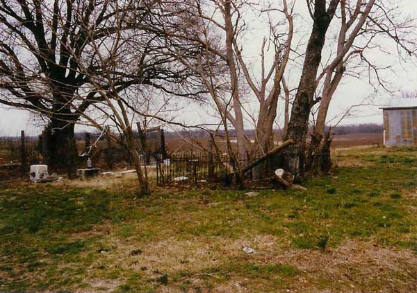
| Description | : | From the intersection of TN-54 S/TN-88 W, north of Alamo, travel northwest on TN-54 S/TN-88 W for 0.8 mi.; turning southwest (left) to continue on TN-54 S, going 1.6 mi. to a private residence on the west (right). With permission, the unknown cemetery/grave & the three 'found' monuments are together on this private property. There are at least 3 hilltops within the adjoining cultivated fields, that are as high as this home-place, at 370', per USGS topo maps, which may have been the original grave-site location of these relocated tombstones. These tombstones are located at 1659 Highway... Read More |
frequently asked questions (FAQ):
-
Where is Whitaker Tombstones?
Whitaker Tombstones is located at 1659 TN-54 Johnsons Grove, Crockett County ,Tennessee ,USA.
-
Whitaker Tombstones cemetery's updated grave count on graveviews.com?
0 memorials
-
Where are the coordinates of the Whitaker Tombstones?
Latitude: 35.7815350
Longitude: -89.1881060
Nearby Cemetories:
1. Whitaker Cemetery
Johnsons Grove, Crockett County, USA
Coordinate: 35.7865270, -89.1996220
2. Old Liberty Cemetery
Johnsons Grove, Crockett County, USA
Coordinate: 35.7645470, -89.1824440
3. Liberty Cemetery
Johnsons Grove, Crockett County, USA
Coordinate: 35.7635540, -89.1823900
4. Buford Family Cemetery
Alamo, Crockett County, USA
Coordinate: 35.7612160, -89.1850940
5. Poston Field Cemetery
Maury City, Crockett County, USA
Coordinate: 35.8019920, -89.1964960
6. Edwards Cemetery
Johnsons Grove, Crockett County, USA
Coordinate: 35.7627700, -89.1724300
7. Frank Varner Cemetery
Johnsons Grove, Crockett County, USA
Coordinate: 35.7638070, -89.2057050
8. Castellaw Cemetery
Johnsons Grove, Crockett County, USA
Coordinate: 35.7597900, -89.1964710
9. Hughes Cemetery
Johnsons Grove, Crockett County, USA
Coordinate: 35.7708960, -89.2150330
10. Prescott Cemetery
Alamo, Crockett County, USA
Coordinate: 35.7749120, -89.1589760
11. Robertson Cemetery
Johnsons Grove, Crockett County, USA
Coordinate: 35.7578011, -89.1735992
12. Smith Cemetery
Cairo, Crockett County, USA
Coordinate: 35.8072720, -89.1737770
13. Kail Cemetery
Alamo, Crockett County, USA
Coordinate: 35.7708070, -89.1552290
14. Johnson Family Cemetery
Johnsons Grove, Crockett County, USA
Coordinate: 35.7554260, -89.2085790
15. Old Hickory Cemetery
Maury City, Crockett County, USA
Coordinate: 35.7949780, -89.2246320
16. Manning Cemetery
Maury City, Crockett County, USA
Coordinate: 35.7949240, -89.2246940
17. Pond Creek Church Cemetery
Alamo, Crockett County, USA
Coordinate: 35.8111000, -89.1669006
18. Tempy Walker Tombstone
Alamo, Crockett County, USA
Coordinate: 35.8130500, -89.1716900
19. Koonce Cemetery
Cairo, Crockett County, USA
Coordinate: 35.8176300, -89.1849750
20. Harris Grove Cemetery
Alamo, Crockett County, USA
Coordinate: 35.7780850, -89.1434760
21. King Cemetery
Maury City, Crockett County, USA
Coordinate: 35.8052310, -89.2228300
22. Branch Cemetery
Frog Jump, Crockett County, USA
Coordinate: 35.7727540, -89.2383390
23. Maury City Cemetery
Maury City, Crockett County, USA
Coordinate: 35.8174680, -89.2178350
24. Jennings Cemetery
Alamo, Crockett County, USA
Coordinate: 35.7684510, -89.2401620

