
| Memorials | : | 509 |
| Location | : | White Cliffs, Central Darling Shire, Australia |
| Coordinate | : | -30.8587800, 143.1040220 |
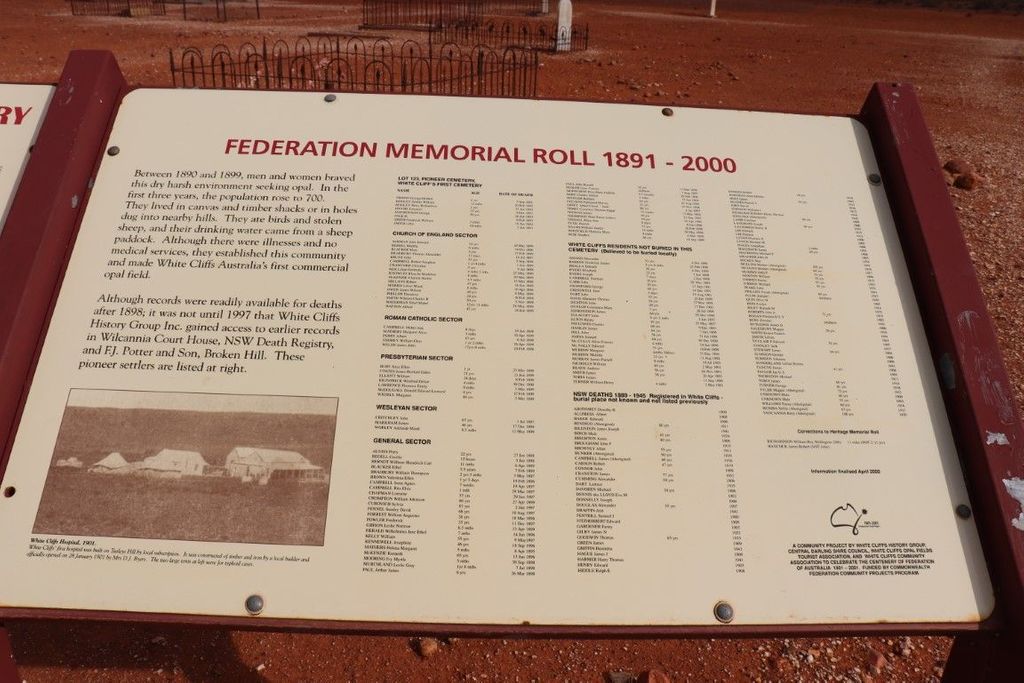
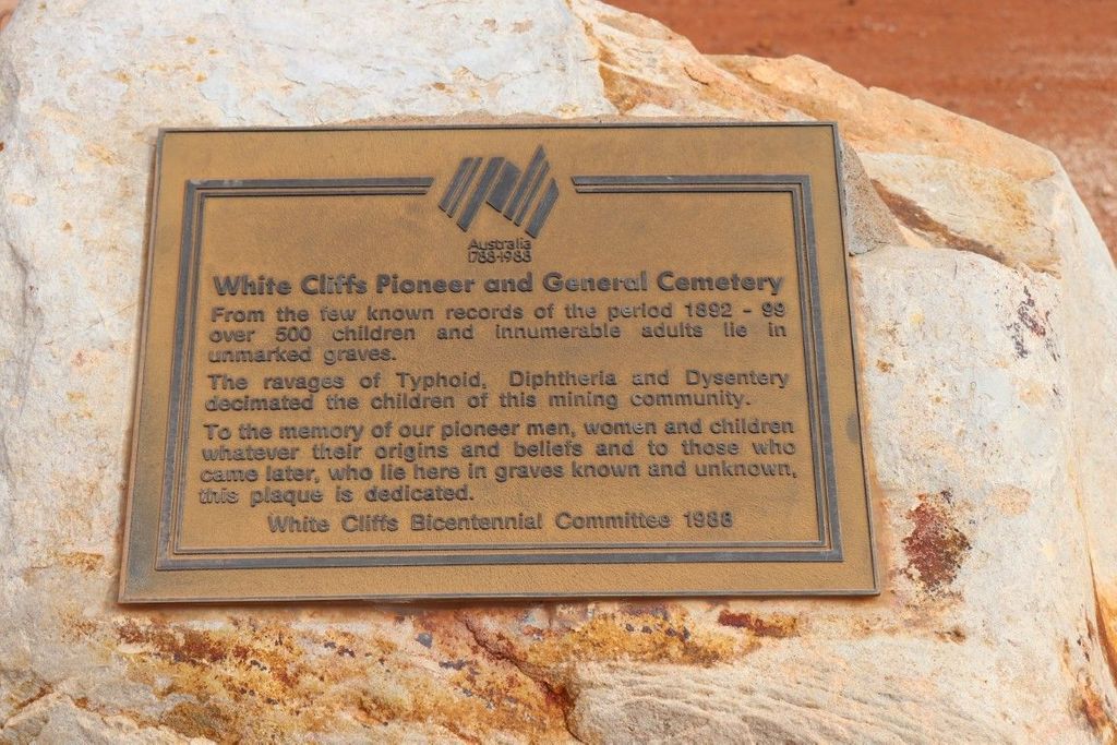
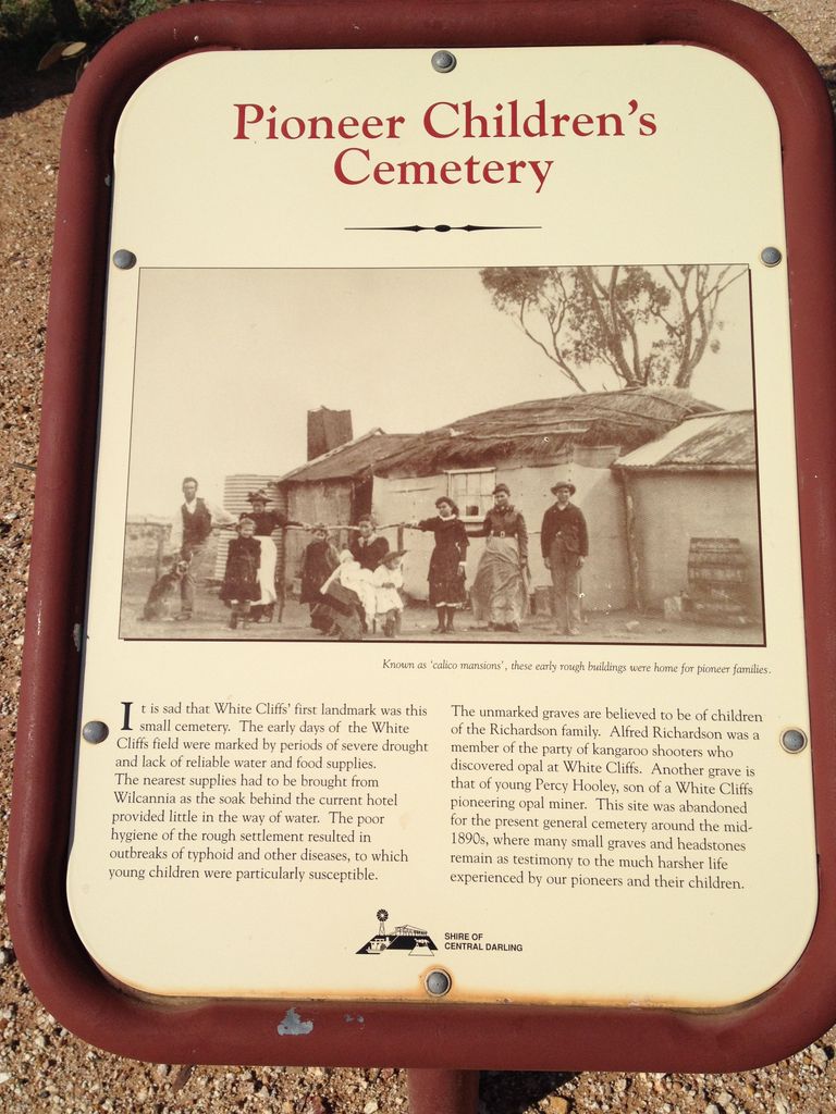
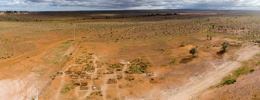
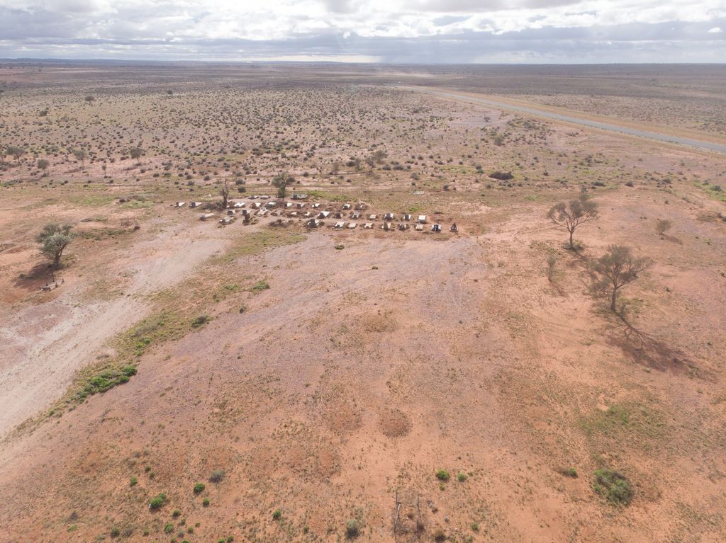
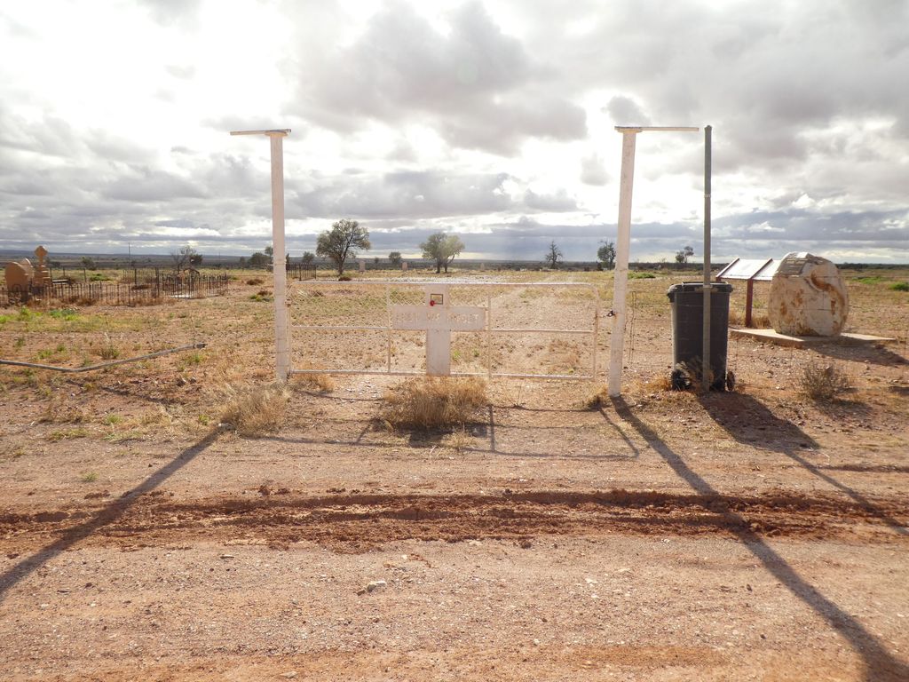
| Description | : | White Cliffs is an historic opal mining area near Wilcannia in outback Western NSW. The population ranges from 100-200 residents, some of whom continue to mine for opal. The cemetery is located on Keraro Road, just out of town. While there are over 500 interments in the cemetery, many of the oldest interments are unmarked and/or have rusty iron fences around them. The General Section at the rear of the cemetery is the most modern containing identifiable headstones. The local White Cliffs Bicentennial Committee has erected memorial plaques at the entrance to the cemetery listing the names of those interred,... Read More |
frequently asked questions (FAQ):
-
Where is White Cliffs Cemetery?
White Cliffs Cemetery is located at Keraro Road White Cliffs, Central Darling Shire ,New South Wales , 2836Australia.
-
White Cliffs Cemetery cemetery's updated grave count on graveviews.com?
501 memorials
-
Where are the coordinates of the White Cliffs Cemetery?
Latitude: -30.8587800
Longitude: 143.1040220
Nearby Cemetories:
1. White Cliffs Pioneer and Pioneer Children's Cemetery
White Cliffs, Central Darling Shire, Australia
Coordinate: -30.8473155, 143.0870036
2. Lone Graves
Wilcannia, Central Darling Shire, Australia
Coordinate: -31.5586440, 143.3782770
3. Wilcannia Cemetery
Wilcannia, Central Darling Shire, Australia
Coordinate: -31.5746960, 143.3662390
4. Kallara Station
Tilpa, Central Darling Shire, Australia
Coordinate: -30.8884100, 144.5021860
5. Innesowen Station Cemetery
Tilpa, Central Darling Shire, Australia
Coordinate: -31.2151390, 144.6586000
6. Wanaaring Cemetery
Wanaaring, Bourke Shire, Australia
Coordinate: -29.7003330, 144.1433310
7. Lone Graves
Menindee, Central Darling Shire, Australia
Coordinate: -32.3892390, 142.4212650
8. Menindee Cenotaph and Rose Garden
Menindee, Central Darling Shire, Australia
Coordinate: -32.3932433, 142.4164522
9. Stoney Creek Cemetery
Louth, Bourke Shire, Australia
Coordinate: -30.6585400, 145.0080900
10. Menindee Cemetery
Menindee, Central Darling Shire, Australia
Coordinate: -32.3952680, 142.4016090
11. Trilby Station cemetery
Louth, Bourke Shire, Australia
Coordinate: -30.6192090, 145.0350630
12. Louth Cemetery
Louth, Bourke Shire, Australia
Coordinate: -30.5343390, 145.1225390
13. Eldorado Station Cemetery
Louth, Bourke Shire, Australia
Coordinate: -30.4763000, 145.1215400
14. Sacred Heart Cathedral
Broken Hill, Broken Hill City, Australia
Coordinate: -31.9532110, 141.4589990
15. Broken Hill Cemetery
Broken Hill, Broken Hill City, Australia
Coordinate: -31.9636120, 141.4317060
16. Netley Station
Menindee, Central Darling Shire, Australia
Coordinate: -32.7576360, 142.3719430
17. Toorale National Park & State Conservation Area
Bourke Shire, Australia
Coordinate: -30.3444500, 145.4219440
18. Redbank Homestead Burial
Bourke Shire, Australia
Coordinate: -30.3627780, 145.5708330
19. Cockburn Cemetery
Cockburn, Outback Communities Authority, Australia
Coordinate: -32.0695650, 140.9741470
20. Yantabulla Cemetery
Yantabulla, Bourke Shire, Australia
Coordinate: -29.3509080, 145.0009270
21. Old Yanda Station
Bourke Shire, Australia
Coordinate: -30.2691930, 145.6287200
22. Wyrama Old Cuthero Cemetery
Menindee, Central Darling Shire, Australia
Coordinate: -33.0287900, 142.3512900
23. Ivanhoe Cemetery
Ivanhoe, Central Darling Shire, Australia
Coordinate: -32.8914970, 144.3154560
24. Fords Bridge Cemetery
Fords Bridge, Bourke Shire, Australia
Coordinate: -29.7556900, 145.4161800