
| Memorials | : | 10 |
| Location | : | White Cliffs, Central Darling Shire, Australia |
| Coordinate | : | -30.8473155, 143.0870036 |
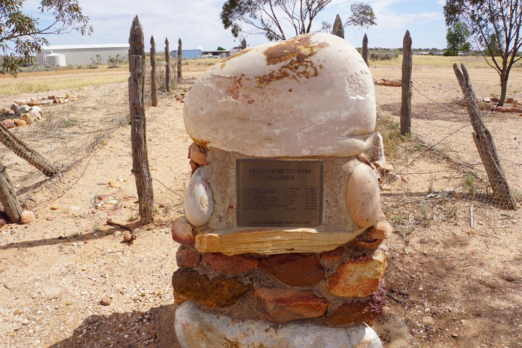
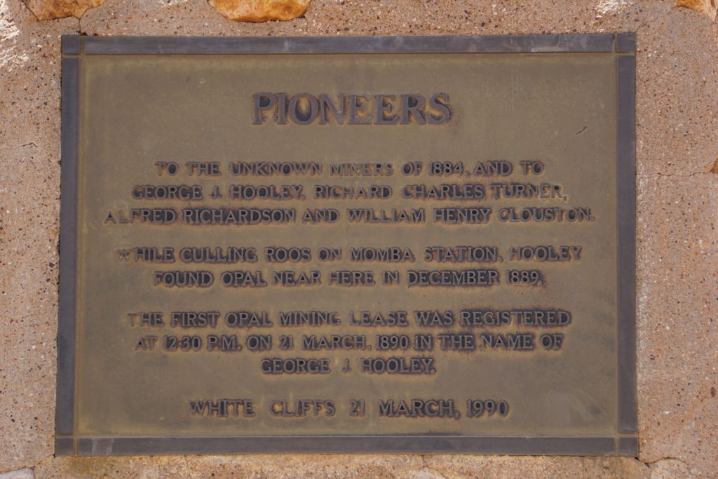
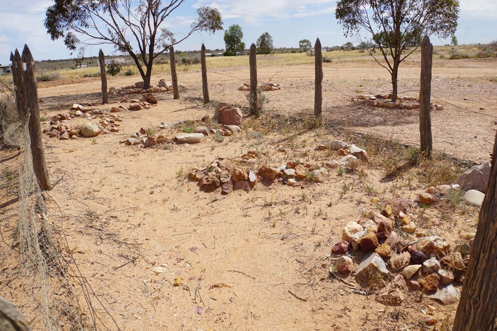
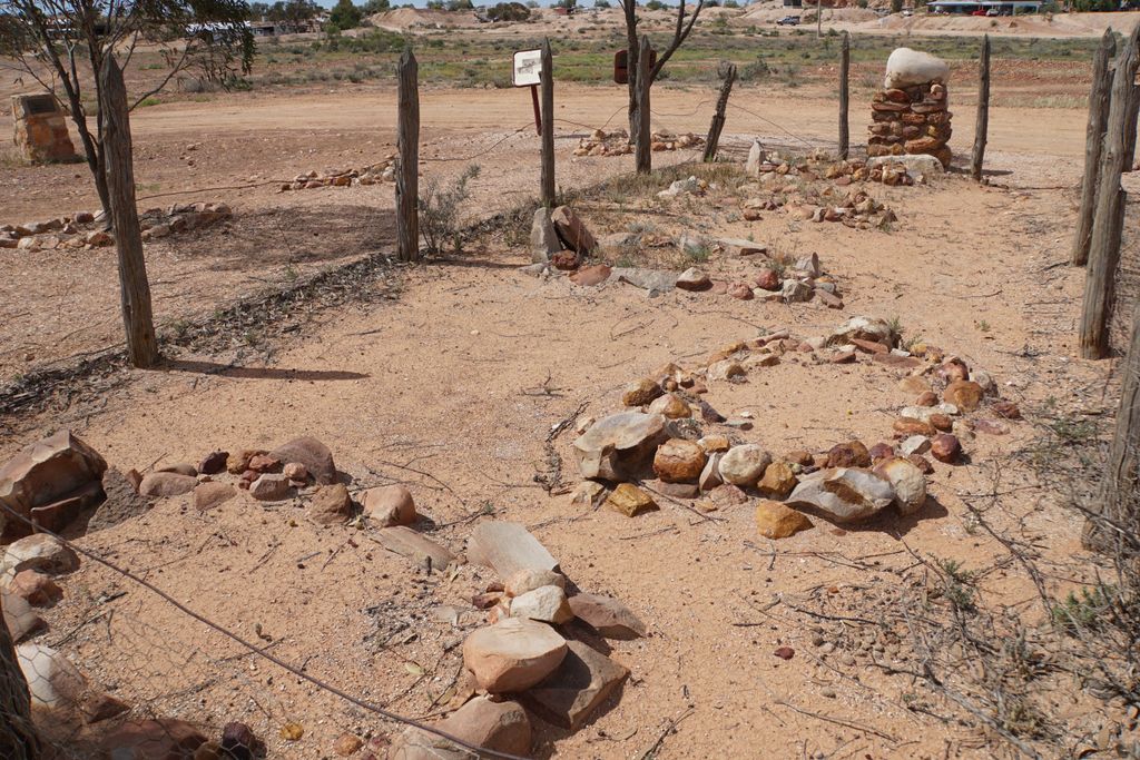
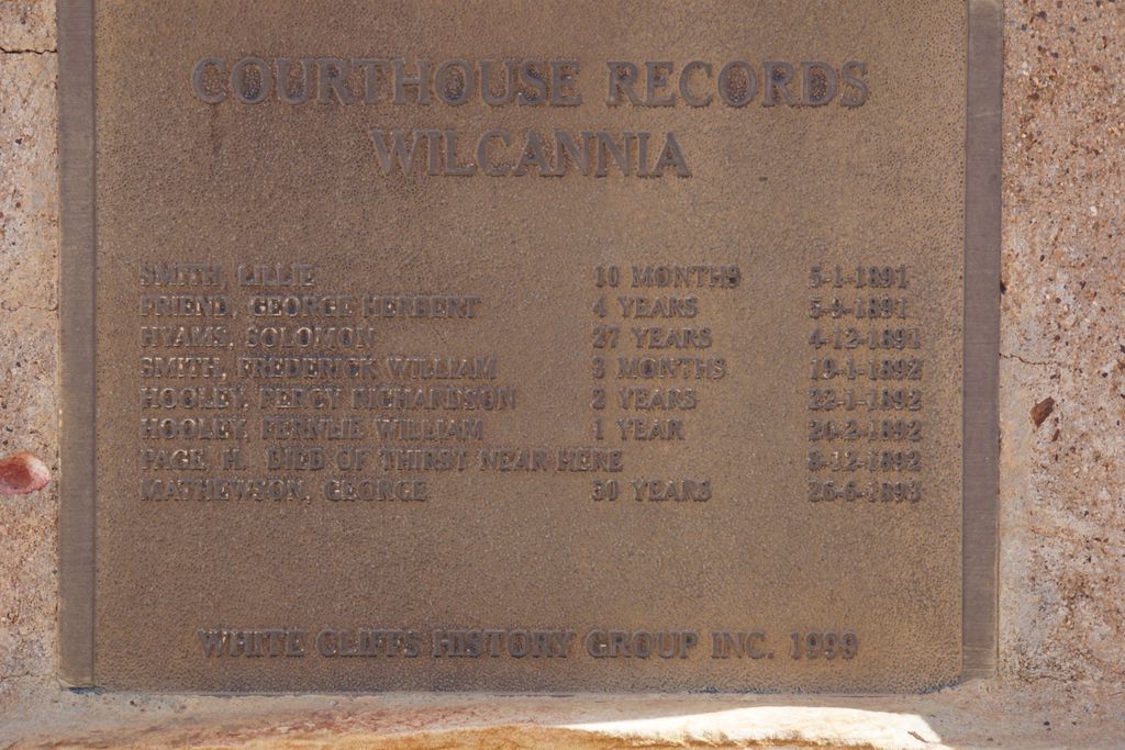
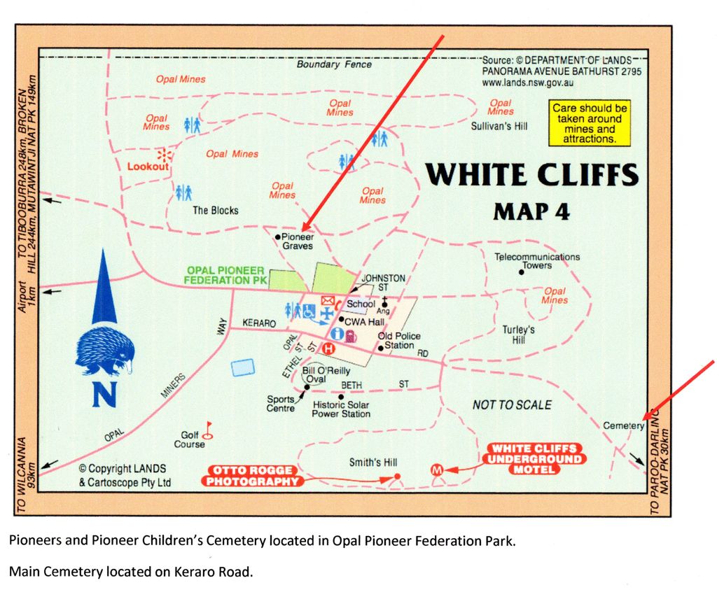
| Description | : | This is a small group of pioneer graves with plaques detailing the children and pioneers interred there. It is separate from the main White Cliffs Cemetery on Keraro Road. The graves of the children have no headstones but are marked with rock surrounds within a fence. White Cliffs is an historic opal mining area near Wilcannia in outback western NSW, Australia. It continues to be an opal mining town and has many mines and evidence of previous mining . The population in this interesting town ranges between 100 - 200 residents. |
frequently asked questions (FAQ):
-
Where is White Cliffs Pioneer and Pioneer Children's Cemetery?
White Cliffs Pioneer and Pioneer Children's Cemetery is located at Opal Pioneer Federation Park, off Johnston Street White Cliffs, Central Darling Shire ,New South Wales , 2836Australia.
-
White Cliffs Pioneer and Pioneer Children's Cemetery cemetery's updated grave count on graveviews.com?
10 memorials
-
Where are the coordinates of the White Cliffs Pioneer and Pioneer Children's Cemetery?
Latitude: -30.8473155
Longitude: 143.0870036
Nearby Cemetories:
1. White Cliffs Cemetery
White Cliffs, Central Darling Shire, Australia
Coordinate: -30.8587800, 143.1040220
2. Lone Graves
Wilcannia, Central Darling Shire, Australia
Coordinate: -31.5586440, 143.3782770
3. Wilcannia Cemetery
Wilcannia, Central Darling Shire, Australia
Coordinate: -31.5746960, 143.3662390
4. Kallara Station
Tilpa, Central Darling Shire, Australia
Coordinate: -30.8884100, 144.5021860
5. Innesowen Station Cemetery
Tilpa, Central Darling Shire, Australia
Coordinate: -31.2151390, 144.6586000
6. Wanaaring Cemetery
Wanaaring, Bourke Shire, Australia
Coordinate: -29.7003330, 144.1433310
7. Lone Graves
Menindee, Central Darling Shire, Australia
Coordinate: -32.3892390, 142.4212650
8. Menindee Cenotaph and Rose Garden
Menindee, Central Darling Shire, Australia
Coordinate: -32.3932433, 142.4164522
9. Menindee Cemetery
Menindee, Central Darling Shire, Australia
Coordinate: -32.3952680, 142.4016090
10. Stoney Creek Cemetery
Louth, Bourke Shire, Australia
Coordinate: -30.6585400, 145.0080900
11. Trilby Station cemetery
Louth, Bourke Shire, Australia
Coordinate: -30.6192090, 145.0350630
12. Sacred Heart Cathedral
Broken Hill, Broken Hill City, Australia
Coordinate: -31.9532110, 141.4589990
13. Louth Cemetery
Louth, Bourke Shire, Australia
Coordinate: -30.5343390, 145.1225390
14. Eldorado Station Cemetery
Louth, Bourke Shire, Australia
Coordinate: -30.4763000, 145.1215400
15. Broken Hill Cemetery
Broken Hill, Broken Hill City, Australia
Coordinate: -31.9636120, 141.4317060
16. Netley Station
Menindee, Central Darling Shire, Australia
Coordinate: -32.7576360, 142.3719430
17. Toorale National Park & State Conservation Area
Bourke Shire, Australia
Coordinate: -30.3444500, 145.4219440
18. Cockburn Cemetery
Cockburn, Outback Communities Authority, Australia
Coordinate: -32.0695650, 140.9741470
19. Redbank Homestead Burial
Bourke Shire, Australia
Coordinate: -30.3627780, 145.5708330
20. Yantabulla Cemetery
Yantabulla, Bourke Shire, Australia
Coordinate: -29.3509080, 145.0009270
21. Old Yanda Station
Bourke Shire, Australia
Coordinate: -30.2691930, 145.6287200
22. Wyrama Old Cuthero Cemetery
Menindee, Central Darling Shire, Australia
Coordinate: -33.0287900, 142.3512900
23. Fords Bridge Cemetery
Fords Bridge, Bourke Shire, Australia
Coordinate: -29.7556900, 145.4161800
24. Ivanhoe Cemetery
Ivanhoe, Central Darling Shire, Australia
Coordinate: -32.8914970, 144.3154560