
| Memorials | : | 4 |
| Location | : | Slate, Wood County, USA |
| Coordinate | : | 39.1182400, -81.4612560 |
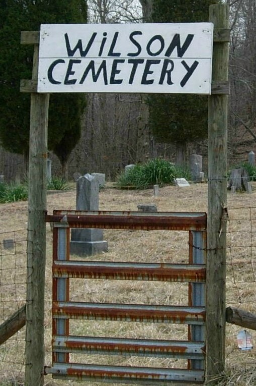
| Description | : | The Wilson Cemetery is locate on the Charles Powell Farm on Slate Creek about 2 miles from R.T. 14. It can be seen on the left going up Slate Creek, about 1/2 mile off the Slate Creek Road. It is well maintained and there is a fence and gates to keep the livestock from entering. The Cemetery is no longer in use with the last buriel being in 1967: Tombstone Photo's were from additional contributors and Buriel information was obtained by researching Death Certificates: From the West Virginia Division of Culture and History Web Sight. Documents show that the... Read More |
frequently asked questions (FAQ):
-
Where is Wilson Cemetery?
Wilson Cemetery is located at Slate, Wood County ,West Virginia ,USA.
-
Wilson Cemetery cemetery's updated grave count on graveviews.com?
4 memorials
-
Where are the coordinates of the Wilson Cemetery?
Latitude: 39.1182400
Longitude: -81.4612560
Nearby Cemetories:
1. Boice Cemetery
Slate, Wood County, USA
Coordinate: 39.1254330, -81.4489830
2. Slate Chapel Cemetery Old
Slate, Wood County, USA
Coordinate: 39.1084000, -81.4747000
3. Slate Chapel Cemetery
Slate, Wood County, USA
Coordinate: 39.1067000, -81.4791000
4. Merrill Chapel United Methodist Church Cemetery
Elizabeth, Wirt County, USA
Coordinate: 39.1261800, -81.4371500
5. Slate Baptist Cemetery
Slate, Wood County, USA
Coordinate: 39.1022400, -81.4887500
6. Deem Cemetery
Leachtown, Wood County, USA
Coordinate: 39.1434180, -81.4475970
7. Beulah Humble Presbyterian Church Cemetery
Elizabeth, Wirt County, USA
Coordinate: 39.1171989, -81.4216995
8. Hammond Cemetery
Elizabeth, Wirt County, USA
Coordinate: 39.0982780, -81.4246670
9. Bibbee Cemetery
Wood County, USA
Coordinate: 39.1394210, -81.4256580
10. Rose Hill Cemetery
Wirt County, USA
Coordinate: 39.0833600, -81.4462600
11. Leachtown Cemetery
Leachtown, Wood County, USA
Coordinate: 39.1495700, -81.4352300
12. Dye Cemetery
Mineral Wells, Wood County, USA
Coordinate: 39.1545790, -81.4803500
13. Vaught Chapel Cemetery
Leachtown, Wood County, USA
Coordinate: 39.1516200, -81.4343400
14. Kanawha Baptist Cemetery
Leachtown, Wood County, USA
Coordinate: 39.1492700, -81.4284500
15. Brand Cemetery
Mineral Wells, Wood County, USA
Coordinate: 39.1247670, -81.5125000
16. Deem Cemetery
Mineral Wells, Wood County, USA
Coordinate: 39.1455994, -81.5017014
17. Central Hill Baptist Church Cemetery
Elizabeth, Wirt County, USA
Coordinate: 39.0765400, -81.4585400
18. Grandview Cemetery
Elizabeth, Wirt County, USA
Coordinate: 39.0786018, -81.4396973
19. West Cemetery
Elizabeth, Wirt County, USA
Coordinate: 39.1018060, -81.4071390
20. Oak Hill Cemetery
Wirt County, USA
Coordinate: 39.1016998, -81.4068985
21. Timms Cemetery
Elizabeth, Wirt County, USA
Coordinate: 39.1013060, -81.4067780
22. Pribble Cemetery
Newark, Wirt County, USA
Coordinate: 39.1193333, -81.3992500
23. Spencer Cemetery
Chesterville, Wood County, USA
Coordinate: 39.1576690, -81.4975690
24. Steed Cemetery
Wirt County, USA
Coordinate: 39.1372500, -81.4034170