
| Memorials | : | 9 |
| Location | : | Liberty County, USA |
| Coordinate | : | 48.1617620, -110.9984420 |
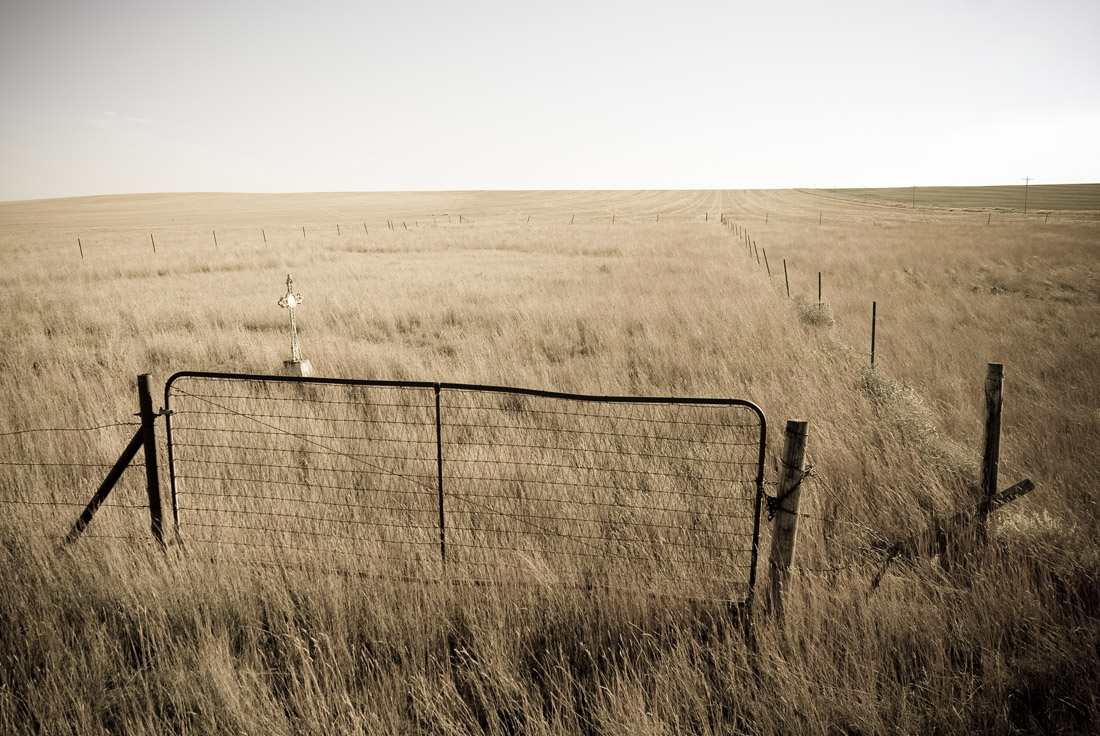
| Description | : | This cemetery was created in 1917, with land donated by the Herman Wolf family. The cemetery was originally named St. Francis Cemetery, and it was intended for use as a burial site for the Catholic congregants of the Marias Mission Church. This mission church was served by the priest of Our Lady of Ransom Catholic Church in Hingham, Montana. The cemetery soon began allowing non-Catholic burials. The name that appeared on death certificates then changed to Hervin Cemetery, based on the historical township in this area. It was also commonly known as Wolf Cemetery, due to the fact that it... Read More |
frequently asked questions (FAQ):
-
Where is Wolf Cemetery?
Wolf Cemetery is located at Liberty County ,Montana ,USA.
-
Wolf Cemetery cemetery's updated grave count on graveviews.com?
9 memorials
-
Where are the coordinates of the Wolf Cemetery?
Latitude: 48.1617620
Longitude: -110.9984420
Nearby Cemetories:
1. Riverview Colony Cemetery
Riverview Colony, Liberty County, USA
Coordinate: 48.1762000, -111.0315000
2. Twin Hills Colony Cemetery
Chouteau County, USA
Coordinate: 48.0142000, -111.0720000
3. Erickson Cemetery
Liberty County, USA
Coordinate: 48.3143997, -110.9503021
4. Sample Flat Cemetery
Chouteau County, USA
Coordinate: 48.0175018, -111.1224976
5. Saint Olaf Lutheran Cemetery
Toole County, USA
Coordinate: 48.2479000, -111.3182000
6. Knees Church Cemetery
Fort Benton, Chouteau County, USA
Coordinate: 47.9875000, -111.3621000
7. Golden West Cemetery
Conrad, Pondera County, USA
Coordinate: 48.1906013, -111.4957962
8. Lothair Protestant Cemetery
Lothair, Liberty County, USA
Coordinate: 48.4694000, -111.2393100
9. Lothair Catholic Cemetery
Lothair, Liberty County, USA
Coordinate: 48.4687000, -111.2484000
10. Chester Cemetery
Chester, Liberty County, USA
Coordinate: 48.5219002, -110.9807968
11. Carter Cemetery
Carter, Chouteau County, USA
Coordinate: 47.7852000, -110.9616000
12. Galata Cemetery
Toole County, USA
Coordinate: 48.4655991, -111.3349991
13. Omholt Cemetery
Toole County, USA
Coordinate: 48.3058014, -111.5346985
14. Kenilworth Cemetery
Chouteau County, USA
Coordinate: 48.2192001, -110.4188995
15. Old Shep Gravesite
Fort Benton, Chouteau County, USA
Coordinate: 47.8369000, -110.6557000
16. Riverside Cemetery
Fort Benton, Chouteau County, USA
Coordinate: 47.8402330, -110.6408830
17. Museum of the Upper Missouri
Fort Benton, Chouteau County, USA
Coordinate: 47.8207000, -110.6642000
18. Joplin Cemetery
Joplin, Liberty County, USA
Coordinate: 48.5576720, -110.7622930
19. Camrose Colony Cemetery
Conrad, Pondera County, USA
Coordinate: 48.3092000, -111.6114000
20. Devon Cemetery
Toole County, USA
Coordinate: 48.4693000, -111.4713000
21. Inverness Cemetery
Hill County, USA
Coordinate: 48.5531340, -110.6688450
22. Rudyard Cemetery
Rudyard, Hill County, USA
Coordinate: 48.5659500, -110.5390000
23. Dunkirk Cemetery
Dunkirk, Toole County, USA
Coordinate: 48.4797810, -111.6761860
24. Eagle Creek Colony Cemetery
Chester, Liberty County, USA
Coordinate: 48.6976000, -111.2011000