
| Memorials | : | 29 |
| Location | : | Toole County, USA |
| Coordinate | : | 48.2479000, -111.3182000 |
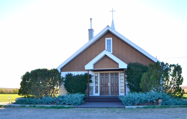
| Description | : | The Cemetery is located in Toole County, although the address for the church is Ledgr, MT, which is in Pondera County. It can be found by taking the Ledger Rd east about 20 miles to the Bootlegger Trail and then south on the Bootlegger Trail about 3 miles. |
frequently asked questions (FAQ):
-
Where is Saint Olaf Lutheran Cemetery?
Saint Olaf Lutheran Cemetery is located at Toole County ,Montana ,USA.
-
Saint Olaf Lutheran Cemetery cemetery's updated grave count on graveviews.com?
29 memorials
-
Where are the coordinates of the Saint Olaf Lutheran Cemetery?
Latitude: 48.2479000
Longitude: -111.3182000
Nearby Cemetories:
1. Golden West Cemetery
Conrad, Pondera County, USA
Coordinate: 48.1906013, -111.4957962
2. Omholt Cemetery
Toole County, USA
Coordinate: 48.3058014, -111.5346985
3. Riverview Colony Cemetery
Riverview Colony, Liberty County, USA
Coordinate: 48.1762000, -111.0315000
4. Camrose Colony Cemetery
Conrad, Pondera County, USA
Coordinate: 48.3092000, -111.6114000
5. Galata Cemetery
Toole County, USA
Coordinate: 48.4655991, -111.3349991
6. Lothair Catholic Cemetery
Lothair, Liberty County, USA
Coordinate: 48.4687000, -111.2484000
7. Lothair Protestant Cemetery
Lothair, Liberty County, USA
Coordinate: 48.4694000, -111.2393100
8. Wolf Cemetery
Liberty County, USA
Coordinate: 48.1617620, -110.9984420
9. Devon Cemetery
Toole County, USA
Coordinate: 48.4693000, -111.4713000
10. Erickson Cemetery
Liberty County, USA
Coordinate: 48.3143997, -110.9503021
11. Knees Church Cemetery
Fort Benton, Chouteau County, USA
Coordinate: 47.9875000, -111.3621000
12. Sample Flat Cemetery
Chouteau County, USA
Coordinate: 48.0175018, -111.1224976
13. Twin Hills Colony Cemetery
Chouteau County, USA
Coordinate: 48.0142000, -111.0720000
14. Dunkirk Cemetery
Dunkirk, Toole County, USA
Coordinate: 48.4797810, -111.6761860
15. Chester Cemetery
Chester, Liberty County, USA
Coordinate: 48.5219002, -110.9807968
16. Mountain View Cemetery
Shelby, Toole County, USA
Coordinate: 48.5032200, -111.8675800
17. Hillside Cemetery
Conrad, Pondera County, USA
Coordinate: 48.1768990, -111.9835968
18. Eagle Creek Colony Cemetery
Chester, Liberty County, USA
Coordinate: 48.6976000, -111.2011000
19. Valley View Cemetery
Shelby, Toole County, USA
Coordinate: 48.5190000, -111.8863000
20. Dutton Cemetery
Dutton, Teton County, USA
Coordinate: 47.8504000, -111.7100000
21. Grandview Cemetery
Toole County, USA
Coordinate: 48.7265000, -111.3615000
22. Sacred Heart Cemetery
Williams, Pondera County, USA
Coordinate: 48.3187000, -112.0327000
23. Joplin Cemetery
Joplin, Liberty County, USA
Coordinate: 48.5576720, -110.7622930
24. Trinity Church Cemetery
Lothair, Liberty County, USA
Coordinate: 48.7263000, -111.2296000