
| Memorials | : | 4 |
| Location | : | Rosebud, Falls County, USA |
| Coordinate | : | 31.0711002, -96.9852982 |
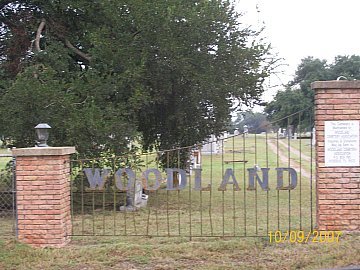
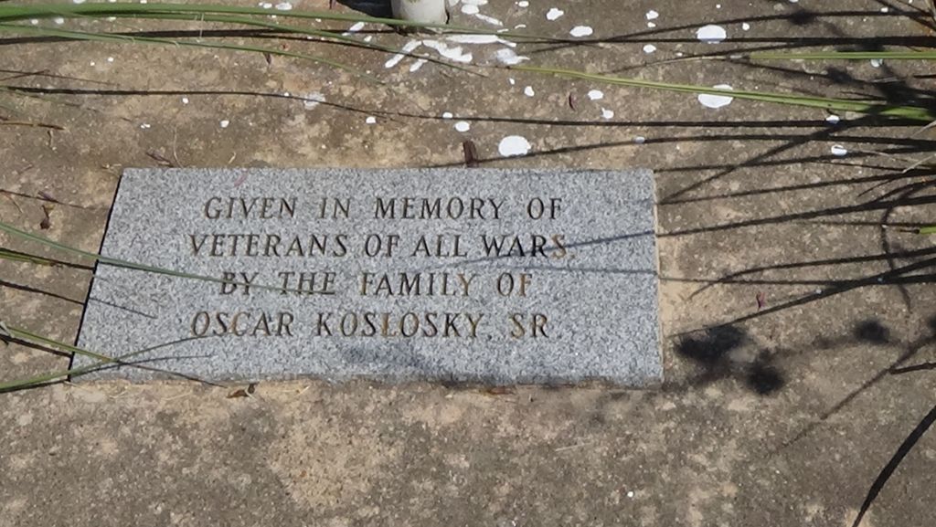
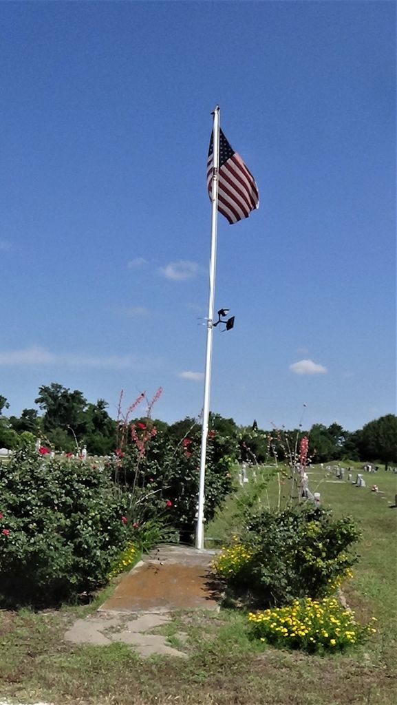
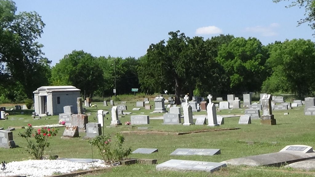
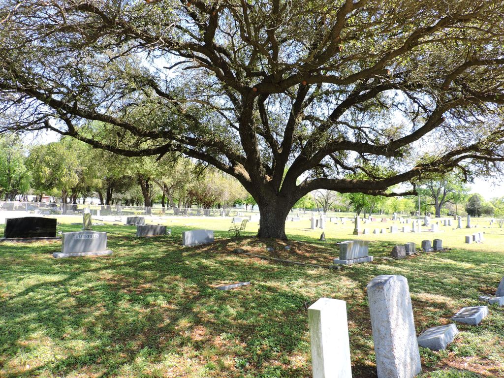
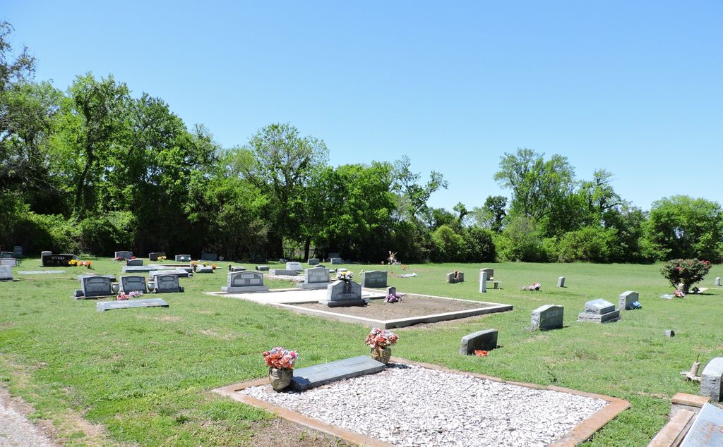
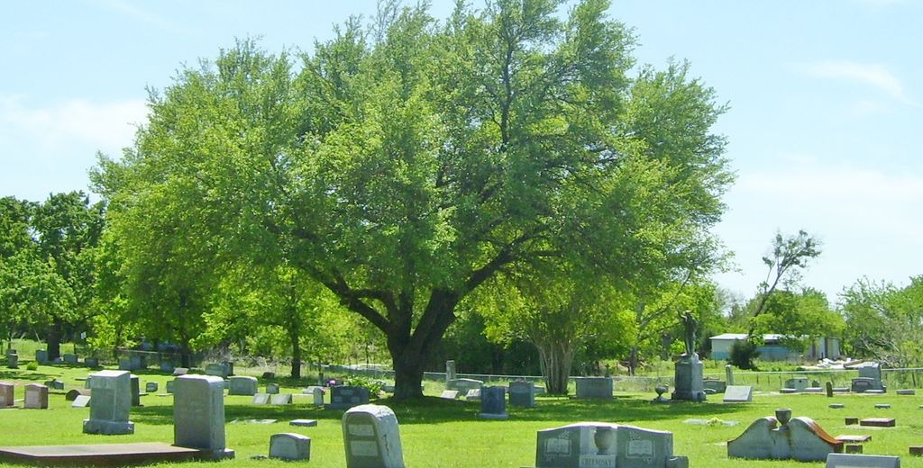
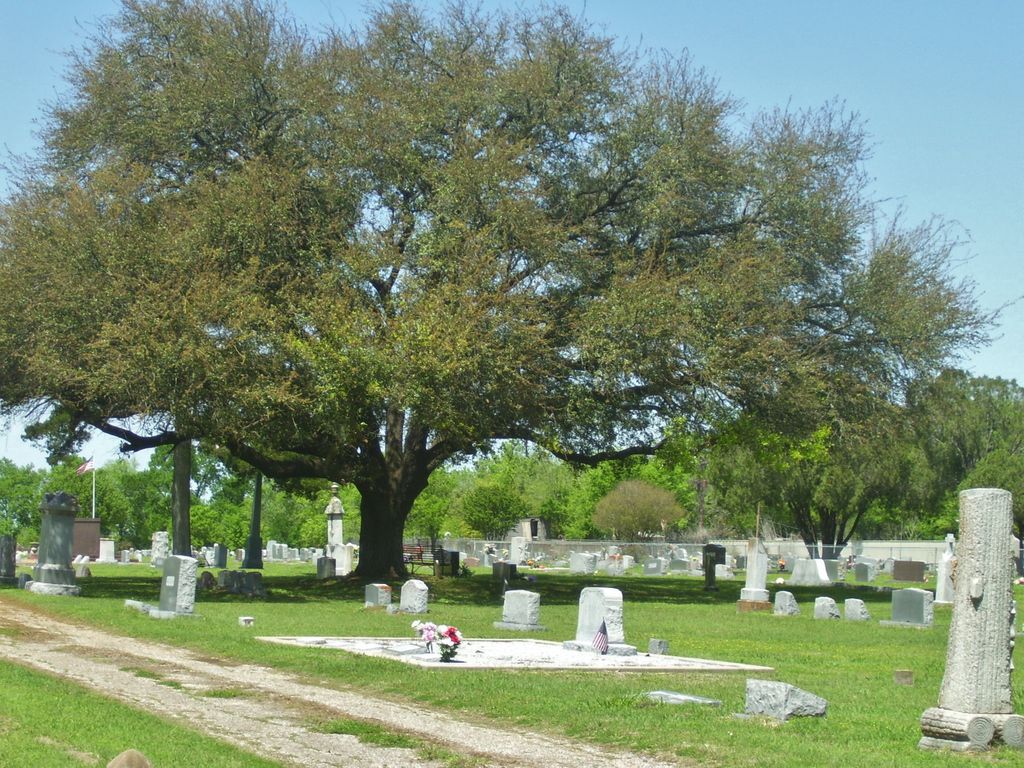
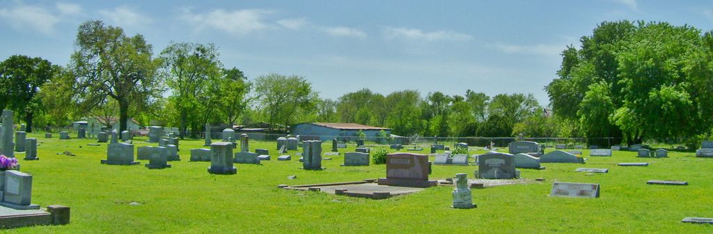
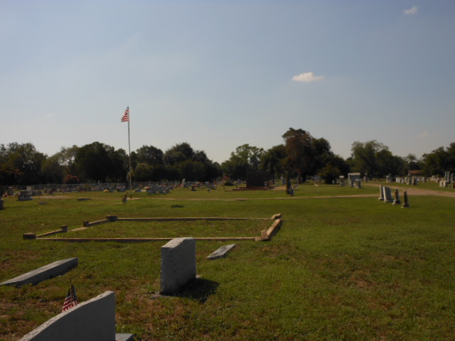
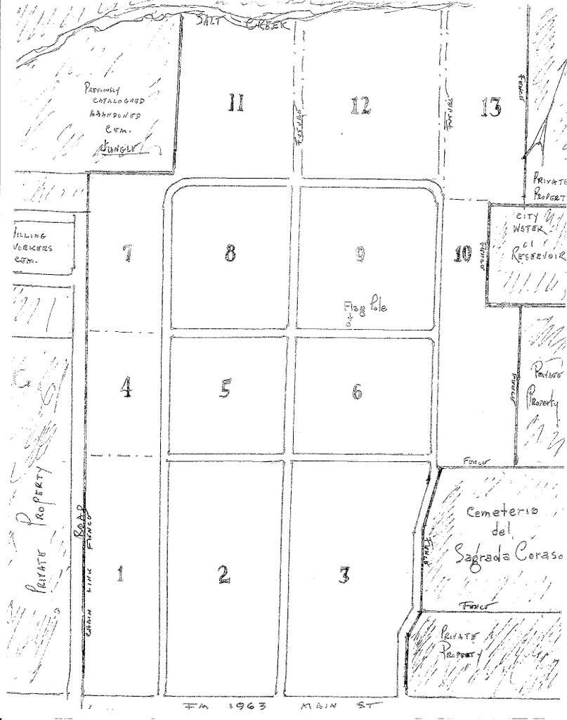
| Description | : | This burial ground is located on the west side of Rosebud. The sign is located on the front fence between brick columns, and the remaining property is fenced on all sides. A flag pole is located on this land. The headstones are beautiful and large and are located among statues. The graves are in neat rows and many are encased in curbing. The cemetery is clean and well maintained. There are 2 mausoleums on the land. One contains 5 deceased people, with beautiful stained glass windows in the walls, and 1 open space for a future interment. The 2nd... Read More |
frequently asked questions (FAQ):
-
Where is Woodland Cemetery?
Woodland Cemetery is located at 1175 W. Mullins Road (Hwy 1963) Rosebud, Falls County ,Texas , 76570USA.
-
Woodland Cemetery cemetery's updated grave count on graveviews.com?
4 memorials
-
Where are the coordinates of the Woodland Cemetery?
Latitude: 31.0711002
Longitude: -96.9852982
Nearby Cemetories:
1. Sacred Heart Cemetery
Rosebud, Falls County, USA
Coordinate: 31.0723110, -96.9845140
2. Willing Worker Cemetery
Rosebud, Falls County, USA
Coordinate: 31.0719520, -96.9868690
3. Bluebonnet Cemetery
Rosebud, Falls County, USA
Coordinate: 31.0599995, -97.0074997
4. Pomykal Cemetery
Rosebud, Falls County, USA
Coordinate: 31.0425700, -97.0028300
5. Tarver Cemetery
Falls County, USA
Coordinate: 31.1119080, -96.9956470
6. Powell Cemetery
Lott, Falls County, USA
Coordinate: 31.1539001, -96.9841995
7. Phillips Cemetery
Lott, Falls County, USA
Coordinate: 31.1506004, -97.0128021
8. Sanches Cemetery
Travis, Falls County, USA
Coordinate: 31.1503600, -97.0138500
9. Powers Cemetery
Rosebud, Falls County, USA
Coordinate: 31.1081000, -96.8914000
10. Powers Chapel Cemetery
Rosebud, Falls County, USA
Coordinate: 31.1164820, -96.8905770
11. Salem Lutheran Cemetery
Rosebud, Falls County, USA
Coordinate: 31.0519047, -97.0974274
12. Live Oak Cemetery
Lott, Falls County, USA
Coordinate: 31.1583004, -97.0571976
13. Barclay Cemetery
Barclay, Falls County, USA
Coordinate: 31.0727997, -97.1125031
14. Pieper Cemetery
Barclay, Falls County, USA
Coordinate: 31.0731070, -97.1132980
15. Pool Family Cemetery
Lott, Falls County, USA
Coordinate: 31.1816700, -96.9805600
16. Ferguson Cemetery
Rosebud, Falls County, USA
Coordinate: 31.1413200, -96.8841100
17. Shiloh Cemetery
Rosebud, Falls County, USA
Coordinate: 31.1441994, -96.8692017
18. Saint Mary's Cemetery
Westphalia, Falls County, USA
Coordinate: 31.1228008, -97.1168976
19. Saint Joseph Cemetery
Cyclone, Bell County, USA
Coordinate: 31.0321999, -97.1232986
20. Cedar Springs Cemetery
Rosebud, Falls County, USA
Coordinate: 31.1828190, -96.9204910
21. Jerusalem Cemetery
Lott, Falls County, USA
Coordinate: 31.2060940, -96.9547010
22. Lott Cemetery
Lott, Falls County, USA
Coordinate: 31.2071760, -97.0417700
23. Krumnow Cemetery
Cedar Springs, Falls County, USA
Coordinate: 31.2138020, -96.9533530
24. Clover Hill Cemetery
Lott, Falls County, USA
Coordinate: 31.2089005, -97.0432968