
| Memorials | : | 0 |
| Location | : | Vienna, Maries County, USA |
| Coordinate | : | 38.2474500, -92.0372300 |
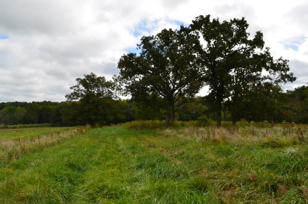
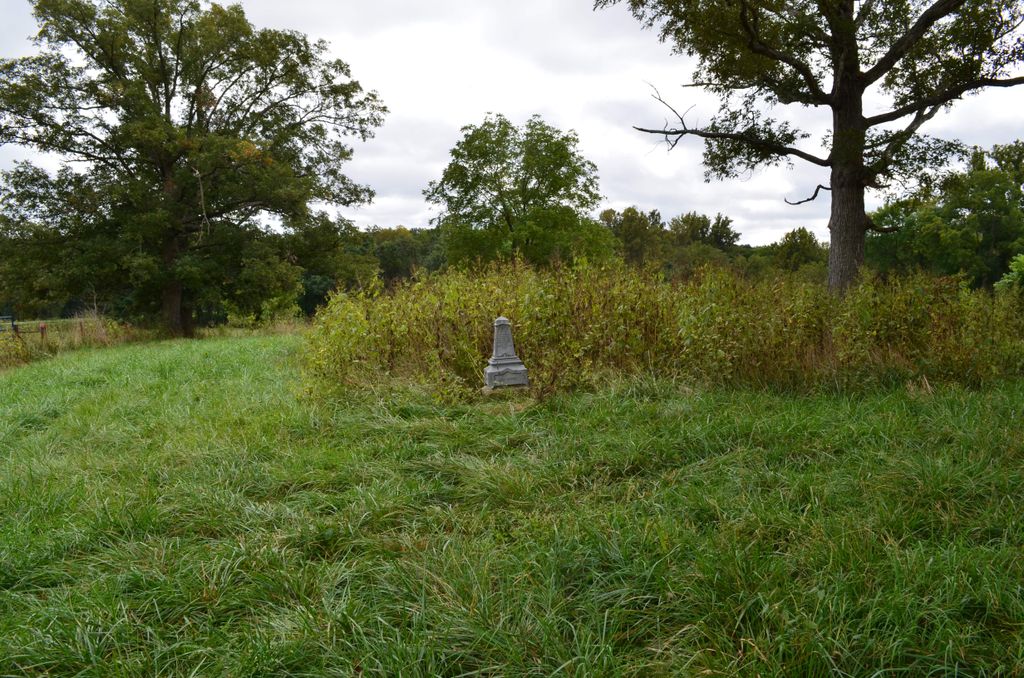
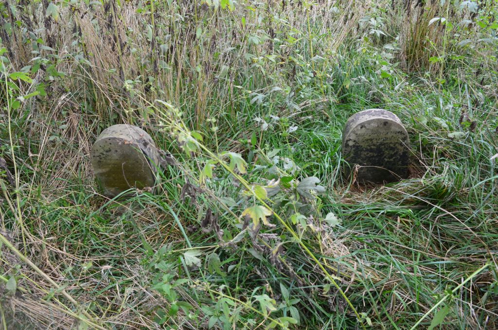
| Description | : | Cemetery is roughly 3 miles south of Argyle, Osage County Missouri. It can be reached by going south from Argyle on Highway T for roughly 3 miles, and then turn right on Road JJ and go 2 tenths of a mile. The cemetery is on the left alongside a bean field. through a gate approximately 100 hundred yards from the road on private farm property owned by Tim and Ruth Barnhart. The cemetery is very rough and over grown. It has reportedly been dozed over, with cattle having had access to the area. Only three... Read More |
frequently asked questions (FAQ):
-
Where is Woody Cemetery?
Woody Cemetery is located at Vienna, Maries County ,Missouri ,USA.
-
Woody Cemetery cemetery's updated grave count on graveviews.com?
0 memorials
-
Where are the coordinates of the Woody Cemetery?
Latitude: 38.2474500
Longitude: -92.0372300
Nearby Cemetories:
1. Owens Cemetery
Maries County, USA
Coordinate: 38.2337500, -92.0408500
2. Saint Aloysius Cemetery
Argyle, Osage County, USA
Coordinate: 38.2968800, -92.0222500
3. Lewis Bolton Burial Ground
Saint Thomas, Cole County, USA
Coordinate: 38.2635000, -92.1007000
4. Venus Cemetery
Venus, Maries County, USA
Coordinate: 38.1874660, -92.0368480
5. Brenner - Engelbrecht Burial Ground
Saint Thomas, Cole County, USA
Coordinate: 38.2612000, -92.1255000
6. Stokes Cemetery
Van Cleve, Maries County, USA
Coordinate: 38.2366700, -92.1302800
7. Saint Boniface Catholic Cemetery
Koeltztown, Osage County, USA
Coordinate: 38.3253100, -92.0399100
8. Little Flock Cemetery
Vienna, Maries County, USA
Coordinate: 38.2286600, -91.9350200
9. Rader Cemetery
Vienna, Maries County, USA
Coordinate: 38.2489700, -91.9300600
10. Vienna Public Cemetery
Vienna, Maries County, USA
Coordinate: 38.1880500, -91.9591800
11. Visitation Cemetery
Vienna, Maries County, USA
Coordinate: 38.1872800, -91.9585800
12. Maries County Poor Farm Cemetery
Maries County, USA
Coordinate: 38.1732400, -91.9570800
13. Campground Christian Church Cemetery
Van Cleve, Maries County, USA
Coordinate: 38.2262800, -92.1602700
14. Bell Burial Ground
Saint Thomas, Cole County, USA
Coordinate: 38.2550000, -92.1645000
15. Beck Cemetery
Saint Thomas, Cole County, USA
Coordinate: 38.2857000, -92.1602000
16. Crismon Cemetery
Maries County, USA
Coordinate: 38.1641998, -92.1271973
17. Holy Family Cemetery
Freeburg, Osage County, USA
Coordinate: 38.3121986, -91.9238968
18. Meta Southside Cemetery
Meta, Osage County, USA
Coordinate: 38.3050720, -92.1570750
19. Thompson Cemetery
Maries County, USA
Coordinate: 38.2619019, -92.1789017
20. Breeding Cemetery
Freeburg, Osage County, USA
Coordinate: 38.2933006, -91.9030991
21. Blue River Cemetery Old
Saint Thomas, Cole County, USA
Coordinate: 38.2723000, -92.1855000
22. Pendleton Cemetery
Maries County, USA
Coordinate: 38.2243996, -92.1872025
23. Saint Cecilia Cemetery
Meta, Osage County, USA
Coordinate: 38.3156013, -92.1641998
24. Red Rowden Cemetery
Maries County, USA
Coordinate: 38.1863200, -92.1700900