
| Memorials | : | 0 |
| Location | : | Wroxham, Broadland District, England |
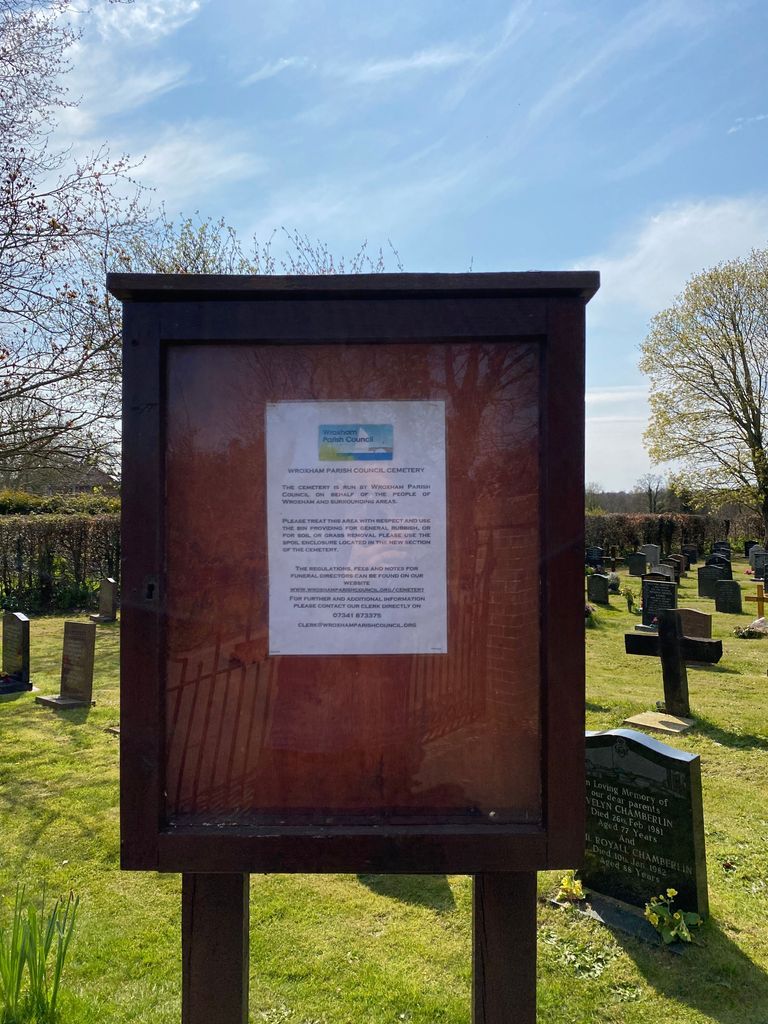
| Phone | : | 07341873375 |
| Website | : | wroxhamparishcouncil.org/cemetery |
| Coordinate | : | 52.7079631, 1.3994432 |
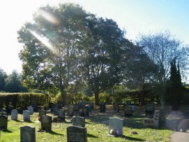
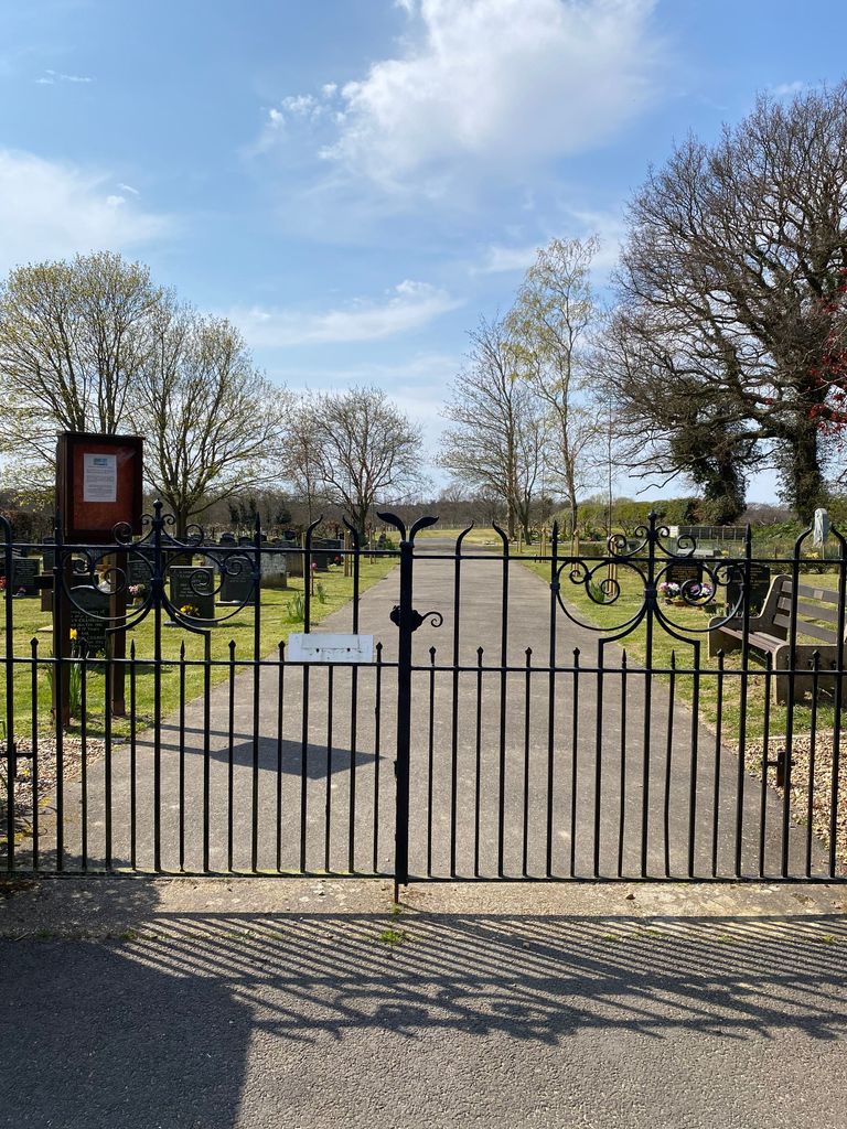
| Description | : | Wroxham Cemetery is owned and managed by Wroxham Parish Council. It is open to the public all year round. |
frequently asked questions (FAQ):
-
Where is Wroxham Parish Council Cemetery?
Wroxham Parish Council Cemetery is located at Nobel Crescent, Wroxham, Norwich Wroxham, Broadland District ,Norfolk , NR12 8SFEngland.
-
Wroxham Parish Council Cemetery cemetery's updated grave count on graveviews.com?
0 memorials
-
Where are the coordinates of the Wroxham Parish Council Cemetery?
Latitude: 52.7079631
Longitude: 1.3994432
Nearby Cemetories:
1. St. Mary the Virgin Churchyard
Wroxham, Broadland District, England
Coordinate: 52.7067470, 1.3984620
2. St. Peter's Churchyard
Belaugh, Broadland District, England
Coordinate: 52.7153080, 1.3867600
3. St John's Churchyard
Hoveton, North Norfolk District, England
Coordinate: 52.7120040, 1.4174270
4. St. Peter's Churchyard
Hoveton, North Norfolk District, England
Coordinate: 52.7239790, 1.4256250
5. All Saints Churchyard
Salhouse, Broadland District, England
Coordinate: 52.6833600, 1.4063280
6. St. John the Baptist Churchyard
Coltishall, Broadland District, England
Coordinate: 52.7278530, 1.3626450
7. Salhouse Baptist Church
Salhouse, Broadland District, England
Coordinate: 52.6807500, 1.4223800
8. All Saints Churchyard
Rackheath, Broadland District, England
Coordinate: 52.6846160, 1.3573490
9. St. Swithin's Churchyard
Ashmanhaugh, North Norfolk District, England
Coordinate: 52.7384470, 1.4271260
10. All Saints Churchyard
Horstead, Broadland District, England
Coordinate: 52.7294900, 1.3499140
11. St. Fabian & St. Sebastian Churchyard
Woodbastwick, Broadland District, England
Coordinate: 52.6841900, 1.4492890
12. St. Peter Crostwick Church Cemetery
Crostwick, Broadland District, England
Coordinate: 52.6934480, 1.3395750
13. Neatishead Baptist Churchyard
Neatishead, North Norfolk District, England
Coordinate: 52.7240100, 1.4633560
14. St. Peter Churchyard
Neatishead, North Norfolk District, England
Coordinate: 52.7244260, 1.4703220
15. Saint Lawrence Churchyard
Beeston St Lawrence, North Norfolk District, England
Coordinate: 52.7451100, 1.4474500
16. St Swithin Churchyard
Frettenham, Broadland District, England
Coordinate: 52.7177780, 1.3223060
17. St. Benedict's Church Cemetery
Horning, North Norfolk District, England
Coordinate: 52.6955690, 1.4836570
18. Saint Peter's Churchyard
Spixworth, Broadland District, England
Coordinate: 52.6933240, 1.3145170
19. St. Michael and All Angels Churchyard
Barton Turf, North Norfolk District, England
Coordinate: 52.7437260, 1.4702980
20. All Saints Churchyard
Panxworth, Broadland District, England
Coordinate: 52.6688790, 1.4703430
21. St. Helen's Churchyard
Ranworth, Broadland District, England
Coordinate: 52.6792260, 1.4836790
22. St Gervase and St Protase Churchyard
Little Plumstead, Broadland District, England
Coordinate: 52.6468000, 1.4093000
23. Sprowston Cemetery
Sprowston, Broadland District, England
Coordinate: 52.6644440, 1.3249400
24. St. Mary and St. Margaret Churchyard
Sprowston, Broadland District, England
Coordinate: 52.6635430, 1.3248800