
| Memorials | : | 0 |
| Location | : | Powiat wschowski, Poland |
| Website | : | muzeum.wschowa.pl/siedziby/lapidarium/ |
| Coordinate | : | 51.8086102, 16.3182998 |
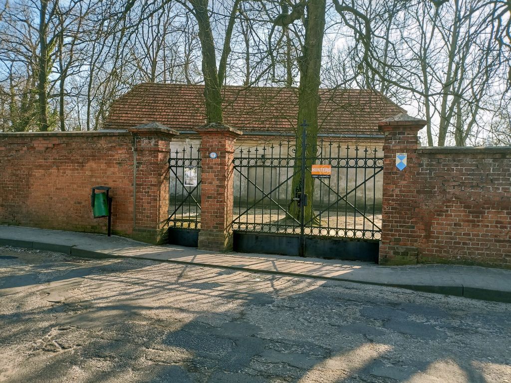
| Description | : | The old Protestant cemetery in Wschowa (German: Fraustadt) was founded in 1609 on the initiative of pastor Valerius Herberger. It is one of the earliest cemeteries in Europe to break with the tradition of buying the dead near the churches, and is the oldest of its kind in Poland. It was also an early example of the Italian "camposanto" model in Central Europe. The cemetery contains many ornate and valuable graves from the 17th and 18th century, and was the burial place of most of the town's Protestant elite through the 19th century. The cemetery was damaged during WWII, and... Read More |
frequently asked questions (FAQ):
-
Where is Wschowa Old Protestant Cemetery?
Wschowa Old Protestant Cemetery is located at ul. Spokojna 7, Wschowa Powiat wschowski ,Lubuskie ,Poland.
-
Wschowa Old Protestant Cemetery cemetery's updated grave count on graveviews.com?
0 memorials
-
Where are the coordinates of the Wschowa Old Protestant Cemetery?
Latitude: 51.8086102
Longitude: 16.3182998
Nearby Cemetories:
1. Geyersdorf Friedhof
Powiat wschowski, Poland
Coordinate: 51.8183960, 16.3532140
2. Krzepielów Church of St. Martin
Powiat wschowski, Poland
Coordinate: 51.7882136, 16.1068936
3. Bazylika św. Mikołaja w Lesznie
Leszno, Miasto Leszno, Poland
Coordinate: 51.8423740, 16.5741449
4. Glinka Leszczynskie
Powiat górowski, Poland
Coordinate: 51.7087690, 16.5375460
5. Jüdischer Friedhof Lissa
Miasto Leszno, Poland
Coordinate: 51.8403060, 16.5861110
6. Białołęka Church Graveyard
Wrocław, Miasto Wrocław, Poland
Coordinate: 51.6488200, 16.2125300
7. Cmentarz Komunalny w Lesznie
Leszno, Miasto Leszno, Poland
Coordinate: 51.8464572, 16.5932854
8. Collegiate church
Glinno, Powiat wałbrzyski, Poland
Coordinate: 51.6704600, 16.0940300
9. Church of Saint Nicolas
Glinno, Powiat wałbrzyski, Poland
Coordinate: 51.6625000, 16.0919440
10. Czernina Communal Cemetery
Trzebnica, Powiat trzebnicki, Poland
Coordinate: 51.7235304, 16.6180283
11. Czernina Church of St. Lawrence
Powiat górowski, Poland
Coordinate: 51.7191369, 16.6175247
12. Grębocice Church Graveyard
Trzebnica, Powiat trzebnicki, Poland
Coordinate: 51.5979200, 16.1642500
13. Cmentarz Parafialny w Kąkolewie
Powiat leszczyński, Poland
Coordinate: 51.8650454, 16.6907046
14. Kurowice Cemetery
Bolesławiec, Powiat bolesławiecki, Poland
Coordinate: 51.6369600, 16.0407500
15. Żukowice Church of St. Hedwig
Powiat głogowski, Poland
Coordinate: 51.6711341, 15.9822348
16. Gwizdanów Church Graveyard
Bolesławiec, Powiat bolesławiecki, Poland
Coordinate: 51.5326000, 16.2913200
17. Jakubów Church Graveyard
Bolesławiec, Powiat bolesławiecki, Poland
Coordinate: 51.6085800, 15.9992700
18. Konotop Communal Cemetery
Powiat nowosolski, Poland
Coordinate: 51.9278193, 15.8982824
19. Konotop Church of St. Anne
Powiat nowosolski, Poland
Coordinate: 51.9348543, 15.9016898
20. Kurów Wielki Church Graveyard
Bolesławiec, Powiat bolesławiecki, Poland
Coordinate: 51.6653100, 15.9095300
21. Bytom Odrzański Church of St. Jerome
Powiat nowosolski, Poland
Coordinate: 51.7297088, 15.8268909
22. Trzebcz Evangelical Cemetery
Bolesławiec, Powiat bolesławiecki, Poland
Coordinate: 51.5207300, 16.1140100
23. Cmentarz w Siedlisku
Powiat nowosolski, Poland
Coordinate: 51.7692889, 15.8059587
24. Gaworzyce Parish Cemetery
Bolesławiec, Powiat bolesławiecki, Poland
Coordinate: 51.6297900, 15.8874600