
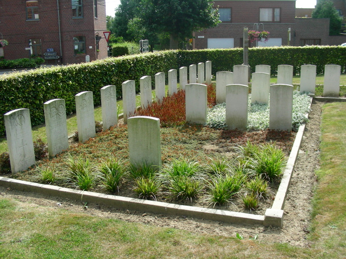
| Memorials | : | 0 |
| Location | : | Heuvelland, Arrondissement Ieper, Belgium |
| Coordinate | : | 50.7595600, 2.8547600 |
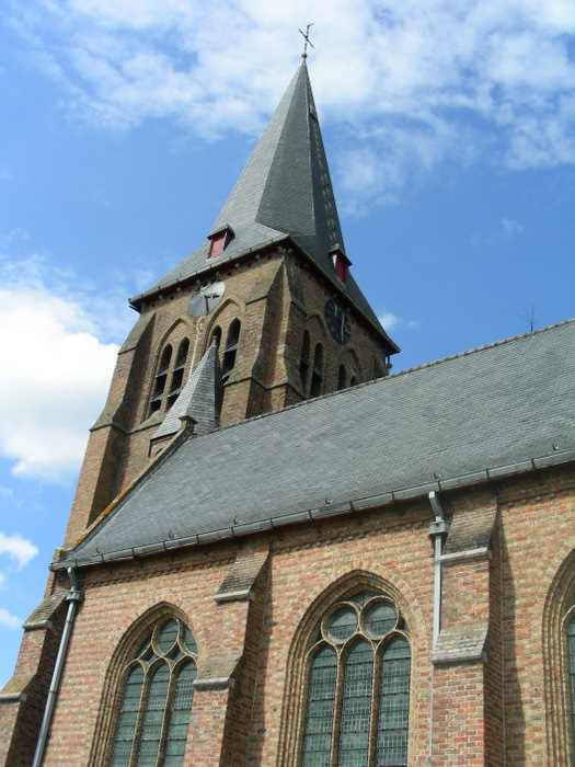
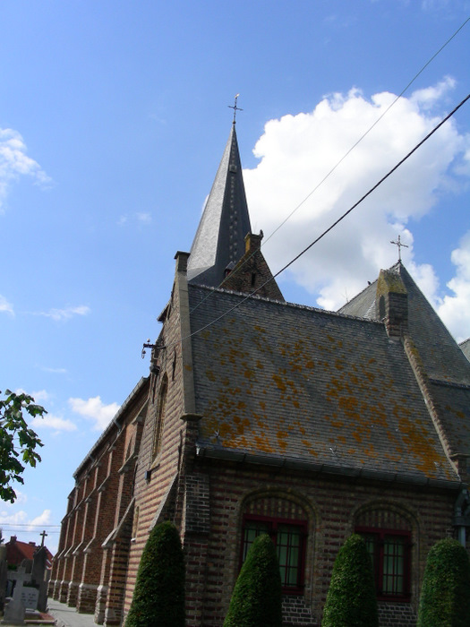
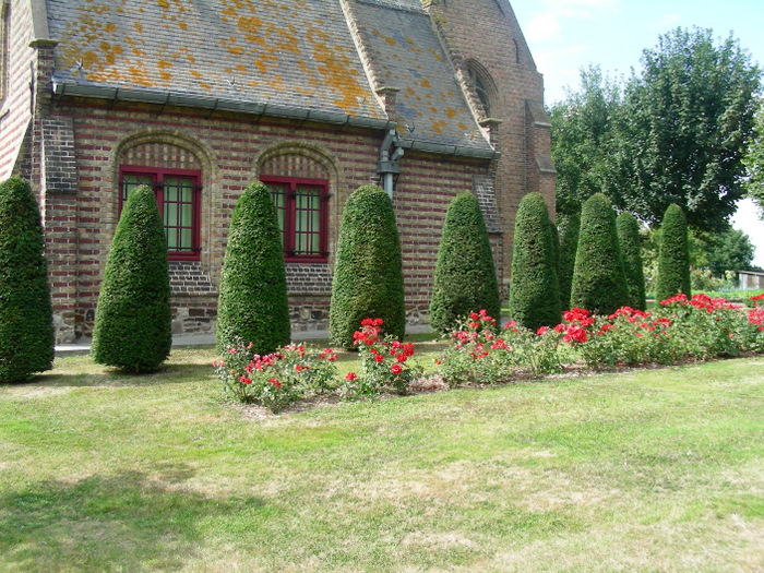
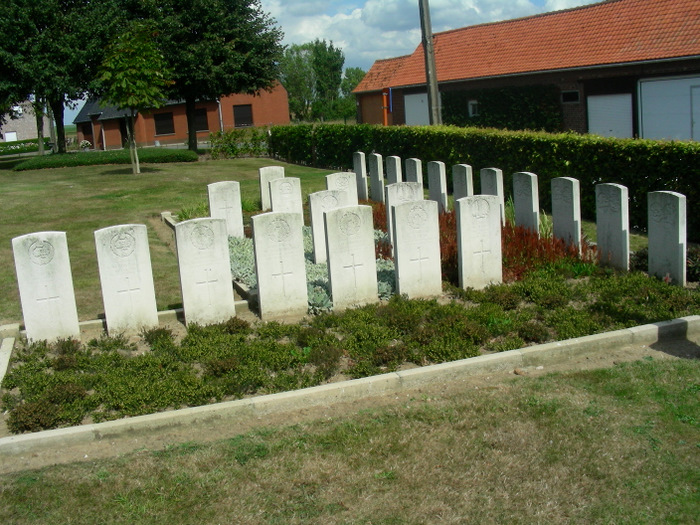
| Description | : | Visiting Information: Wheelchair access to site possible - maybe by an alternative entrance. For further information regarding wheelchair access, please contact our Enquiries Department on telephone number: 01628 634221 Location Information: Wulvergem Churchyard is located 13 Km south of Ieper town centre, on a road leading from the Rijselseweg N365, which connects Ieper to Wijtschate, Mesen and onto Armentieres. From Ieper town centre the Rijselsestraat runs from the market square, through the Lille Gate (Rijselpoort) and directly over the crossroads with the Ieper ring road. The road name then changes to the Rijselseweg. On reaching the town of Mesen the first... Read More |
frequently asked questions (FAQ):
-
Where is Wulvergem Churchyard?
Wulvergem Churchyard is located at Heuvelland, Arrondissement Ieper ,West Flanders (West-Vlaanderen) ,Belgium.
-
Wulvergem Churchyard cemetery's updated grave count on graveviews.com?
0 memorials
-
Where are the coordinates of the Wulvergem Churchyard?
Latitude: 50.7595600
Longitude: 2.8547600
Nearby Cemetories:
1. Saint Quentin Cabaret Military Cemetery
Comines-Warneton, Arrondissement de Mouscron, Belgium
Coordinate: 50.7569700, 2.8556500
2. Kandahar Farm Cemetery
Heuvelland, Arrondissement Ieper, Belgium
Coordinate: 50.7548100, 2.8475800
3. Ration Farm La Plus Douve Cemetery Annex
Comines-Warneton, Arrondissement de Mouscron, Belgium
Coordinate: 50.7548300, 2.8637100
4. Wulverghem-Lindenhoek Road Military Cemetery
Heuvelland, Arrondissement Ieper, Belgium
Coordinate: 50.7636800, 2.8439200
5. R.E. Farm Cemetery
Heuvelland, Arrondissement Ieper, Belgium
Coordinate: 50.7671200, 2.8602600
6. La Plus Douve Farm Military Cemetery
Comines-Warneton, Arrondissement de Mouscron, Belgium
Coordinate: 50.7529200, 2.8645700
7. Pond Farm Cemetery
Heuvelland, Arrondissement Ieper, Belgium
Coordinate: 50.7690100, 2.8450400
8. Lone Tree Military Cemetery
Mesen, Arrondissement Ieper, Belgium
Coordinate: 50.7745300, 2.8619200
9. Packhorse Farm Shrine Cemetery
Heuvelland, Arrondissement Ieper, Belgium
Coordinate: 50.7701500, 2.8332100
10. Spanbroekmolen British Cemetery
Heuvelland, Arrondissement Ieper, Belgium
Coordinate: 50.7783700, 2.8670900
11. Underhill Farm Cemetery
Comines-Warneton, Arrondissement de Mouscron, Belgium
Coordinate: 50.7411700, 2.8702400
12. Nieuwkerke Churchyard
Heuvelland, Arrondissement Ieper, Belgium
Coordinate: 50.7455300, 2.8258700
13. Messines Ridge British Cemetery
Mesen, Arrondissement Ieper, Belgium
Coordinate: 50.7645700, 2.8909700
14. Messines Ridge New Zealand Memorial
Mesen, Arrondissement Ieper, Belgium
Coordinate: 50.7649474, 2.8909312
15. Irish House Cemetery
Heuvelland, Arrondissement Ieper, Belgium
Coordinate: 50.7844200, 2.8538100
16. Island of Ireland Peace Park
Mesen, Arrondissement Ieper, Belgium
Coordinate: 50.7594550, 2.8951760
17. Lindenhoek Chalet Military Cemetery
Heuvelland, Arrondissement Ieper, Belgium
Coordinate: 50.7765100, 2.8236600
18. Berks Cemetery Extension
Comines-Warneton, Arrondissement de Mouscron, Belgium
Coordinate: 50.7377900, 2.8820700
19. Ploegsteert Memorial
Ploegsteert, Arrondissement de Mouscron, Belgium
Coordinate: 50.7378000, 2.8822800
20. Hyde Park Corner Royal Berk Cemetery
Comines-Warneton, Arrondissement de Mouscron, Belgium
Coordinate: 50.7377300, 2.8826700
21. Sint-Niklaaskerk
Mesen, Arrondissement Ieper, Belgium
Coordinate: 50.7640800, 2.8987640
22. Wytschaete Military Cemetery
Heuvelland, Arrondissement Ieper, Belgium
Coordinate: 50.7849600, 2.8769600
23. Kemmel Churchyard
Heuvelland, Arrondissement Ieper, Belgium
Coordinate: 50.7838600, 2.8265100
24. Mesen Communal Cemetery
Mesen, Arrondissement Ieper, Belgium
Coordinate: 50.7669322, 2.9017516