
| Memorials | : | 2 |
| Location | : | Heuvelland, Arrondissement Ieper, Belgium |
| Coordinate | : | 50.7636800, 2.8439200 |
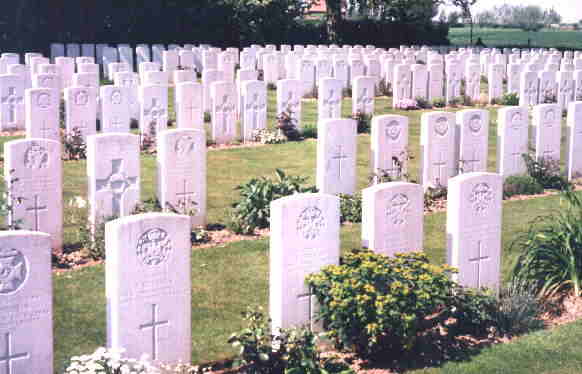
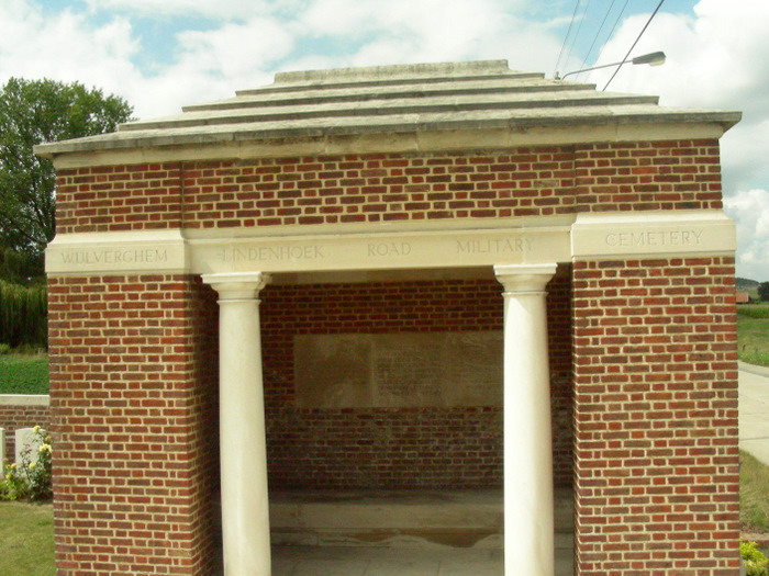
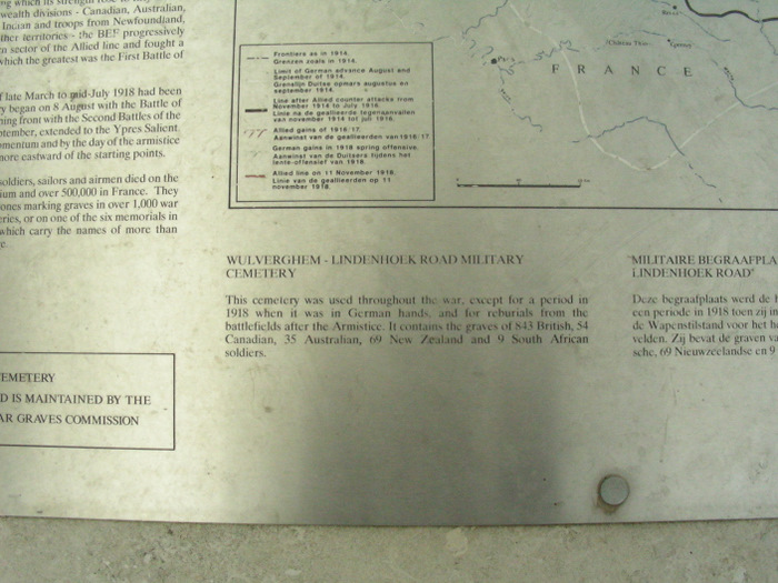
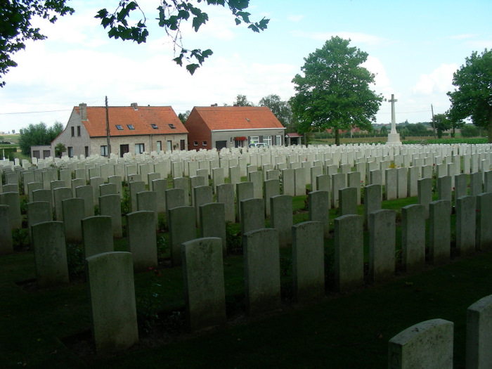
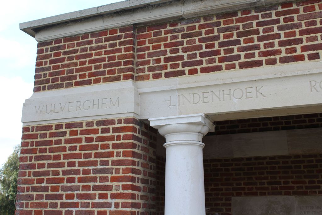
| Description | : | Location Information: Wulverghem-Lindenhoek Road Military Cemetery is located 13 Km south of Ieper town centre, on a road leading from the Kemmelseweg N331 connecting Ieper to Kemmel. From Ieper town centre the Kemmelseweg is reached via the Rijselsestraat, through the Lille Gate (Rijselpoort) and straight on towards Armentieres (N365). 900 metres after the crossroads is the right hand turning onto the Kemmelseweg. (Made prominent by a railway level crossing). 2 Km after passing the village of Kemmel lies the left hand turning onto the Hooghofstraat. The cemetery lies 1.5 Km along the Hooghofstraat on the right hand side of the... Read More |
frequently asked questions (FAQ):
-
Where is Wulverghem-Lindenhoek Road Military Cemetery?
Wulverghem-Lindenhoek Road Military Cemetery is located at Heuvelland, Arrondissement Ieper ,West Flanders (West-Vlaanderen) ,Belgium.
-
Wulverghem-Lindenhoek Road Military Cemetery cemetery's updated grave count on graveviews.com?
1 memorials
-
Where are the coordinates of the Wulverghem-Lindenhoek Road Military Cemetery?
Latitude: 50.7636800
Longitude: 2.8439200
Nearby Cemetories:
1. Pond Farm Cemetery
Heuvelland, Arrondissement Ieper, Belgium
Coordinate: 50.7690100, 2.8450400
2. Wulvergem Churchyard
Heuvelland, Arrondissement Ieper, Belgium
Coordinate: 50.7595600, 2.8547600
3. Kandahar Farm Cemetery
Heuvelland, Arrondissement Ieper, Belgium
Coordinate: 50.7548100, 2.8475800
4. Packhorse Farm Shrine Cemetery
Heuvelland, Arrondissement Ieper, Belgium
Coordinate: 50.7701500, 2.8332100
5. Saint Quentin Cabaret Military Cemetery
Comines-Warneton, Arrondissement de Mouscron, Belgium
Coordinate: 50.7569700, 2.8556500
6. R.E. Farm Cemetery
Heuvelland, Arrondissement Ieper, Belgium
Coordinate: 50.7671200, 2.8602600
7. Ration Farm La Plus Douve Cemetery Annex
Comines-Warneton, Arrondissement de Mouscron, Belgium
Coordinate: 50.7548300, 2.8637100
8. Lone Tree Military Cemetery
Mesen, Arrondissement Ieper, Belgium
Coordinate: 50.7745300, 2.8619200
9. La Plus Douve Farm Military Cemetery
Comines-Warneton, Arrondissement de Mouscron, Belgium
Coordinate: 50.7529200, 2.8645700
10. Lindenhoek Chalet Military Cemetery
Heuvelland, Arrondissement Ieper, Belgium
Coordinate: 50.7765100, 2.8236600
11. Spanbroekmolen British Cemetery
Heuvelland, Arrondissement Ieper, Belgium
Coordinate: 50.7783700, 2.8670900
12. Nieuwkerke Churchyard
Heuvelland, Arrondissement Ieper, Belgium
Coordinate: 50.7455300, 2.8258700
13. Irish House Cemetery
Heuvelland, Arrondissement Ieper, Belgium
Coordinate: 50.7844200, 2.8538100
14. Kemmel Churchyard
Heuvelland, Arrondissement Ieper, Belgium
Coordinate: 50.7838600, 2.8265100
15. Kemmel Chateau Military Cemetery
Heuvelland, Arrondissement Ieper, Belgium
Coordinate: 50.7865400, 2.8291100
16. La Laiterie Military Cemetery
Ypres (Ieper), Arrondissement Ieper, Belgium
Coordinate: 50.7914200, 2.8413150
17. Underhill Farm Cemetery
Comines-Warneton, Arrondissement de Mouscron, Belgium
Coordinate: 50.7411700, 2.8702400
18. Messines Ridge New Zealand Memorial
Mesen, Arrondissement Ieper, Belgium
Coordinate: 50.7649474, 2.8909312
19. Messines Ridge British Cemetery
Mesen, Arrondissement Ieper, Belgium
Coordinate: 50.7645700, 2.8909700
20. Wytschaete Military Cemetery
Heuvelland, Arrondissement Ieper, Belgium
Coordinate: 50.7849600, 2.8769600
21. Island of Ireland Peace Park
Mesen, Arrondissement Ieper, Belgium
Coordinate: 50.7594550, 2.8951760
22. Wijtschate Communal Cemetery
Wytschaete, Arrondissement Ieper, Belgium
Coordinate: 50.7873400, 2.8840100
23. Sint-Niklaaskerk
Mesen, Arrondissement Ieper, Belgium
Coordinate: 50.7640800, 2.8987640
24. Berks Cemetery Extension
Comines-Warneton, Arrondissement de Mouscron, Belgium
Coordinate: 50.7377900, 2.8820700