
| Memorials | : | 89 |
| Location | : | York, Sandusky County, USA |
| Coordinate | : | 41.2803100, -82.8982300 |
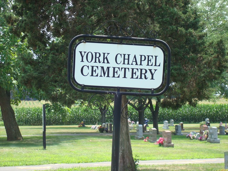
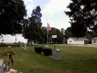
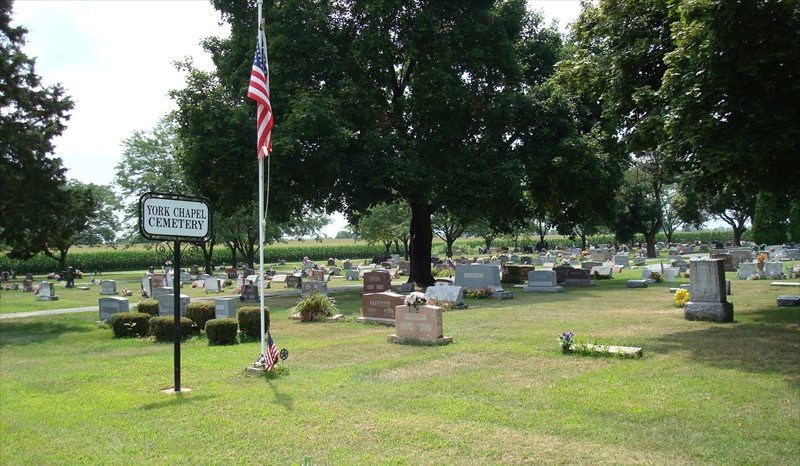
| Description | : | History: The Christian Church of York Township was organized in 1835 and met in homes until the building was erected in 1842. The cemetery association was organized in 1881. The church deeded the cemetery and building to the York Free Chapel Cemetery Association in 1885. The building and cemetery were dedded to the township trustees in 1932 with the condition that the building be used as a house of worship. The cemetery is located on the west side of Riddle Road (County Road 292) about 600 feet south of its intersection with Portland Road (County Road 177). The... Read More |
frequently asked questions (FAQ):
-
Where is York Free Chapel Cemetery?
York Free Chapel Cemetery is located at Riddle Road (County Road 292) York, Sandusky County ,Ohio , 44811USA.
-
York Free Chapel Cemetery cemetery's updated grave count on graveviews.com?
79 memorials
-
Where are the coordinates of the York Free Chapel Cemetery?
Latitude: 41.2803100
Longitude: -82.8982300
Nearby Cemetories:
1. Gilbert Cemetery
Clyde, Sandusky County, USA
Coordinate: 41.2778015, -82.9186020
2. Wales Corners Cemetery
Clyde, Sandusky County, USA
Coordinate: 41.3166885, -82.9018860
3. Saint Paul United Church of Christ Cemetery
Bellevue, Sandusky County, USA
Coordinate: 41.2703270, -82.8485000
4. Bellevue Cemetery
Bellevue, Huron County, USA
Coordinate: 41.2658005, -82.8368988
5. Immaculate Conception Cemetery
Bellevue, Huron County, USA
Coordinate: 41.2664500, -82.8340630
6. Ellsworth Cemetery
Clyde, Sandusky County, USA
Coordinate: 41.3293991, -82.9269028
7. Fireside Cemetery
Seneca County, USA
Coordinate: 41.2270000, -82.9072100
8. Avery Cemetery
Clyde, Sandusky County, USA
Coordinate: 41.3207290, -82.8499700
9. Bishop Seybert Cemetery
Flat Rock, Seneca County, USA
Coordinate: 41.2257996, -82.8739014
10. McPherson Cemetery
Clyde, Sandusky County, USA
Coordinate: 41.3093987, -82.9681015
11. Colwell Cemetery
Green Creek, Sandusky County, USA
Coordinate: 41.2700005, -82.9800034
12. Saint Marys Cemetery
Clyde, Sandusky County, USA
Coordinate: 41.3058900, -82.9807500
13. Lay Cemetery
Green Springs, Seneca County, USA
Coordinate: 41.2552986, -82.9816971
14. Thompson Center Cemetery
Seneca County, USA
Coordinate: 41.2117004, -82.9024963
15. Underhill Cemetery
Seneca County, USA
Coordinate: 41.2098030, -82.8758530
16. Parkhurst Cemetery
Clyde, Sandusky County, USA
Coordinate: 41.3561550, -82.8732740
17. Deyo Cemetery
Groton Township, Erie County, USA
Coordinate: 41.3428001, -82.8332977
18. Saint Pauls German Lutheran Cemetery
Lyme Township, Huron County, USA
Coordinate: 41.2268600, -82.8172600
19. Fuller Cemetery
Townsend Township, Sandusky County, USA
Coordinate: 41.3655280, -82.9118770
20. Strongs Ridge Cemetery
Strongs Ridge, Huron County, USA
Coordinate: 41.2833290, -82.7830582
21. Union Cemetery
Seneca County, USA
Coordinate: 41.2118988, -82.9710999
22. Bakertown Cemetery
Clyde, Sandusky County, USA
Coordinate: 41.2882996, -83.0149994
23. Keegan Farm Cemetery
Clyde, Sandusky County, USA
Coordinate: 41.3659610, -82.8574340
24. Tew Cemetery
Clyde, Sandusky County, USA
Coordinate: 41.3675003, -82.8569031