| Memorials | : | 5 |
| Location | : | Laholms kommun, Sweden |
| Coordinate | : | 56.4939320, 13.1185930 |
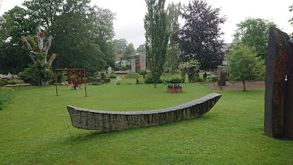
| Description | : | The medieval brick church, probably built in the 1200s, is one of the best preserved in Halland. The church tower of gray stone is of unknown date, but received its present form in the mid-1800s. |
frequently asked questions (FAQ):
-
Where is Ysby Kyrkogård?
Ysby KyrkogÃ¥rd is located at Brödåkravägen Laholms kommun ,Hallands län , 312 94Sweden.
-
Ysby Kyrkogård cemetery's updated grave count on graveviews.com?
5 memorials
-
Where are the coordinates of the Ysby Kyrkogård?
Latitude: 56.4939320
Longitude: 13.1185930
Nearby Cemetories:
1. Ränneslövs Kyrkogård
Ranneslov, Laholms kommun, Sweden
Coordinate: 56.4536990, 13.0636290
2. Skogaby Kapell
Skogaby, Laholms kommun, Sweden
Coordinate: 56.5286100, 13.1854600
3. Veinge kyrkogård
Veinge, Laholms kommun, Sweden
Coordinate: 56.5722110, 13.0924670
4. Trönninge Kyrka
Tronninge, Varbergs kommun, Sweden
Coordinate: 56.6226760, 12.9360640
5. St. Mary's Church Cemetery
Bastad, Båstads kommun, Sweden
Coordinate: 56.4335910, 12.8353360
6. Tåssjö Kyrkogård
Ängelholms kommun, Sweden
Coordinate: 56.3073400, 13.0901200
7. Grevie Kyrkogård
Grevie, Båstads kommun, Sweden
Coordinate: 56.3709610, 12.7916820
8. Västra Karups kyrkogård
Bastad, Båstads kommun, Sweden
Coordinate: 56.4109320, 12.7415200
9. Nya Kyrkogården
Örkelljunga kommun, Sweden
Coordinate: 56.2788143, 13.2711418
10. Munka-Ljungby church cemetery
Munka-Ljungby, Ängelholms kommun, Sweden
Coordinate: 56.2604608, 12.9743124
11. Össjö Kyrkogård
Ängelholm, Ängelholms kommun, Sweden
Coordinate: 56.2287780, 13.0280280
12. Vrå kyrkogård
Vra, Ljungby kommun, Sweden
Coordinate: 56.7342559, 13.4538185
13. Harplinge Kryrka Cemetery
Harplinge, Halmstads kommun, Sweden
Coordinate: 56.7372320, 12.7377720
14. Torpa Kyrkogård
Ljungby, Ljungby kommun, Sweden
Coordinate: 56.7094720, 13.5951390
15. Ausås Kyrka
Ausas, Ängelholms kommun, Sweden
Coordinate: 56.1670938, 12.8872368
16. Klippans Kapellkyrkogård
Klippan, Klippans kommun, Sweden
Coordinate: 56.1352600, 13.1556600
17. Jonstorps Kyrkogård
Höganäs, Höganäs kommun, Sweden
Coordinate: 56.2280360, 12.6719080
18. Strovelstorp Kyrka Cemetery
Strovelstorp, Ängelholms kommun, Sweden
Coordinate: 56.1593328, 12.8378950
19. Bjornekulla Kyrka
Åstorp, Åstorps kommun, Sweden
Coordinate: 56.1340861, 12.9631889
20. Steninge Kyrka
Steninge, Halmstads kommun, Sweden
Coordinate: 56.7722110, 12.6594470
21. Hallaryd Kyrkogård
Hallaryd, Älmhults kommun, Sweden
Coordinate: 56.4862740, 13.8839000
22. Riseberga Churchyard
Riseberga, Klippans kommun, Sweden
Coordinate: 56.0724417, 13.3017722
23. Kropps kyrkogård
Kropp, Helsingborgs kommun, Sweden
Coordinate: 56.0859678, 12.7969199
24. Odensjö
Odensjo, Ljungby kommun, Sweden
Coordinate: 56.8607780, 13.6149720

