Adolph Pfisterer
| Birth | : | 5 Feb 1865 Baden-Württemberg, Germany |
| Death | : | 3 Nov 1935 Winside, Wayne County, Nebraska, USA |
| Burial | : | Saint Marys Cemetery, Rushville, Sheridan County, USA |
| Coordinate | : | 42.7174988, -102.4436035 |
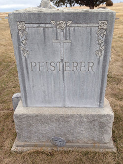
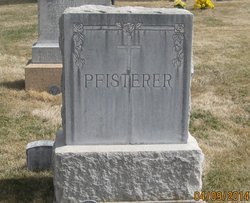
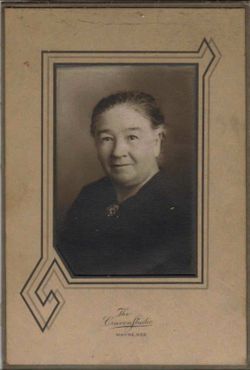
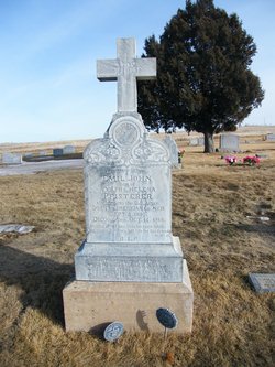
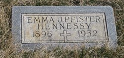
| Description | : | Adolph Pfisterer born in Sankt Leon, Heidelberg, Baden-Wuerttemberg, Germany, migrated to the United States around 1893. He met his bride, Helena Zelmer and they were married in August of 1894 in Chicago, Illinois. As they began their family, they moved North of Rushville, Nebraska where a brother had previously moved. To this family, two children were born; Emil John and Emma J (Pfisterer) Hennessy. Helena died in February of 1926. Adolph remarried to Alice (Kearns) Vandenburg. On November 3, 1935, Adolph was killed in an auto accident near Winside, Nebraska. |
frequently asked questions (FAQ):
-
Where is Adolph Pfisterer's memorial?
Adolph Pfisterer's memorial is located at: Saint Marys Cemetery, Rushville, Sheridan County, USA.
-
When did Adolph Pfisterer death?
Adolph Pfisterer death on 3 Nov 1935 in Winside, Wayne County, Nebraska, USA
-
Where are the coordinates of the Adolph Pfisterer's memorial?
Latitude: 42.7174988
Longitude: -102.4436035
Family Members:
Spouse
Children
Flowers:
Nearby Cemetories:
1. Saint Marys Cemetery
Rushville, Sheridan County, USA
Coordinate: 42.7174988, -102.4436035
2. Fair View Cemetery
Rushville, Sheridan County, USA
Coordinate: 42.7155991, -102.4325027
3. Amity Cemetery
Sheridan County, USA
Coordinate: 42.8036003, -102.4389038
4. Preble Cemetery
Sheridan County, USA
Coordinate: 42.6504000, -102.5765000
5. Novotny Cemetery
Hay Springs, Sheridan County, USA
Coordinate: 42.7742004, -102.5963974
6. Holly Cemetery
Rushville, Sheridan County, USA
Coordinate: 42.8575120, -102.5370990
7. Mount Hope Cemetery
Gordon, Sheridan County, USA
Coordinate: 42.7113991, -102.2241974
8. Bomar Cemetery
Hay Springs, Sheridan County, USA
Coordinate: 42.8062000, -102.6459600
9. Davis Cemetery
Rushville, Sheridan County, USA
Coordinate: 42.5421000, -102.4118800
10. Gordon Cemetery
Gordon, Sheridan County, USA
Coordinate: 42.7858009, -102.2102966
11. Saint Aloysius Cemetery
Sheridan County, USA
Coordinate: 42.9015500, -102.4025500
12. St. Mary's Cemetery
Hay Springs, Sheridan County, USA
Coordinate: 42.6721992, -102.7035980
13. Hay Springs Cemetery
Hay Springs, Sheridan County, USA
Coordinate: 42.6702995, -102.7033005
14. Bethel Cemetery
Sheridan County, USA
Coordinate: 42.9011002, -102.3208008
15. Beguin Cemetery
Sheridan County, USA
Coordinate: 42.5107994, -102.4982986
16. Abold Family Cemetery
Rushville, Sheridan County, USA
Coordinate: 42.8863500, -102.6158000
17. Sacred Heart Cemetery
Hay Springs, Sheridan County, USA
Coordinate: 42.5213220, -102.5782690
18. Antelope Cemetery
Hay Springs, Sheridan County, USA
Coordinate: 42.7144970, -102.7727290
19. Highland Cemetery
Hay Springs, Sheridan County, USA
Coordinate: 42.7145500, -102.7727500
20. White Clay Cemetery
Rushville, Sheridan County, USA
Coordinate: 42.9732820, -102.5667230
21. Dane Cemetery
Cherry County, USA
Coordinate: 42.7924300, -102.0824700
22. Beaver Valley Cemetery
Sheridan County, USA
Coordinate: 42.8880997, -102.7517014
23. Saint Peters Cemetery
Sheridan County, USA
Coordinate: 42.4975014, -102.7161026
24. Holy Cross Cemetery
Pine Ridge, Oglala Lakota County, USA
Coordinate: 43.0194016, -102.5503006

