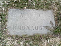
Albert Joseph Armbruster
| Birth | : | 1 Nov 1858 Auburn, Placer County, California, USA |
| Death | : | 28 Feb 1941 Manson, Chelan County, Washington, USA |
| Burial | : | Bridgeville Cemetery, Bridgeville, Pictou County, Canada |
| Coordinate | : | 45.4246400, -62.5895700 |
| Plot | : | North Fraternal Row59 BLK59 LS8 |
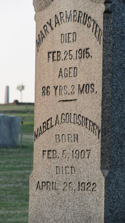
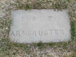
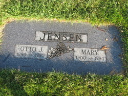
| Description | : | m: 7 Nov 1881 in Yolo Co, CA Funeral services for Albert Armbruster, 82, who died Friday, February 28, at his home were held Sunday. Mr. Armbruster was born in Auburn, Ca., on November 7, 1858 and has been a resident of Washington since 1901. In 1881 he married Eva Hiller. Surviving are four daughters, Mrs. Mabel Sanderson, Coulee City, Mrs. Otto Jensen, Coulee City, Mrs. Fanny Hall of Spokane and Mrs. E. H. Martin of Monticello, Arkansas and three sons – Albert, Jr., Roseville, Ca., Earl of Spokane and Jim of Manson; one sister, Mrs. Mary... Read More |
frequently asked questions (FAQ):
-
Where is Albert Joseph Armbruster's memorial?
Albert Joseph Armbruster's memorial is located at: Bridgeville Cemetery, Bridgeville, Pictou County, Canada.
-
When did Albert Joseph Armbruster death?
Albert Joseph Armbruster death on 28 Feb 1941 in Manson, Chelan County, Washington, USA
-
Where are the coordinates of the Albert Joseph Armbruster's memorial?
Latitude: 45.4246400
Longitude: -62.5895700
Family Members:
Parent
Spouse
Siblings
Children
Flowers:
Nearby Cemetories:
1. Bridgeville Cemetery
Bridgeville, Pictou County, Canada
Coordinate: 45.4246400, -62.5895700
2. Springville Cemetery
Springville, Pictou County, Canada
Coordinate: 45.4522220, -62.6313890
3. Elgin Cemetery
Elgin, Pictou County, Canada
Coordinate: 45.4219500, -62.6698800
4. Sunny Brae Cemetery
Sunny Brae, Pictou County, Canada
Coordinate: 45.3987900, -62.4937900
5. Brookville Cemetery
Brookville, Pictou County, Canada
Coordinate: 45.5003300, -62.5867900
6. Elgin Pioneer Cemetery
Elgin, Pictou County, Canada
Coordinate: 45.4610200, -62.6878200
7. MacLean Cemetery
Hopewell, Pictou County, Canada
Coordinate: 45.4616700, -62.6882100
8. Saint Columba Cemetery
Hopewell, Pictou County, Canada
Coordinate: 45.4591100, -62.6916500
9. Blanchard Road
Blanchard Road, Pictou County, Canada
Coordinate: 45.4776560, -62.4935310
10. Fraser Cemetery
Blanchard Road, Pictou County, Canada
Coordinate: 45.4704400, -62.4785100
11. Lorne Cemetery
Lorne, Pictou County, Canada
Coordinate: 45.4198500, -62.7281100
12. Hopewell Cemetery
Pictou County, Canada
Coordinate: 45.4858100, -62.7024000
13. MacLellan's Mountain Cemetery
Kirkmount, Pictou County, Canada
Coordinate: 45.5244700, -62.5742500
14. Churchville Pioneer Cemetery
Churchville, Pictou County, Canada
Coordinate: 45.5189800, -62.6459700
15. Churchville Cemetery
Churchville, Pictou County, Canada
Coordinate: 45.5194444, -62.6451111
16. Greenvale Cemetery
Greenvale, Pictou County, Canada
Coordinate: 45.5069700, -62.4874400
17. Blue Mountain Pioneer Cemetery
Blue Mountain, Pictou County, Canada
Coordinate: 45.4725800, -62.4479500
18. Riverton Cemetery
Riverton, Pictou County, Canada
Coordinate: 45.5148690, -62.6811860
19. Marshdale Cemetery
Marshdale, Pictou County, Canada
Coordinate: 45.4498700, -62.7451300
20. Blue Mountain Cemetery
Blue Mountain, Pictou County, Canada
Coordinate: 45.4931700, -62.4442300
21. Castle Hill Cemetery
McLellans Brook, Pictou County, Canada
Coordinate: 45.5494600, -62.6042800
22. MacLeod Cemetery
Fox Brook, Pictou County, Canada
Coordinate: 45.5206111, -62.7106667
23. MacPhersons Mills Cemetery
McPhersons Mills, Pictou County, Canada
Coordinate: 45.5486700, -62.5178700
24. Meiklefield Cemetery
Pictou County, Canada
Coordinate: 45.5321509, -62.4600190

