Albert Jay Armbruster
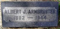
| Birth | : | 15 Aug 1882 California, USA |
| Death | : | 5 Aug 1944 San Francisco, San Francisco County, California, USA |
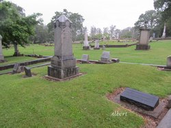
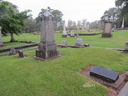
| Burial | : | Old Burial Ground, Rutland, Worcester County, USA |
| Coordinate | : | 42.3756000, -71.9578000 |
| Plot | : | E-1/2-25 |
| Description | : | Mother's maiden name: Hiller Armbruster German (also Armbrüster): occupational name for a soldier armed with a crossbow or for a maker of crossbows, from an agent derivative of armbrust ‘crossbow' (see Armbrust). Dictionary of American Family Names, Oxford University Press Armbrust German: from Middle High German armbrust, earlier arbrust ‘crossbow', hence a metonymic occupational name for a maker of crossbows or for a soldier who used one. This term is adapted from Old French arbalestre, Late Latin arcuballista, a compound of arcus ‘bow' + ballista ‘catapult'. In Middle High German it was altered by folk etymology as if composed of the elements arm ‘arm'... Read More |
frequently asked questions (FAQ):
-
Where is Albert Jay Armbruster's memorial?
Albert Jay Armbruster's memorial is located at: Old Burial Ground, Rutland, Worcester County, USA.
-
When did Albert Jay Armbruster death?
Albert Jay Armbruster death on 5 Aug 1944 in San Francisco, San Francisco County, California, USA
-
Where are the coordinates of the Albert Jay Armbruster's memorial?
Latitude: 42.3756000
Longitude: -71.9578000
Family Members:
Parent
Spouse
Siblings
Flowers:
Nearby Cemetories:
1. Old Burial Ground
Rutland, Worcester County, USA
Coordinate: 42.3756000, -71.9578000
2. Rutland Rural Cemetery
Rutland, Worcester County, USA
Coordinate: 42.3790100, -71.9447500
3. West Rutland Cemetery
Rutland, Worcester County, USA
Coordinate: 42.3561970, -71.9897170
4. Putnam Farm Cemetery
Rutland, Worcester County, USA
Coordinate: 42.3484010, -71.9771420
5. Smith Family Cemetery
Rutland, Worcester County, USA
Coordinate: 42.3946064, -71.9231169
6. Rutland Prison Camp Cemetery
Rutland, Worcester County, USA
Coordinate: 42.3988500, -71.9923800
7. Goose Hill Cemetery
Rutland, Worcester County, USA
Coordinate: 42.3997400, -71.9914000
8. Mooreland Cemetery
Paxton, Worcester County, USA
Coordinate: 42.3280800, -71.9321000
9. Green Hollow Cemetery
Oakham, Worcester County, USA
Coordinate: 42.3549995, -72.0243988
10. Worcester County Memorial Park
Paxton, Worcester County, USA
Coordinate: 42.3245697, -71.9308777
11. South Burying Ground
Princeton, Worcester County, USA
Coordinate: 42.4192009, -71.8957977
12. Oakham Center Cemetery
Oakham, Worcester County, USA
Coordinate: 42.3540000, -72.0421400
13. Paxton Center Cemetery
Paxton, Worcester County, USA
Coordinate: 42.3128900, -71.9277700
14. Parker Cemetery
Barre, Worcester County, USA
Coordinate: 42.4250800, -72.0240400
15. South Cemetery
Oakham, Worcester County, USA
Coordinate: 42.3382988, -72.0374985
16. Saint Mary Cemetery
Holden, Worcester County, USA
Coordinate: 42.3522400, -71.8684200
17. Grove Cemetery
Holden, Worcester County, USA
Coordinate: 42.3520400, -71.8672700
18. Park Avenue Cemetery
Holden, Worcester County, USA
Coordinate: 42.3514200, -71.8656900
19. Coldbrook Cemetery
Barre, Worcester County, USA
Coordinate: 42.3944016, -72.0541992
20. West Cemetery
Princeton, Worcester County, USA
Coordinate: 42.4454100, -71.9256500
21. Route 62 Cemetery
Hubbardston, Worcester County, USA
Coordinate: 42.4426910, -72.0014980
22. Old Burying Ground
Holden, Worcester County, USA
Coordinate: 42.3505800, -71.8626000
23. Saint Francis Episcopal Church Memorial Garden
Holden, Worcester County, USA
Coordinate: 42.3522800, -71.8588700
24. Southwest Cemetery
Oakham, Worcester County, USA
Coordinate: 42.3457985, -72.0582962

