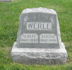
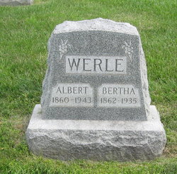
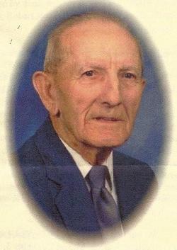
Albert Werle
| Birth | : | 6 Nov 1860 Stony Hill, Gasconade County, Missouri, USA |
| Death | : | 19 Feb 1943 Orrick, Ray County, Missouri, USA |
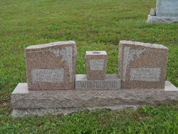
| Burial | : | Pleasant Grove Methodist Church Cemetery, Hardin County, USA |
| Coordinate | : | 37.6116982, -86.2117004 |
| Description | : | Albert Werle married Bertha Schindler on 20 Oct 1883 in Gasconade County, Missouri *********************************** Missouri Certificate of Death Name: Albert Werle Date of Death: Feb 19, 1943 Place of Death: 4 miles NW of Orrick, Rural Orrick, Ray County Usual Residence: 4 miles NW of Orrick, Ray County, Missouri Male/White/Widowed Name of husband or wife: Bertha Schindler Birth date of deceased: Nov 6, 1860 Birthplace: Stony Hill, Missouri Usual Occupation: Farmer Father: George Werle; Birthplace: Switzerland Mother Maiden Name: Catherine Phillips [maiden name spelled various ways in records] Informant: Mrs. Ellie Woods, Orrick, Missouri Burial, cremation, or removal: Burial |
frequently asked questions (FAQ):
-
Where is Albert Werle's memorial?
Albert Werle's memorial is located at: Pleasant Grove Methodist Church Cemetery, Hardin County, USA.
-
When did Albert Werle death?
Albert Werle death on 19 Feb 1943 in Orrick, Ray County, Missouri, USA
-
Where are the coordinates of the Albert Werle's memorial?
Latitude: 37.6116982
Longitude: -86.2117004
Family Members:
Parent
Spouse
Siblings
Children
Flowers:
Nearby Cemetories:
1. Pleasant Grove Methodist Church Cemetery
Hardin County, USA
Coordinate: 37.6116982, -86.2117004
2. Mount Olive Cemetery
Eastview, Hardin County, USA
Coordinate: 37.6308800, -86.2430300
3. Aubrey Cemetery
Eastview, Hardin County, USA
Coordinate: 37.6413780, -86.2273090
4. Moore Cemetery #1
Hardin County, USA
Coordinate: 37.5881700, -86.1810200
5. Moore Cemetery #2
Eastview, Hardin County, USA
Coordinate: 37.5881160, -86.1810570
6. Royalty Cemetery
Hardin County, USA
Coordinate: 37.6203003, -86.2536011
7. Givan Family Graveyard
Hardin County, USA
Coordinate: 37.6422690, -86.1772520
8. Mount Hebron Cemetery
Grayson County, USA
Coordinate: 37.5813720, -86.2506300
9. Pole Bridge Baptist Church Cemetery
Hardin County, USA
Coordinate: 37.6487030, -86.1820580
10. Saint Francis Cemetery
Leitchfield, Grayson County, USA
Coordinate: 37.5815360, -86.2520010
11. Needham Family Cemetery
Hardin County, USA
Coordinate: 37.6338900, -86.1556000
12. Needham Smith Chapel Cemetery
Hardin County, USA
Coordinate: 37.6260986, -86.1485977
13. Hudson Family Cemetery
Hudson, Breckinridge County, USA
Coordinate: 37.6165220, -86.2854510
14. Hudson Cemetery
Hudson, Breckinridge County, USA
Coordinate: 37.6178017, -86.2855988
15. Old Hudson Cemetery
Hudson, Breckinridge County, USA
Coordinate: 37.6468590, -86.2740900
16. Comer Cemetery
Breckinridge County, USA
Coordinate: 37.6306000, -86.2850037
17. Jacobs Graveyard
Hardin County, USA
Coordinate: 37.6047270, -86.1348970
18. Constantine Baptist Cemetery
Constantine, Breckinridge County, USA
Coordinate: 37.6722380, -86.2428720
19. Hazelwood Cemetery
Leitchfield, Grayson County, USA
Coordinate: 37.5587000, -86.2616000
20. Hazelwood Cemetery
Grayson County, USA
Coordinate: 37.5586014, -86.2617035
21. Holbert Cemetery
Hardin County, USA
Coordinate: 37.6692009, -86.1635971
22. Constantine United Methodist Church Cemetery
Constantine, Breckinridge County, USA
Coordinate: 37.6785240, -86.2333830
23. Horn Cemetery
Hardin County, USA
Coordinate: 37.6800003, -86.1905975
24. Saint Paul Catholic Cemetery
Saint Paul, Grayson County, USA
Coordinate: 37.5391998, -86.1980972

