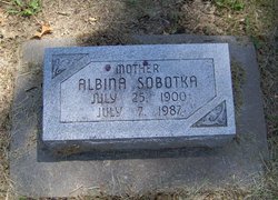
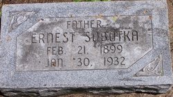
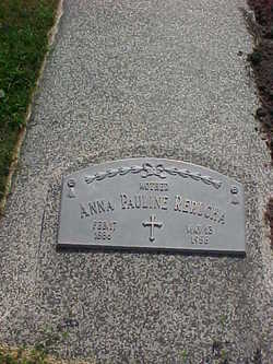
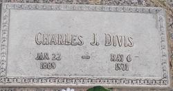
Albina Divis Sobotka
| Birth | : | 25 Jul 1900 Loma, Butler County, Nebraska, USA |
| Death | : | 7 Jul 1987 Seward, Seward County, Nebraska, USA |
| Burial | : | Cowpen Cemetery and Crematorium, Blyth, Northumberland Unitary Authority, England |
| Coordinate | : | 55.1311260, -1.5294460 |
| Plot | : | 1st Addition, Alley North, Row: 220 |
| Description | : | Albina Divis Sobotka Obit Albina Sobotka, 86, Seward, died Tuesday, July 7, 1987. She was born July 25, 1900, in Loma, to Charles and Anna (Rejda) Divis. She was married to Ernest Sobotka on Jan. 31, 1921. The couple made their home in Bee where Ernest was employed as a carpenter. After Ernest's death in 1932, she continued to live in Bee until 1938. She moved to Seward in 1938 and lived there until her death. She was preceded in death by her parents, her daughter Erma in 1927, her husband in 1932, her grandson Roger Wood in... Read More |
frequently asked questions (FAQ):
-
Where is Albina Divis Sobotka's memorial?
Albina Divis Sobotka's memorial is located at: Cowpen Cemetery and Crematorium, Blyth, Northumberland Unitary Authority, England.
-
When did Albina Divis Sobotka death?
Albina Divis Sobotka death on 7 Jul 1987 in Seward, Seward County, Nebraska, USA
-
Where are the coordinates of the Albina Divis Sobotka's memorial?
Latitude: 55.1311260
Longitude: -1.5294460
Family Members:
Parent
Spouse
Siblings
Children
Flowers:
Nearby Cemetories:
1. Cowpen Cemetery and Crematorium
Blyth, Northumberland Unitary Authority, England
Coordinate: 55.1311260, -1.5294460
2. Cowpen Roman Catholic Burial Ground
Blyth, Northumberland Unitary Authority, England
Coordinate: 55.1305300, -1.5386300
3. Saint Cuthbert's Churchyard
Blyth, Northumberland Unitary Authority, England
Coordinate: 55.1265800, -1.5031400
4. Blyth Links Cemetery
Blyth, Northumberland Unitary Authority, England
Coordinate: 55.1053800, -1.4997200
5. St. Mary's Churchyard
Horton, Northumberland Unitary Authority, England
Coordinate: 55.1106200, -1.5706200
6. St Peter Churchyard
Cambois, Northumberland Unitary Authority, England
Coordinate: 55.1615300, -1.5604100
7. St. Cuthbert Churchyard
Bedlington, Northumberland Unitary Authority, England
Coordinate: 55.1303910, -1.5928880
8. North Seaton Cemetery
Ashington, Northumberland Unitary Authority, England
Coordinate: 55.1669770, -1.5575500
9. St. Paul's Churchyard
Choppington, Northumberland Unitary Authority, England
Coordinate: 55.1494290, -1.6009780
10. Netherton Lane Cemetery
Bedlington, Northumberland Unitary Authority, England
Coordinate: 55.1318960, -1.6106800
11. Mayfield Cemetery
Cramlington, Northumberland Unitary Authority, England
Coordinate: 55.0837139, -1.5730931
12. St. Nicholas' Churchyard
Cramlington, Northumberland Unitary Authority, England
Coordinate: 55.0856460, -1.5834930
13. Saint Aidens Churchyard
Ashington, Northumberland Unitary Authority, England
Coordinate: 55.1826900, -1.5781400
14. St Andrew's Churchyard
Bothal, Northumberland Unitary Authority, England
Coordinate: 55.1731340, -1.6205890
15. St. John's Churchyard
Annitsford, Metropolitan Borough of North Tyneside, England
Coordinate: 55.0676900, -1.5785500
16. St. John the Baptist Catholic Churchyard
Cramlington, Northumberland Unitary Authority, England
Coordinate: 55.0675480, -1.5783300
17. Lynemouth Cemetery
Lynemouth, Northumberland Unitary Authority, England
Coordinate: 55.2031759, -1.5361996
18. Whitley Bay Cemetery and Crematorium
Whitley Bay, Metropolitan Borough of North Tyneside, England
Coordinate: 55.0636970, -1.4588430
19. Earsdon Cemetery
Earsdon, Metropolitan Borough of North Tyneside, England
Coordinate: 55.0474600, -1.5007200
20. St. Alban’s Churchyard
Earsdon, Metropolitan Borough of North Tyneside, England
Coordinate: 55.0461000, -1.5004000
21. Dudley Cemetery
Dudley, Metropolitan Borough of North Tyneside, England
Coordinate: 55.0566100, -1.6143420
22. Saint John's Churchyard
Longhirst, Northumberland Unitary Authority, England
Coordinate: 55.1936200, -1.6474840
23. St. Mary the Virgin Church
Morpeth, Northumberland Unitary Authority, England
Coordinate: 55.1598990, -1.6917760
24. St. Mary the Virgin Churchyard
Morpeth, Northumberland Unitary Authority, England
Coordinate: 55.1597110, -1.6921530

