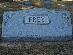
| Birth | : | 15 Jan 1912 Richardson County, Nebraska, USA |
| Death | : | 4 Mar 2006 Humboldt, Richardson County, Nebraska, USA |
| Burial | : | Calvary Cemetery, Mount Morris, Genesee County, USA |
| Coordinate | : | 43.1122017, -83.6900024 |
| Description | : | Son of Frederick W. & Mary A. (Leuenberger) Frey. Alfred grew up on the family farm and attended the Middleburg Country School Dist. #69. Married to Eva Mae Ast. Father of Nancy, Tom & Jerry. Alfred farmed with his father and would continue to farm his entire life. He & his wife established their home on the same land that his grandfather settled in 1855. He also enjoyed hunting, fishing and whittling. |
frequently asked questions (FAQ):
-
Where is Alfred Milford “Coonie” Frey's memorial?
Alfred Milford “Coonie” Frey's memorial is located at: Calvary Cemetery, Mount Morris, Genesee County, USA.
-
When did Alfred Milford “Coonie” Frey death?
Alfred Milford “Coonie” Frey death on 4 Mar 2006 in Humboldt, Richardson County, Nebraska, USA
-
Where are the coordinates of the Alfred Milford “Coonie” Frey's memorial?
Latitude: 43.1122017
Longitude: -83.6900024
Family Members:
Parent
Spouse
Siblings
Children
Flowers:
Nearby Cemetories:
1. Calvary Cemetery
Mount Morris, Genesee County, USA
Coordinate: 43.1122017, -83.6900024
2. Mount Morris Cemetery
Mount Morris, Genesee County, USA
Coordinate: 43.1192017, -83.6995010
3. Oakwood Cemetery
Genesee, Genesee County, USA
Coordinate: 43.1054200, -83.6678800
4. Beecher Tornado Memorial Monument
Flint, Genesee County, USA
Coordinate: 43.0899320, -83.6945390
5. Flint Memorial Park
Mount Morris, Genesee County, USA
Coordinate: 43.1455994, -83.6838989
6. Wager Farm Cemetery
Mount Morris, Genesee County, USA
Coordinate: 43.1242340, -83.6349200
7. Upton Cemetery
Genesee, Genesee County, USA
Coordinate: 43.1202600, -83.6333300
8. Gracelawn Cemetery
Flint, Genesee County, USA
Coordinate: 43.0656200, -83.6935600
9. All Saints Church Cemetery
Flint, Genesee County, USA
Coordinate: 43.0637890, -83.6682810
10. Saint Michael Byzantine Cemetery
Flint, Genesee County, USA
Coordinate: 43.0638870, -83.6669180
11. Saint Nicholas Orthodox Church Cemetery
Flint, Genesee County, USA
Coordinate: 43.0639650, -83.6660170
12. Assyrian Cemetery
Flint, Genesee County, USA
Coordinate: 43.0578003, -83.6521988
13. Machpelah Cemetery
Flint, Genesee County, USA
Coordinate: 43.0569000, -83.6521988
14. Woodlawn Memorial Cemetery
Clio, Genesee County, USA
Coordinate: 43.1669006, -83.7356033
15. Pine Run Cemetery
Pine Run, Genesee County, USA
Coordinate: 43.1819000, -83.7182007
16. Tanner Cemetery
Genesee, Genesee County, USA
Coordinate: 43.0838290, -83.5969230
17. Thetford Township Cemetery
Clio, Genesee County, USA
Coordinate: 43.1767998, -83.6391983
18. Avondale Cemetery
Flint, Genesee County, USA
Coordinate: 43.0289001, -83.6817017
19. Aventine Cemetery
Flint, Genesee County, USA
Coordinate: 43.0275002, -83.6810989
20. West Vienna Cemetery
Clio, Genesee County, USA
Coordinate: 43.1625480, -83.7916840
21. Old City Cemetery (Defunct)
Flint, Genesee County, USA
Coordinate: 43.0225800, -83.6830100
22. New Calvary Catholic Cemetery
Flint, Genesee County, USA
Coordinate: 43.0358009, -83.7568970
23. River Rest Cemetery
Flint, Genesee County, USA
Coordinate: 43.0395910, -83.7665840
24. Sunset Hills Cemetery
Flint, Genesee County, USA
Coordinate: 43.0378580, -83.7634130


