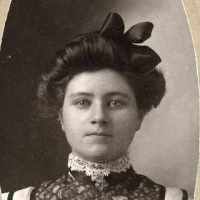
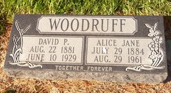
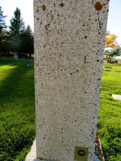
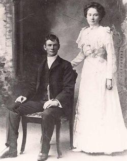
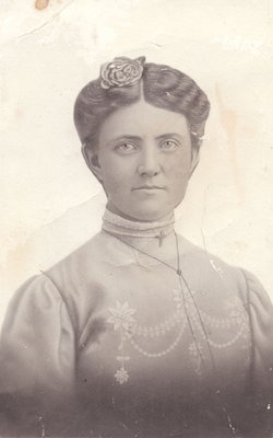
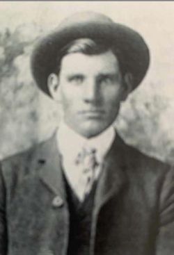
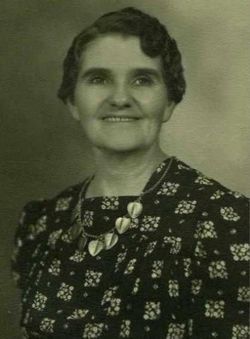
Alice Jane Hinman Woodruff
| Birth | : | 29 Jul 1884 Farmington, Davis County, Utah, USA |
| Death | : | 29 Aug 1961 Claresholm, Claresholm Census Division, Alberta, Canada |
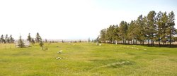
| Burial | : | Glenwood Cemetery, Glenwood, Claresholm Census Division, Canada |
| Coordinate | : | 49.3859800, -113.5003500 |
| Plot | : | PA 34-2 |
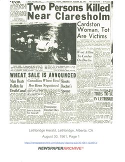
| Description | : | Lethbridge Herald Wednesday, August 30, 1961, Lethbridge, Alberta |
frequently asked questions (FAQ):
-
Where is Alice Jane Hinman Woodruff's memorial?
Alice Jane Hinman Woodruff's memorial is located at: Glenwood Cemetery, Glenwood, Claresholm Census Division, Canada.
-
When did Alice Jane Hinman Woodruff death?
Alice Jane Hinman Woodruff death on 29 Aug 1961 in Claresholm, Claresholm Census Division, Alberta, Canada
-
Where are the coordinates of the Alice Jane Hinman Woodruff's memorial?
Latitude: 49.3859800
Longitude: -113.5003500
Family Members:
Parent
Spouse
Siblings
Children
Flowers:
Nearby Cemetories:
1. Glenwood Cemetery
Glenwood, Claresholm Census Division, Canada
Coordinate: 49.3859800, -113.5003500
2. Pioneer Cemetery
Levern, Claresholm Census Division, Canada
Coordinate: 49.3489700, -113.4642000
3. Thompson Hutterite Cemetery
Glenwood, Claresholm Census Division, Canada
Coordinate: 49.4269974, -113.5401975
4. Riverside Hutterite Colony Cemetery
Glenwood, Claresholm Census Division, Canada
Coordinate: 49.4379404, -113.4492438
5. Ewelme Hutterite Cemetery
Glenwood, Claresholm Census Division, Canada
Coordinate: 49.4510436, -113.4906843
6. Hartley Cemetery
Hartleyville, Claresholm Census Division, Canada
Coordinate: 49.3777000, -113.6227000
7. Springridge Mennonite Church Cemetery
Springridge, Claresholm Census Division, Canada
Coordinate: 49.4529305, -113.6340179
8. Hill Spring Pioneer Cemetery
Hill Spring, Claresholm Census Division, Canada
Coordinate: 49.3035000, -113.6249000
9. Hill Spring Cemetery
Hill Spring, Claresholm Census Division, Canada
Coordinate: 49.3128700, -113.6436100
10. Fishburn United Church Cemetery
Pincher Creek, Claresholm Census Division, Canada
Coordinate: 49.3783700, -113.7011300
11. Saint Catherine Cemetery
Stand Off, Claresholm Census Division, Canada
Coordinate: 49.4516900, -113.3112300
12. Standoff Hutterite Colony Cemetery
Stand Off, Claresholm Census Division, Canada
Coordinate: 49.4829507, -113.3130885
13. Waterton Hutterite Cemetery
Hill Spring, Claresholm Census Division, Canada
Coordinate: 49.2661602, -113.6918691
14. Blue Ridge Hutterite Cemetery
Hill Spring, Claresholm Census Division, Canada
Coordinate: 49.2320117, -113.6305672
15. Saint Henry's Roman Catholic Church Cemetery
Twin Butte, Claresholm Census Division, Canada
Coordinate: 49.3189900, -113.7728900
16. Brocket Colony Cemetery
Pincher Creek, Claresholm Census Division, Canada
Coordinate: 49.4655200, -113.7694100
17. West Raley Hutterite Cemetery
Raley, Claresholm Census Division, Canada
Coordinate: 49.2908857, -113.2283616
18. Leavitt Cemetery
Leavitt, Claresholm Census Division, Canada
Coordinate: 49.1830500, -113.4768200
19. Cardston Cemetery
Cardston, Claresholm Census Division, Canada
Coordinate: 49.1906900, -113.3415300
20. Brocket Cemetery
Brocket, Claresholm Census Division, Canada
Coordinate: 49.5457100, -113.7667700
21. Pincher Creek Mennonite Brethren Cemetery
Pincher Creek, Claresholm Census Division, Canada
Coordinate: 49.4699090, -113.8627370
22. Mountain View Cemetery
Mountain View, Claresholm Census Division, Canada
Coordinate: 49.1293300, -113.5986300
23. East Cardston Hutterite Cemetery
Cardston, Claresholm Census Division, Canada
Coordinate: 49.1908348, -113.2258004
24. Beazer Cemetery
Beazer, Claresholm Census Division, Canada
Coordinate: 49.1097500, -113.4975800

