
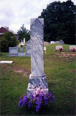
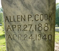
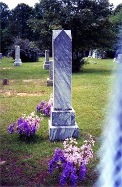
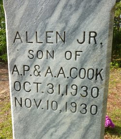
Allen Palmer Cook
| Birth | : | 27 Apr 1881 Lancaster County, South Carolina, USA |
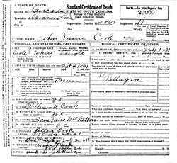
| Death | : | 24 Apr 1940 Rock Hill, York County, South Carolina, USA |
| Burial | : | Six Mile Cemetery, Indian Land, Lancaster County, USA |
| Coordinate | : | 34.9308014, -80.8319016 |
frequently asked questions (FAQ):
-
Where is Allen Palmer Cook's memorial?
Allen Palmer Cook's memorial is located at: Six Mile Cemetery, Indian Land, Lancaster County, USA.
-
When did Allen Palmer Cook death?
Allen Palmer Cook death on 24 Apr 1940 in Rock Hill, York County, South Carolina, USA
-
Where are the coordinates of the Allen Palmer Cook's memorial?
Latitude: 34.9308014
Longitude: -80.8319016
Family Members:
Parent
Spouse
Siblings
Children

Flowers:


Nearby Cemetories:
1. Six Mile Cemetery
Indian Land, Lancaster County, USA
Coordinate: 34.9308014, -80.8319016
2. Indian Land Baptist Church Cemetery
Indian Land, Lancaster County, USA
Coordinate: 34.9318840, -80.8367260
3. Center Grove Memorial Park
Indian Land, Lancaster County, USA
Coordinate: 34.9205500, -80.8122100
4. Old Six Mile Cemetery
Indian Land, Lancaster County, USA
Coordinate: 34.9484250, -80.8220320
5. Belair Methodist Church Cemetery
Lancaster County, USA
Coordinate: 34.9509964, -80.8433228
6. Gold Hill AME Zion Church Cemetery
Van Wyck, Lancaster County, USA
Coordinate: 34.9094340, -80.8472940
7. Osceola United Methodist Church Cemetery
Lancaster, Lancaster County, USA
Coordinate: 34.9056920, -80.8091770
8. Elbethel AME Zion Church Cemetery
Belair, Lancaster County, USA
Coordinate: 34.9626270, -80.8299860
9. Our Lady of Grace Catholic Church Cemetery
Indian Land, Lancaster County, USA
Coordinate: 34.9191510, -80.7933580
10. Old Elbethel AME Zion Church Cemetery
Indian Land, Lancaster County, USA
Coordinate: 34.9631250, -80.8125350
11. Macedonia Baptist Church
Indian Land, Lancaster County, USA
Coordinate: 34.8975580, -80.8555820
12. Higher Ground Church Cemetery
Indian Land, Lancaster County, USA
Coordinate: 34.9713300, -80.8597020
13. Catawba Indian Nation Cemetery
Rock Hill, York County, USA
Coordinate: 34.9043999, -80.8824005
14. Steele Hill AME Zion Church Cemetery
Lancaster, Lancaster County, USA
Coordinate: 34.8898697, -80.7984009
15. Edwards Cemetery
Indian Land, Lancaster County, USA
Coordinate: 34.9770010, -80.8607570
16. Heath Memorial United Methodist Church Cemetery
Union County, USA
Coordinate: 34.8889046, -80.7834396
17. Price Chapel Baptist Church Cemetery
Waxhaw, Union County, USA
Coordinate: 34.9415283, -80.7617188
18. Church of Jesus Christ of Latter-day Sts Cemetery
Catawba, York County, USA
Coordinate: 34.9071007, -80.9012985
19. Banks Presbyterian Church Cemetery
Marvin, Union County, USA
Coordinate: 34.9930305, -80.8189697
20. Marvin United Methodist Church Cemetery
Marvin, Union County, USA
Coordinate: 34.9928894, -80.8166580
21. Pleasant Valley Baptist Church Cemetery
Lancaster County, USA
Coordinate: 34.9931793, -80.8495407
22. Providence Baptist Church Cemetery
Waxhaw, Union County, USA
Coordinate: 34.9441200, -80.7547200
23. Marvin AME Zion Church Cemetery
Waxhaw, Union County, USA
Coordinate: 34.9920000, -80.8040000
24. Bonds Grove United Methodist Church Cemetery
Waxhaw, Union County, USA
Coordinate: 34.9739609, -80.7715378