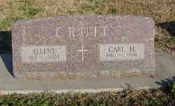
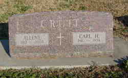
Allene Orpha Smith Cruit
| Birth | : | 20 May 1913 |
| Death | : | 15 Mar 2003 Wichita, Sedgwick County, Kansas, USA |
| Burial | : | Logans Chapel Cemetery, Maryville, Blount County, USA |
| Coordinate | : | 35.8046989, -83.8731003 |
| Plot | : | Section: B Lot: 92 Space: W3 |
| Description | : | Wichita Eagle, The (KS) - March 17, 2003 Deceased Name: Cruit, Allene O. (Smith) Cruit, Allene O. (Smith), 89, retired USD 259 teacher, died Saturday, March 15, 2003. Service 11 a.m. Tuesday, Pilgrim Congregational Church. Survivors: sons, Carlton of Decaturville, Tenn., Craig of Augusta, Mehl of Clearwater; sister, Glennis Hower of El Dorado; four grandchildren; five great-grandchildren. Memorial established with Adopt A School, Caldwell Elementary. DeVorss Flanagan-Hunt Mortuary. |
frequently asked questions (FAQ):
-
Where is Allene Orpha Smith Cruit's memorial?
Allene Orpha Smith Cruit's memorial is located at: Logans Chapel Cemetery, Maryville, Blount County, USA.
-
When did Allene Orpha Smith Cruit death?
Allene Orpha Smith Cruit death on 15 Mar 2003 in Wichita, Sedgwick County, Kansas, USA
-
Where are the coordinates of the Allene Orpha Smith Cruit's memorial?
Latitude: 35.8046989
Longitude: -83.8731003
Family Members:
Parent
Spouse
Siblings
Children
Flowers:
Nearby Cemetories:
1. Logans Chapel Cemetery
Maryville, Blount County, USA
Coordinate: 35.8046989, -83.8731003
2. Slave Cemetery
Blount County, USA
Coordinate: 35.8241997, -83.8768997
3. Central Point Baptist Church Cemetery
Blount County, USA
Coordinate: 35.8260994, -83.8855972
4. Mount Lebanon Cemetery
Maryville, Blount County, USA
Coordinate: 35.7949982, -83.9057999
5. Union Temple Cemetery
Blount County, USA
Coordinate: 35.7985992, -83.8339005
6. Nails Creek Cemetery
Blount County, USA
Coordinate: 35.8347015, -83.8486023
7. Cedar Grove Baptist Church Cemetery
Maryville, Blount County, USA
Coordinate: 35.8344002, -83.8469009
8. Headrick-Henry Cemetery
Blount County, USA
Coordinate: 35.7736015, -83.8491974
9. Old Mount Lebanon Cemetery
Eagleton Village, Blount County, USA
Coordinate: 35.7991982, -83.9210968
10. Centennial Cemetery
Blount County, USA
Coordinate: 35.7672005, -83.8908005
11. Oak View Cemetery
Walland, Blount County, USA
Coordinate: 35.7839012, -83.8293991
12. Pleasant Grove Cemetery
Blount County, USA
Coordinate: 35.7606010, -83.8743973
13. Vineyard Cemetery
Blount County, USA
Coordinate: 35.8400002, -83.9057999
14. Bethlehem Cemetery
Maryville, Blount County, USA
Coordinate: 35.7881012, -83.8114014
15. Cold Springs Cemetery
Walland, Blount County, USA
Coordinate: 35.7757988, -83.8181000
16. Faithway Fellowship Cemetery
Wildwood, Blount County, USA
Coordinate: 35.7518473, -83.8617859
17. Clarks Grove Cemetery
Maryville, Blount County, USA
Coordinate: 35.8093987, -83.9413986
18. Wilders Chapel Cemetery
Blount County, USA
Coordinate: 35.7653008, -83.9263992
19. Ridgeview Missionary Baptist Cemetery
Walland, Blount County, USA
Coordinate: 35.7496700, -83.8473600
20. Prospect Cemetery
Walland, Blount County, USA
Coordinate: 35.8135986, -83.8011017
21. East Maryville Baptist Cemetery
Maryville, Blount County, USA
Coordinate: 35.7708015, -83.9332962
22. Brantleys Chapel Cemetery
Maryville, Blount County, USA
Coordinate: 35.7825600, -83.9436600
23. Keebles Chapel Cemetery
Walland, Blount County, USA
Coordinate: 35.7556000, -83.8261032
24. Edington Cemetery
Blount County, USA
Coordinate: 35.8546982, -83.9197006

