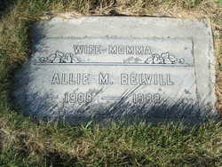
Allie Mae Ball Belvill
| Birth | : | 3 Oct 1908 Japton, Madison County, Arkansas, USA |
| Death | : | 14 Dec 1998 Brewster, Okanogan County, Washington, USA |
| Burial | : | Pioneer Cemetery, Loudonville, Ashland County, USA |
| Coordinate | : | 40.6952800, -82.1637400 |
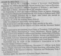
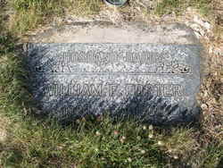
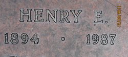
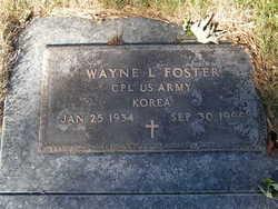
| Description | : | Allie M Belvill, 90, a long time resident of Brewster, died Monday, December 14, 1998, in the Harmony House Health Care Center at Brewster. She was born October 3, 1908 the daughter of William L and Sarah J (Hull) Ball at Mante, Arkansas where she attended school. On September 9, 1925 she married William Foster at Japton, Arkansas, they moved to Okanogan County March 1953 living in Pateros until 1960 when her husband preceded her in death, after which she moved to Brester where she has since resided. On June 15, 1978 she married Henry Belvill. |
frequently asked questions (FAQ):
-
Where is Allie Mae Ball Belvill's memorial?
Allie Mae Ball Belvill's memorial is located at: Pioneer Cemetery, Loudonville, Ashland County, USA.
-
When did Allie Mae Ball Belvill death?
Allie Mae Ball Belvill death on 14 Dec 1998 in Brewster, Okanogan County, Washington, USA
-
Where are the coordinates of the Allie Mae Ball Belvill's memorial?
Latitude: 40.6952800
Longitude: -82.1637400
Family Members:
Parent
Spouse
Children
Flowers:
Nearby Cemetories:
1. Pioneer Cemetery
Loudonville, Ashland County, USA
Coordinate: 40.6952800, -82.1637400
2. Saint John Cemetery
McZena, Ashland County, USA
Coordinate: 40.6968900, -82.1524700
3. Mohicanville Cemetery
Mohicanville, Ashland County, USA
Coordinate: 40.7265830, -82.1840700
4. Newkirk Cemetery
Shreve, Wayne County, USA
Coordinate: 40.6823006, -82.1017990
5. Daubert Cemetery
Holmes County, USA
Coordinate: 40.6552140, -82.2015490
6. Plum Run Cemetery
Washington Township, Holmes County, USA
Coordinate: 40.6547821, -82.2015461
7. County Line Cemetery
Ashland County, USA
Coordinate: 40.7181015, -82.2221985
8. Fairview Cemetery
Craigton, Wayne County, USA
Coordinate: 40.7251015, -82.1067963
9. Lakeville Cemetery
Lakeville, Holmes County, USA
Coordinate: 40.6481078, -82.1232048
10. Lake Fork Cemetery
Lake Fork, Ashland County, USA
Coordinate: 40.7539500, -82.1457200
11. McKay Cemetery
Hayesville, Ashland County, USA
Coordinate: 40.7044487, -82.2457809
12. Sunset Cemetery
Ashland County, USA
Coordinate: 40.7117004, -82.2506027
13. Scenic Ridge Mennonite Church Cemetery
Jeromesville, Ashland County, USA
Coordinate: 40.7619210, -82.1825330
14. Saint Peters Cemetery
Loudonville, Ashland County, USA
Coordinate: 40.6455500, -82.2295000
15. Ripley Township Cemetery
Big Prairie, Holmes County, USA
Coordinate: 40.6640710, -82.0766050
16. Bethesda Cemetery
Ashland County, USA
Coordinate: 40.7125015, -82.2600021
17. Ullman Cemetery
Washington Township, Holmes County, USA
Coordinate: 40.6241989, -82.2007980
18. Synagogue-Church of God Cemetery
Hayesville, Ashland County, USA
Coordinate: 40.7475500, -82.2403500
19. Loudonville Cemetery
Loudonville, Ashland County, USA
Coordinate: 40.6309013, -82.2323990
20. Drake Valley Cemetery
Holmes County, USA
Coordinate: 40.6125310, -82.1725540
21. Stout Cemetery
Holmes County, USA
Coordinate: 40.6122017, -82.1718979
22. Manley Cemetery
Shreve, Wayne County, USA
Coordinate: 40.6975331, -82.0534689
23. Ripley Cemetery
Big Prairie, Holmes County, USA
Coordinate: 40.6517258, -82.0623703
24. Pleasant View Cemetery
Wayne County, USA
Coordinate: 40.7771988, -82.1200027

