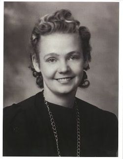
Alma Richards Baker
| Birth | : | 21 Nov 1917 Leavitt, Claresholm Census Division, Alberta, Canada |
| Death | : | 23 Mar 2001 Taber, Lethbridge Census Division, Alberta, Canada |
| Burial | : | Walnut Mound Cemetery, Retreat, Vernon County, USA |
| Coordinate | : | 43.4463997, -91.0718994 |
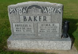
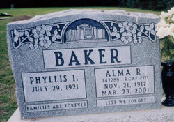
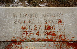
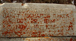
| Description | : | ALMA BAKER 1917 - 2001 Alma Richards Baker of Barnwell, beloved husband of Phyllis Irene (Anderson) Baker, passed away of cancer in Taber on Friday, March 23, 2001 at the age of 83 years. Alma was born November 21, 1917 at Leavitt, Alberta, the second child and son of Samuel Leavitt Baker and Janet Richards. He is survived by his wife of sixty one, Phyllis, six children; Lee (Shirley) Baker of Barnwell and their five children and five grandchildren; Jim (Leena) Baker of Salt Lake City and their five children and four grandchildren; Lynn Baker of Barnwell and her twelve... Read More |
frequently asked questions (FAQ):
-
Where is Alma Richards Baker's memorial?
Alma Richards Baker's memorial is located at: Walnut Mound Cemetery, Retreat, Vernon County, USA.
-
When did Alma Richards Baker death?
Alma Richards Baker death on 23 Mar 2001 in Taber, Lethbridge Census Division, Alberta, Canada
-
Where are the coordinates of the Alma Richards Baker's memorial?
Latitude: 43.4463997
Longitude: -91.0718994
Family Members:
Parent
Spouse
Siblings
Children
Flowers:
Nearby Cemetories:
1. Walnut Mound Cemetery
Retreat, Vernon County, USA
Coordinate: 43.4463997, -91.0718994
2. North West Prairie Cemetery
West Prairie, Vernon County, USA
Coordinate: 43.4661670, -91.0125000
3. Rush Creek Cemetery
Ferryville, Crawford County, USA
Coordinate: 43.3994330, -91.0911160
4. Fargo Cemetery
West Prairie, Vernon County, USA
Coordinate: 43.4562640, -91.0007000
5. Freeman Cemetery
Ferryville, Crawford County, USA
Coordinate: 43.3955300, -91.0429100
6. West Prairie Hauge Lutheran Cemetery
West Prairie, Vernon County, USA
Coordinate: 43.4346600, -90.9923320
7. South West Prairie Cemetery
Fargo, Vernon County, USA
Coordinate: 43.4262660, -90.9923500
8. De Soto Lutheran Cemetery
De Soto, Vernon County, USA
Coordinate: 43.4295700, -91.1753400
9. Bad Axe Independent Lutheran Cemetery
Purdy, Vernon County, USA
Coordinate: 43.5226330, -91.0448000
10. Pine Tree Cemetery
Genoa, Vernon County, USA
Coordinate: 43.5246980, -91.1070870
11. Lawrence Ridge Cemetery
De Soto, Crawford County, USA
Coordinate: 43.4078800, -91.1739700
12. Saint James Cemetery
Rising Sun, Crawford County, USA
Coordinate: 43.4104830, -90.9560660
13. De Soto Cemetery
De Soto, Vernon County, USA
Coordinate: 43.4293600, -91.1958200
14. Ferryville Cemetery
Ferryville, Crawford County, USA
Coordinate: 43.3414170, -91.0775000
15. Victory Cemetery
Victory, Vernon County, USA
Coordinate: 43.4873830, -91.2070170
16. Henderson Family Plot
Liberty Pole, Vernon County, USA
Coordinate: 43.4684500, -90.9266000
17. Carrie Thoreson Cemetery
Viroqua, Vernon County, USA
Coordinate: 43.5522000, -91.0427670
18. Osgood Family Plot
Viroqua, Vernon County, USA
Coordinate: 43.5164000, -90.9580300
19. German Cemetery
Victory, Vernon County, USA
Coordinate: 43.5167007, -91.1941986
20. Zion Lutheran Cemetery
Newton, Vernon County, USA
Coordinate: 43.5594830, -91.0405500
21. Eitsert Cemetery
Fairview, Crawford County, USA
Coordinate: 43.3602982, -90.9638977
22. Cade Family Plot
Liberty Pole, Vernon County, USA
Coordinate: 43.4869700, -90.9146300
23. Clawater Plot
Liberty Pole, Vernon County, USA
Coordinate: 43.4883190, -90.9135930
24. Romance Cemetery
Genoa, Vernon County, USA
Coordinate: 43.5551000, -91.1512400

