| Birth | : | 21 May 1888 Monroe County, Iowa, USA |
| Death | : | 29 Jun 1955 Knoxville, Marion County, Iowa, USA |
| Burial | : | New Norfolk Old Cemetery, New Norfolk, Derwent Valley Council, Australia |
| Coordinate | : | -42.7719330, 147.0579860 |
| Plot | : | South Section Row 5 Grave 17 |
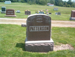
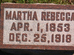
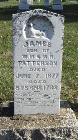
| Description | : | Wife of Ord Howard Howry. Daughter of William Michael Patterson and Martha Rebecca Rogers OBITUARY THE CHARITON LEADER Chariton, Iowa Tuesday, July 12, 1955 MRS. ORD HOWRY Kitty Alta Patterson, the ninth child of William Michael and Martha Rebecca Patterson, was born in Monroe county, May 21, 1888, and died at Collins Memorial hospital at Knoxville June 29, 1955, at the age of 67 years, one month and eight days. On Feb. 27, 1911, she was united in marriage at Albia to Ord Howry, son of Mr. and Mrs. D. H. Howry of Osceola. They... Read More |
frequently asked questions (FAQ):
-
Where is Alta Catherine “Kitty” Patterson Howry's memorial?
Alta Catherine “Kitty” Patterson Howry's memorial is located at: New Norfolk Old Cemetery, New Norfolk, Derwent Valley Council, Australia.
-
When did Alta Catherine “Kitty” Patterson Howry death?
Alta Catherine “Kitty” Patterson Howry death on 29 Jun 1955 in Knoxville, Marion County, Iowa, USA
-
Where are the coordinates of the Alta Catherine “Kitty” Patterson Howry's memorial?
Latitude: -42.7719330
Longitude: 147.0579860
Family Members:
Parent
Spouse
Siblings
Children
Flowers:
Nearby Cemetories:
1. New Norfolk Old Cemetery
New Norfolk, Derwent Valley Council, Australia
Coordinate: -42.7719330, 147.0579860
2. St. Matthew’s Anglican Columbarium Wall
New Norfolk, Derwent Valley Council, Australia
Coordinate: -42.7792220, 147.0673080
3. Saint Matthew's Anglican Cemetery
New Norfolk, Derwent Valley Council, Australia
Coordinate: -42.7806289, 147.0664250
4. Lawitta Church Cemetery
Magra, Derwent Valley Council, Australia
Coordinate: -42.7661690, 147.0331060
5. Malbina General Cemetery
Malbina, Derwent Valley Council, Australia
Coordinate: -42.7866610, 147.1184830
6. Plenty Anglican Church Cemetery
Plenty, Derwent Valley Council, Australia
Coordinate: -42.7382900, 146.9605860
7. Jackman Graveyard
Collinsvale, Glenorchy City, Australia
Coordinate: -42.8406720, 147.1639470
8. Collinsvale Uniting Church Cemetery
Collinsvale, Glenorchy City, Australia
Coordinate: -42.8410560, 147.1991720
9. St. Mary's Anglican Cemetery
Bridgewater, Brighton Council, Australia
Coordinate: -42.7374010, 147.2282310
10. Hestercombe Uniting Church Cemetery
Austins Ferry, Glenorchy City, Australia
Coordinate: -42.7695190, 147.2448030
11. Red Hills Cemetery
Bushy Park, Derwent Valley Council, Australia
Coordinate: -42.7091350, 146.8893740
12. St. Mary's Church of England Cemetery
Gretna, Central Highlands Council, Australia
Coordinate: -42.6669200, 146.9333810
13. St. Augustine's Anglican Cemetery
Broadmarsh, Southern Midlands Council, Australia
Coordinate: -42.6380880, 147.1158740
14. Broadmarsh Congregational Cemetery
Broadmarsh, Southern Midlands Council, Australia
Coordinate: -42.6344620, 147.1129760
15. St. Paul's Anglican Church Cemetery
Glenorchy, Glenorchy City, Australia
Coordinate: -42.8275410, 147.2665830
16. St George's Church of England Cemetery
Gagebrook, Brighton Council, Australia
Coordinate: -42.7499706, 147.2793948
17. Glenorchy Chapel Burial Ground
Glenorchy, Glenorchy City, Australia
Coordinate: -42.8317820, 147.2704320
18. St Matthews Church Cemetery
Glenorchy, Glenorchy City, Australia
Coordinate: -42.8329730, 147.2743670
19. Pontville Saint Matthews Roman Catholic Cemetery
Brighton, Brighton Council, Australia
Coordinate: -42.6900390, 147.2629800
20. St. Mark's Anglican Cemetery
Pontville, Southern Midlands Council, Australia
Coordinate: -42.6807150, 147.2663860
21. St. Michael's Anglican Cemetery
Bagdad, Southern Midlands Council, Australia
Coordinate: -42.6263790, 147.2226500
22. St John’s Anglican Church Cemetery
New Town, Hobart City, Australia
Coordinate: -42.8550230, 147.2969180
23. East Risdon Cemetery
Risdon, Clarence City, Australia
Coordinate: -42.8211910, 147.3184970
24. New Town Congregational Cemetery
New Town, Hobart City, Australia
Coordinate: -42.8545680, 147.3026230


