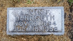
Alvin F. Herrguth
| Birth | : | 13 Nov 1894 Platte Center, Platte County, Nebraska, USA |
| Death | : | 18 Jul 1958 Grand Island, Hall County, Nebraska, USA |
| Burial | : | Vinton Cemetery, Vinton, Plumas County, USA |
| Coordinate | : | 39.8011017, -120.1592026 |
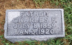
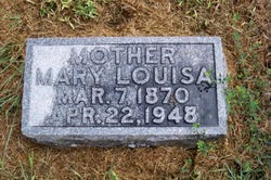
| Description | : | Web site @ http://www.usgennet.org/usa/ne/county/platte/whoplabios.html HERRGUTH, ALVIN F: Grocer & Cafe Operator; b Platte Center, Neb Nov 13, 1894; s of Charles F Herrguth-Louise Schroeder; ed Platte Center HS; Mozer Lampman Bus Coll, Omaha; m Amy Wagner Mar 9, 1921 Columbus; d June Louise; 1919-28 worked for Eugene Miessler Drug Co, Columbus; 1928-30 salesman; 1930- ptr in firm, Clother & Herrguth, cafe & groc, Platte Center; treas vol fire dept; during World War in US army Co I 355th inf, 89th div, priv 1st class, disch Camp Dodge, Ia 1919; Lions; past secy-treas Farmers Comm Club; ch mbr Columbus Country Club; BPOE; Izaak... Read More |
frequently asked questions (FAQ):
-
Where is Alvin F. Herrguth's memorial?
Alvin F. Herrguth's memorial is located at: Vinton Cemetery, Vinton, Plumas County, USA.
-
When did Alvin F. Herrguth death?
Alvin F. Herrguth death on 18 Jul 1958 in Grand Island, Hall County, Nebraska, USA
-
Where are the coordinates of the Alvin F. Herrguth's memorial?
Latitude: 39.8011017
Longitude: -120.1592026
Family Members:
Parent
Spouse
Siblings
Children
Flowers:
Nearby Cemetories:
1. Vinton Cemetery
Vinton, Plumas County, USA
Coordinate: 39.8011017, -120.1592026
2. Chilcoot Cemetery
Chilcoot, Plumas County, USA
Coordinate: 39.7966800, -120.1254400
3. Mountain View Cemetery
Loyalton, Sierra County, USA
Coordinate: 39.6718490, -120.2496190
4. Westside-Sharkey Cemetery
Beckworth, Plumas County, USA
Coordinate: 39.7378006, -120.3867035
5. Whispering Pines Cemetery
Beckworth, Plumas County, USA
Coordinate: 39.8252983, -120.4180984
6. Long Valley Cemetery
Doyle, Lassen County, USA
Coordinate: 40.0268400, -120.1087300
7. Shady Grove Cemetery
Portola, Plumas County, USA
Coordinate: 39.8072014, -120.4593964
8. Summers Family Cemetery
Calpine, Sierra County, USA
Coordinate: 39.6861940, -120.4355350
9. Sattley Cemetery
Sattley, Sierra County, USA
Coordinate: 39.6214000, -120.4225500
10. Sierraville Cemetery
Sierraville, Sierra County, USA
Coordinate: 39.5842018, -120.3786011
11. Crystal Peak Cemetery
Verdi, Washoe County, USA
Coordinate: 39.5250310, -119.9984690
12. Sierra Memorial Gardens Cemetery
Reno, Washoe County, USA
Coordinate: 39.6081009, -119.8491974
13. Reno-Sparks Indian Colony Hungry Valley Cemetery
Reno, Washoe County, USA
Coordinate: 39.7152840, -119.7400810
14. Our Mother of Sorrows Cemetery
Reno, Washoe County, USA
Coordinate: 39.5519981, -119.8229980
15. Masonic Memorial Gardens
Reno, Washoe County, USA
Coordinate: 39.5266724, -119.8409042
16. Mohawk Cemetery
Mohawk, Plumas County, USA
Coordinate: 39.7791060, -120.6384200
17. Mountain View Cemetery
Reno, Washoe County, USA
Coordinate: 39.5238991, -119.8419037
18. Saint Thomas Cemetery
Reno, Washoe County, USA
Coordinate: 39.5401500, -119.8163400
19. Hebrew Cemetery
Reno, Washoe County, USA
Coordinate: 39.5373400, -119.8197000
20. Knights of Pythias Cemetery
Reno, Washoe County, USA
Coordinate: 39.5357208, -119.8214874
21. Grand Army of the Republic Cemetery
Reno, Washoe County, USA
Coordinate: 39.5366200, -119.8198000
22. Hillside Cemetery
Reno, Washoe County, USA
Coordinate: 39.5351982, -119.8206024
23. Trinity Episcopal Church Columbarium
Reno, Washoe County, USA
Coordinate: 39.5236690, -119.8145810
24. Reno Chinese Cemetery
Reno, Washoe County, USA
Coordinate: 39.5277260, -119.8079560

