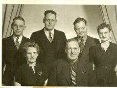
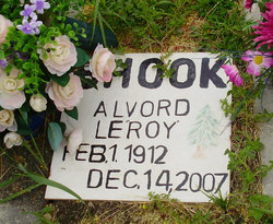
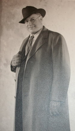
Alvord Leroy “Uncle Roy” Shook
| Birth | : | 1 Feb 1912 Ravalli County, Montana, USA |
| Death | : | 14 Dec 2007 Darby, Ravalli County, Montana, USA |
| Burial | : | Rose Hill Cemetery, Hagerstown, Washington County, USA |
| Coordinate | : | 39.6316900, -77.7229100 |
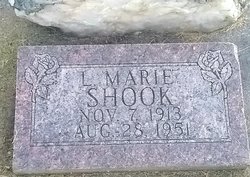
| Description | : | Alvord Leroy Shook, a legend in his own time, passed away Dec, 14, 2007, at Valley View Estates at age 95. He was born Feb. 1, 1912, to Granville "Fone" and Helen "Mattie" Shook and lived his life in the south Bitterroot Valley. He married his high school sweetheart Marie Greenup who died an early death. He later was married to Edna Donica who also preceded him in death. Roy loved the Bitterroot Valley and the forests. He grew up in the lumber industry working with his father, and later operated his own mill. He owned an outfitter and guide business and started... Read More |
frequently asked questions (FAQ):
-
Where is Alvord Leroy “Uncle Roy” Shook's memorial?
Alvord Leroy “Uncle Roy” Shook's memorial is located at: Rose Hill Cemetery, Hagerstown, Washington County, USA.
-
When did Alvord Leroy “Uncle Roy” Shook death?
Alvord Leroy “Uncle Roy” Shook death on 14 Dec 2007 in Darby, Ravalli County, Montana, USA
-
Where are the coordinates of the Alvord Leroy “Uncle Roy” Shook's memorial?
Latitude: 39.6316900
Longitude: -77.7229100
Family Members:
Parent
Spouse
Siblings
Nearby Cemetories:
1. Washington Confederate Cemetery
Hagerstown, Washington County, USA
Coordinate: 39.6286545, -77.7248306
2. Saint Johns Episcopal Churchyard
Hagerstown, Washington County, USA
Coordinate: 39.6379900, -77.7181000
3. Saint John's Evangelical Lutheran Church Cemetery
Hagerstown, Washington County, USA
Coordinate: 39.6382019, -77.7184099
4. Zion Reformed United Church of Christ Cemetery
Hagerstown, Washington County, USA
Coordinate: 39.6450005, -77.7182999
5. Ebenezer Cemetery
Hagerstown, Washington County, USA
Coordinate: 39.6464005, -77.7177963
6. Funkstown Cemetery
Funkstown, Washington County, USA
Coordinate: 39.6077995, -77.7106018
7. Cedar Lawn Memorial Park
Hagerstown, Washington County, USA
Coordinate: 39.6509600, -77.7567300
8. African-American Cemetery
Halfway, Washington County, USA
Coordinate: 39.6185500, -77.7619600
9. B'nai Abraham Cemetery
Halfway, Washington County, USA
Coordinate: 39.6186200, -77.7621000
10. Rest Haven Cemetery
Hagerstown, Washington County, USA
Coordinate: 39.6699400, -77.7196200
11. Shiloh Graveyard
Security, Washington County, USA
Coordinate: 39.6585999, -77.6825027
12. Meadow View Mennonite Church Cemetery
Hagerstown, Washington County, USA
Coordinate: 39.5937500, -77.7472000
13. E.W. Ditto Jr. Farm Graveyard
Hagerstown, Washington County, USA
Coordinate: 39.6110800, -77.6644600
14. Mount Olive Mennonite Church Cemetery
Maugansville, Washington County, USA
Coordinate: 39.6807900, -77.7413600
15. Salem Reformed Church Cemetery
Cearfoss, Washington County, USA
Coordinate: 39.6749992, -77.7628021
16. Long Meadow Church of the Brethren Cemetery
Hagerstown, Washington County, USA
Coordinate: 39.6822014, -77.6881027
17. Hagerstown Mennonite Fellowship Cemetery
Washington County, USA
Coordinate: 39.6560000, -77.7977800
18. Conococheague Church Cemetery
Hagerstown, Washington County, USA
Coordinate: 39.6560130, -77.7977910
19. Andrew Summers Graveyard
Huyett, Washington County, USA
Coordinate: 39.6517600, -77.7999300
20. Fountain Rock Cemetery
Saint James, Washington County, USA
Coordinate: 39.5753990, -77.7587110
21. Bethel United Methodist Church Cemetery
Chewsville, Washington County, USA
Coordinate: 39.6436005, -77.6421967
22. Beaver Creek Church of the Brethren Cemetery
Beaver Creek, Washington County, USA
Coordinate: 39.5832596, -77.6590347
23. Long Family Cemetery
Broadfording, Washington County, USA
Coordinate: 39.6819800, -77.7861500
24. Mount Tabor Cemetery
Broadfording, Washington County, USA
Coordinate: 39.6686000, -77.8053000


