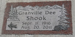
Granville Dee “Dee” Shook
| Birth | : | 11 Sep 1916 Conner, Ravalli County, Montana, USA |
| Death | : | 20 Aug 2011 Hamilton, Ravalli County, Montana, USA |
| Burial | : | Lone Pine Cemetery, Darby, Ravalli County, USA |
| Coordinate | : | 46.0289001, -114.1742020 |
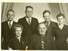
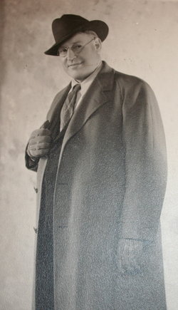
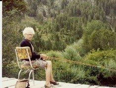
| Description | : | Dee always had close ties to the woods and mountains. His grandfather, Granville Lee Shook homesteaded and began harvesting timber at the base of Shook Mountain at Conner in the late 1870s. His father, Granville Fone Shook logged and used a portable steam engine sawmill in various locations in the West Fork and East Fork areas. Fone ran a steam engine driven sawmill at the French Basin location. It was during this time he married Ilda Katherine Hess and had three daughters. His dad turned the operation over to Dee to go back to ranching. Dee moved the mill to Conner... Read More |
frequently asked questions (FAQ):
-
Where is Granville Dee “Dee” Shook's memorial?
Granville Dee “Dee” Shook's memorial is located at: Lone Pine Cemetery, Darby, Ravalli County, USA.
-
When did Granville Dee “Dee” Shook death?
Granville Dee “Dee” Shook death on 20 Aug 2011 in Hamilton, Ravalli County, Montana, USA
-
Where are the coordinates of the Granville Dee “Dee” Shook's memorial?
Latitude: 46.0289001
Longitude: -114.1742020
Family Members:
Parent
Spouse
Siblings
Children
Flowers:
Nearby Cemetories:
1. Lone Pine Cemetery
Darby, Ravalli County, USA
Coordinate: 46.0289001, -114.1742020
2. Grantsdale Cemetery
Hamilton, Ravalli County, USA
Coordinate: 46.1819000, -114.1442032
3. Riverview Cemetery
Hamilton, Ravalli County, USA
Coordinate: 46.2456017, -114.1803970
4. Sula Cemetery
Sula, Ravalli County, USA
Coordinate: 45.8591995, -113.9777985
5. Tolan Creek Cemetery
Sula, Ravalli County, USA
Coordinate: 45.8560318, -113.9134116
6. Blodgett Cemetery
Ravalli County, USA
Coordinate: 46.2886009, -114.1868973
7. Brickley Cemetery
Darby, Ravalli County, USA
Coordinate: 45.7648000, -114.2786900
8. Corvallis Cemetery
Corvallis, Ravalli County, USA
Coordinate: 46.2991982, -114.1003036
9. Pinesdale Cemetery
Pinesdale, Ravalli County, USA
Coordinate: 46.3255100, -114.2134000
10. Victor Cemetery
Victor, Ravalli County, USA
Coordinate: 46.4268610, -114.1568680
11. Riverside Cemetery
Stevensville, Ravalli County, USA
Coordinate: 46.4986000, -114.0982971
12. Maplewood Cemetery
Stevensville, Ravalli County, USA
Coordinate: 46.5042000, -114.0963974
13. Saint Marys Cemetery
Stevensville, Ravalli County, USA
Coordinate: 46.5093994, -114.0986023
14. Gibbonsville Cemetery
Gibbonsville, Lemhi County, USA
Coordinate: 45.5350000, -113.9350000
15. Big Hole Battlefield Cemetery
Wisdom, Beaverhead County, USA
Coordinate: 45.6472410, -113.6521330
16. Sunnyside Cemetery
Stevensville, Ravalli County, USA
Coordinate: 46.5657997, -113.9916992
17. Saint Josephs Cemetery
Florence, Ravalli County, USA
Coordinate: 46.6294000, -114.0861000
18. Christiansen Ranch Cemetery
Jackson, Beaverhead County, USA
Coordinate: 45.7742700, -113.3571300
19. Indianola Cemetery
Shoup, Lemhi County, USA
Coordinate: 45.4013070, -114.1675800
20. Wisdom Cemetery
Wisdom, Beaverhead County, USA
Coordinate: 45.6624985, -113.4393997
21. Merritt Burial Site
Shoup, Lemhi County, USA
Coordinate: 45.3924460, -114.2540340
22. Carlton Cemetery
Lolo, Missoula County, USA
Coordinate: 46.6788880, -114.0791560
23. Briston Cemetery
Beaverhead County, USA
Coordinate: 45.5141983, -113.5733032
24. Nabob Mine Burial Site
Shoup, Lemhi County, USA
Coordinate: 45.3749410, -114.3883400

