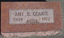
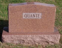
Amy Harriet Smith Quante
| Birth | : | 16 Jun 1909 |
| Death | : | 20 Apr 1972 |
| Burial | : | Lafayette Cemetery, Brock, Nemaha County, USA |
| Coordinate | : | 40.5127983, -95.9543991 |
| Plot | : | Lot 175, Grave 7 |
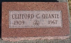
| Description | : | Father: Milo Wesley Smith Mother: Mary Emily Witter Married: August 21, 1937 Husband: Clifford C. Quante |
frequently asked questions (FAQ):
-
Where is Amy Harriet Smith Quante's memorial?
Amy Harriet Smith Quante's memorial is located at: Lafayette Cemetery, Brock, Nemaha County, USA.
-
When did Amy Harriet Smith Quante death?
Amy Harriet Smith Quante death on 20 Apr 1972 in
-
Where are the coordinates of the Amy Harriet Smith Quante's memorial?
Latitude: 40.5127983
Longitude: -95.9543991
Family Members:
Parent
Spouse
Siblings
Children
Flowers:
Nearby Cemetories:
1. Lafayette Cemetery
Brock, Nemaha County, USA
Coordinate: 40.5127983, -95.9543991
2. Saint Pauls Cemetery
Talmage, Otoe County, USA
Coordinate: 40.5448810, -95.9919480
3. Fairview Cemetery
Talmage, Otoe County, USA
Coordinate: 40.5525017, -96.0102997
4. Saint Joseph Catholic Cemetery
Paul, Otoe County, USA
Coordinate: 40.5806530, -95.9339190
5. Grant Evergreen Cemetery
Nemaha County, USA
Coordinate: 40.5065430, -96.0472250
6. Saint Bernards Church Cemetery
Julian, Nemaha County, USA
Coordinate: 40.5078000, -95.8592000
7. Coryell Park Mausoleum
Johnson, Nemaha County, USA
Coordinate: 40.4371150, -95.9548690
8. Glenrock Cemetery
Glenrock, Nemaha County, USA
Coordinate: 40.4644012, -95.8764038
9. Clifton Cemetery
Johnson, Nemaha County, USA
Coordinate: 40.4333000, -95.9563980
10. Bloomingdale Cemetery
Otoe County, USA
Coordinate: 40.5685997, -95.8783035
11. Zion Lutheran Church Cemetery
Johnson, Nemaha County, USA
Coordinate: 40.4287000, -96.0099000
12. Saint Johns Cemetery
Talmage, Otoe County, USA
Coordinate: 40.5820847, -96.0474625
13. Linden Cemetery
Nemaha County, USA
Coordinate: 40.4216995, -95.9032974
14. Biggs Cemetery
Lorton, Otoe County, USA
Coordinate: 40.6025009, -96.0105972
15. Johnson Cemetery
Johnson, Nemaha County, USA
Coordinate: 40.4142000, -96.0052300
16. Heuser Cemetery
Otoe County, USA
Coordinate: 40.6223259, -95.9318848
17. Saint Matthews Lutheran Cemetery
Johnson, Nemaha County, USA
Coordinate: 40.4073060, -96.0086500
18. Highland Baptist Cemetery
Auburn, Nemaha County, USA
Coordinate: 40.4578018, -95.8191986
19. Highland Methodist Cemetery
Nemaha County, USA
Coordinate: 40.4581850, -95.8097140
20. Karn Cemetery
Glenrock, Nemaha County, USA
Coordinate: 40.4789000, -95.7917000
21. Camp Creek Cemetery
Otoe County, USA
Coordinate: 40.5681000, -95.8019028
22. Livingston Cemetery
Cook, Johnson County, USA
Coordinate: 40.5080986, -96.1235962
23. Mount Hope Church Cemetery
Cook, Johnson County, USA
Coordinate: 40.4775000, -96.1233000
24. Schacht Cemetery
Otoe County, USA
Coordinate: 40.5447006, -96.1271973


