| Birth | : | 7 Oct 1844 Ivanivka, Mykolaivska, Ukraine |
| Death | : | 22 Nov 1916 Underwood, McLean County, North Dakota, USA |
| Burial | : | Mount Nebo Memorial Park, Aurora, Arapahoe County, USA |
| Coordinate | : | 39.7383003, -104.8518982 |
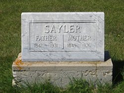
| Inscription | : | Biography as follows: Info from Johannes SAYLER BOOK Pg# 148 by Verine (Sayler) REIMANN: Andreas and Christina were farmers in Johannestal and started their family there. Five children were born in Johannestal with one |
| Description | : | Info from Johannes SAYLER BOOK Pg# 148 by Verine (Sayler) REIMANN: Andreas and Christina were farmers in Johannestal and started their family there. Five children were born in Johannestal with one son passing away and buried in Johannestal. Andreas, his parents, sister and three brothers sold there crop standing in the field, and departed for America leaving Johannestal on the 17th of October 1872. Via the Port of Liverpool, Great Britain they arrived at Castle Garden, New York aboard the SS "City of Bristol" on the 18th of November 1872 and from there proceeded to Sandusky, Ohio. Andreas and Christina with their family... Read More |
frequently asked questions (FAQ):
-
Where is Andreas Sayler Sr.'s memorial?
Andreas Sayler Sr.'s memorial is located at: Mount Nebo Memorial Park, Aurora, Arapahoe County, USA.
-
When did Andreas Sayler Sr. death?
Andreas Sayler Sr. death on 22 Nov 1916 in Underwood, McLean County, North Dakota, USA
-
Where are the coordinates of the Andreas Sayler Sr.'s memorial?
Latitude: 39.7383003
Longitude: -104.8518982
Family Members:
Parent
Spouse
Siblings
Children
Flowers:
Nearby Cemetories:
1. Mount Nebo Memorial Park
Aurora, Arapahoe County, USA
Coordinate: 39.7383003, -104.8518982
2. Saint Stephens Episcopal Church Columbarium
Arapahoe County, USA
Coordinate: 39.7222500, -104.8478700
3. Aurora Police Memorial
Arapahoe County, USA
Coordinate: 39.7115300, -104.8136600
4. Saint Lukes Episcopal Church Columbarium
Denver, Denver County, USA
Coordinate: 39.7369200, -104.9044000
5. Richthofen Memorial
Denver County, USA
Coordinate: 39.7352000, -104.9063000
6. Fairmount Cemetery
Denver, Denver County, USA
Coordinate: 39.7086800, -104.9027400
7. Congregation Emanuel Cemetery
Denver, Denver County, USA
Coordinate: 39.7054900, -104.9025800
8. Park Hill United Methodist Church Columbarium
Denver, Denver County, USA
Coordinate: 39.7477940, -104.9265280
9. Montview Garden Columbarium
Denver, Denver County, USA
Coordinate: 39.7466800, -104.9311900
10. Saint Thomas Episcopal Columbarium
Denver, Denver County, USA
Coordinate: 39.7494500, -104.9329900
11. Augustana Lutheran Church Memorial Garden
Denver, Denver County, USA
Coordinate: 39.7103800, -104.9294400
12. Polar Bear Velox Memorial
Denver, Denver County, USA
Coordinate: 39.7502600, -104.9489000
13. Rocky Mountain Memorial Park
Denver, Denver County, USA
Coordinate: 39.6597000, -104.8558000
14. Cremation Gardens
Aurora, Adams County, USA
Coordinate: 39.6596230, -104.8556500
15. Olinger Eastlawn Cemetery
Aurora, Adams County, USA
Coordinate: 39.7491989, -104.7493973
16. Mount Calvary Cemetery
Denver, Denver County, USA
Coordinate: 39.7319750, -104.9612730
17. Rose Hill Cemetery
Commerce City, Adams County, USA
Coordinate: 39.8111000, -104.9088974
18. Kirk of Bonnie Brae Memorial Garden
Denver, Denver County, USA
Coordinate: 39.6945000, -104.9504000
19. Old Denver City Cemetery
Denver, Denver County, USA
Coordinate: 39.7327780, -104.9658330
20. Hampden Memorial Estates
Denver, Denver County, USA
Coordinate: 39.6521988, -104.8889008
21. Grace United Methodist Church Columbarium
Denver, Denver County, USA
Coordinate: 39.6677340, -104.9298610
22. Calvary Baptist Church Columbarium
Denver, Denver County, USA
Coordinate: 39.6535000, -104.9121700
23. All Souls Walk at Saint Johns Cathedral
Denver, Denver County, USA
Coordinate: 39.7380600, -104.9780000
24. Saint Simeon Catholic Cemetery
Aurora, Arapahoe County, USA
Coordinate: 39.7075000, -104.7297000


