
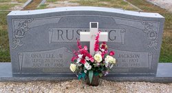

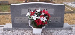
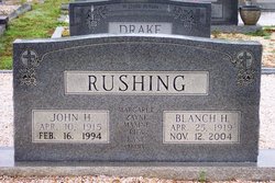
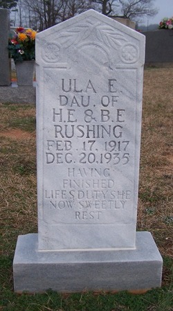
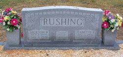
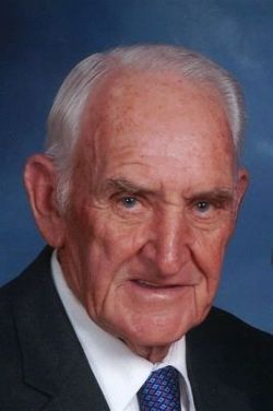
Andrew Jackson Rushing
| Birth | : | 16 Feb 1903 Union County, North Carolina, USA |
| Death | : | 20 Jul 1985 Monroe, Union County, North Carolina, USA |
| Burial | : | Lydeard St Lawrence Churchyard, Lydeard St Lawrence, Taunton Deane Borough, England |
| Coordinate | : | 51.0818820, -3.2462470 |
| Description | : | Married Ona Lee Williams in Union County NC on December 8 1924 |
frequently asked questions (FAQ):
-
Where is Andrew Jackson Rushing's memorial?
Andrew Jackson Rushing's memorial is located at: Lydeard St Lawrence Churchyard, Lydeard St Lawrence, Taunton Deane Borough, England.
-
When did Andrew Jackson Rushing death?
Andrew Jackson Rushing death on 20 Jul 1985 in Monroe, Union County, North Carolina, USA
-
Where are the coordinates of the Andrew Jackson Rushing's memorial?
Latitude: 51.0818820
Longitude: -3.2462470
Family Members:
Parent

Spouse

Siblings
Children
Flowers:


Nearby Cemetories:
1. Lydeard St Lawrence Churchyard
Lydeard St Lawrence, Taunton Deane Borough, England
Coordinate: 51.0818820, -3.2462470
2. St Peter and St Paul Churchyard
Combe Florey, Taunton Deane Borough, England
Coordinate: 51.0735250, -3.2139050
3. Combe Florey Extension Cemetery
Combe Florey, Taunton Deane Borough, England
Coordinate: 51.0733900, -3.2120200
4. St John The Baptist Churchyard
Tolland, Taunton Deane Borough, England
Coordinate: 51.0826570, -3.2856680
5. Holy Trinity Churchyard
Ash Priors, Taunton Deane Borough, England
Coordinate: 51.0584700, -3.2118200
6. Saint James Churchyard
Fitzhead, Taunton Deane Borough, England
Coordinate: 51.0481000, -3.2571000
7. Blessed Virgin Mary Churchyard
Brompton Ralph, West Somerset District, England
Coordinate: 51.0830230, -3.3077060
8. St. Pancras Churchyard
West Bagborough, Taunton Deane Borough, England
Coordinate: 51.0966990, -3.1890352
9. Saint James Churchyard
Halse, Taunton Deane Borough, England
Coordinate: 51.0425680, -3.2285430
10. Blessed Virgin Mary Churchyard
Bishops Lydeard, Taunton Deane Borough, England
Coordinate: 51.0611320, -3.1886320
11. Holy Ghost Churchyard
Crowcombe, West Somerset District, England
Coordinate: 51.1232260, -3.2293260
12. St. Martin de Tours Churchyard
Elworthy, West Somerset District, England
Coordinate: 51.1066110, -3.3113586
13. St. Thomas of Canterbury Churchyard
Cothelstone, Taunton Deane Borough, England
Coordinate: 51.0801700, -3.1699730
14. St. Mary of Stogumber Churchyard
Stogumber, West Somerset District, England
Coordinate: 51.1276170, -3.2902340
15. St Michael Churchyard
Milverton, Taunton Deane Borough, England
Coordinate: 51.0255170, -3.2537660
16. St. Andrew's Churchyard
Wiveliscombe, Taunton Deane Borough, England
Coordinate: 51.0410630, -3.3096850
17. Friends' Burial Ground
Milverton, Taunton Deane Borough, England
Coordinate: 51.0267290, -3.2756778
18. St. John the Baptist Churchyard
Heathfield, Taunton Deane Borough, England
Coordinate: 51.0314500, -3.1990400
19. St. Bartholomew's Churchyard
Oake, Taunton Deane Borough, England
Coordinate: 51.0196440, -3.2094170
20. All Saints Churchyard
Aisholt, Sedgemoor District, England
Coordinate: 51.1142070, -3.1532890
21. Saint George Churchyard
Bicknoller, West Somerset District, England
Coordinate: 51.1472610, -3.2722430
22. Saint Mary Magdalene Churchyard
Clatworthy, West Somerset District, England
Coordinate: 51.0698450, -3.3534250
23. All Saints Churchyard
Monksilver, West Somerset District, England
Coordinate: 51.1287770, -3.3262800
24. St. Peter's Churchyard Huish Champflower
Chipstable, Taunton Deane Borough, England
Coordinate: 51.0543700, -3.3580940