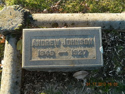
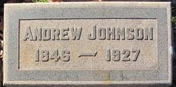
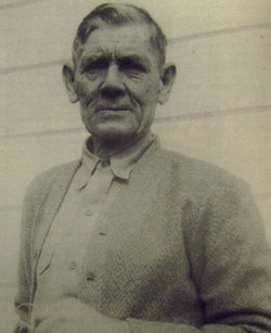
Andrew Johnson
| Birth | : | 14 Nov 1846 Sweden |
| Death | : | 1927 Placer County, California, USA |
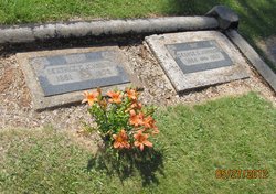
| Burial | : | Taupō Cemetery, Taupō, Taupō District, New Zealand |
| Coordinate | : | -38.6775870, 176.0786520 |
| Plot | : | W-1/2-477 |
| Description | : | September 8, 1878, he married Miss Anna Olivia Laurin pchs pages: He was born November 14, 1846 in Vermland, Sweden. . .he served the required time in the army before he left for America. . .In 1875 he came to California and found work in a copper mine at Spenceville. . . .in 1876 he removed to the Ophir section of Placer County. . .He began to prospect and purchased a mining claim of 15 acres. . . located on Duncan Hill east of Ophir. . .taking out as much as $5000 in a year at the same time he bought 15... Read More |
frequently asked questions (FAQ):
-
Where is Andrew Johnson's memorial?
Andrew Johnson's memorial is located at: Taupō Cemetery, Taupō, Taupō District, New Zealand.
-
When did Andrew Johnson death?
Andrew Johnson death on 1927 in Placer County, California, USA
-
Where are the coordinates of the Andrew Johnson's memorial?
Latitude: -38.6775870
Longitude: 176.0786520
Family Members:
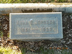
Spouse
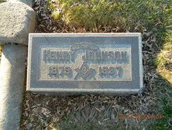
Children
Nearby Cemetories:
1. Taupō Cemetery
Taupō, Taupō District, New Zealand
Coordinate: -38.6775870, 176.0786520
2. Taupō Early Settlers Cemetery
Taupō, Taupō District, New Zealand
Coordinate: -38.6763616, 176.0794441
3. Old Military and Early Settlers Cemetery
Taupō, Taupō District, New Zealand
Coordinate: -38.6839100, 176.0730100
4. Nukuhau Māori Cemetery
Nukuhau, Taupō District, New Zealand
Coordinate: -38.6796400, 176.0607400
5. Taupō Māori Cemetery
Taupō, Taupō District, New Zealand
Coordinate: -38.7013910, 176.0855890
6. Waitahanui Urupā
Waitahanui, Taupō District, New Zealand
Coordinate: -38.7906720, 176.0756252
7. Opepe Military Cemetery
Taupō District, New Zealand
Coordinate: -38.7669130, 176.2179120
8. Waiwharangi Māori Cemetery
Mokai, Taupō District, New Zealand
Coordinate: -38.5162400, 175.8759100
9. Ngakuru Cemetery
Rotorua, Rotorua District, New Zealand
Coordinate: -38.3227770, 176.1911950
10. Tūrangi Cemetery
Tūrangi, Taupō District, New Zealand
Coordinate: -38.9828700, 175.8014900
11. St. Paul's Anglican Churchyard
Tokaanu, Taupō District, New Zealand
Coordinate: -38.9649900, 175.7662100
12. Mangakino Public Cemetery
Mangakino, Taupō District, New Zealand
Coordinate: -38.3617140, 175.7631240
13. Ruamano Parekarangi Urupā
Horohoro, Rotorua District, New Zealand
Coordinate: -38.2349430, 176.1912227
14. Tokoroa Cemetery
Tokoroa, South Waikato District, New Zealand
Coordinate: -38.2311010, 175.8826160
15. Whakarewarewa Urupā
Rotorua, Rotorua District, New Zealand
Coordinate: -38.1629708, 176.2556791
16. Te Papa Marae Māori Cemetery
Murupara, Whakatāne District, New Zealand
Coordinate: -38.4499600, 176.6989500
17. Rotorua Crematorium and Cemetery
Rotorua, Rotorua District, New Zealand
Coordinate: -38.1533100, 176.2630900
18. Murupara-Galatea Cemetery
Galatea, Whakatāne District, New Zealand
Coordinate: -38.4411700, 176.7164800
19. Mamaku Cemetery
Mamaku, Rotorua District, New Zealand
Coordinate: -38.0986200, 176.0726700
20. Kauae Cemetery
Ngongotaha, Rotorua District, New Zealand
Coordinate: -38.0915298, 176.2152557
21. Taringamotu Māori Cemetery
Taringamotu, Ruapehu District, New Zealand
Coordinate: -38.8275100, 175.3158200
22. Kakahi Māori Cemetery
Kakahi, Ruapehu District, New Zealand
Coordinate: -38.9477500, 175.3700700
23. Manunui Cemetery
Manunui, Ruapehu District, New Zealand
Coordinate: -38.9014930, 175.3423740
24. Waiteti (Weriwiri Pa) Cemetery
Ngongotaha, Rotorua District, New Zealand
Coordinate: -38.0689500, 176.2132000

