
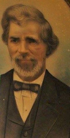
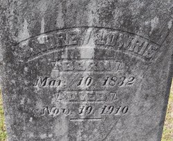

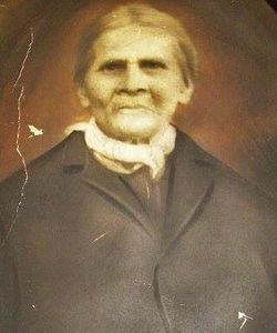
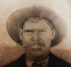
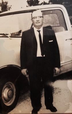
Andrew Lowrie
| Birth | : | 10 Mar 1832 Robeson County, North Carolina, USA |
| Death | : | 19 Nov 1910 Robeson County, North Carolina, USA |
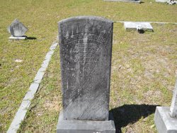
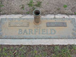
| Burial | : | Oak Grove Cemetery, Scotland County, USA |
| Coordinate | : | 34.6685000, -79.4691200 |
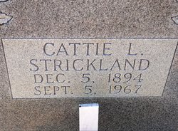
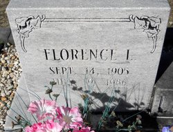
| Description | : | Andrew Lowrie was the son of Zion Lowrie. He married Mary Ann Locklear, daughter of Robert Locklear and Rhoda Charlotte Quick. Their children were:Nancy Lowrie, Vicie Lowrie, Malley Lowrie, and Benjamin Lowrie. Andrew's second wife was Florence Strickland, daughter of Joseph Strickland and Syrena Cummings. Thier children were: Andrew Jody Lowrie, Leimetter "Almetta" Lowrie, Hayes Lowrie, Cattie Lowrie, Louvenia "Binnie" Lowrie, Trussie Lowrie, and Florence Lowrie. Andrew's sir name was spelled Lowrie, however it appears his children changed the spelling to Lowery. |
frequently asked questions (FAQ):
-
Where is Andrew Lowrie's memorial?
Andrew Lowrie's memorial is located at: Oak Grove Cemetery, Scotland County, USA.
-
When did Andrew Lowrie death?
Andrew Lowrie death on 19 Nov 1910 in Robeson County, North Carolina, USA
-
Where are the coordinates of the Andrew Lowrie's memorial?
Latitude: 34.6685000
Longitude: -79.4691200
Family Members:
Parent
Spouse
Siblings
Children
Flowers:


Nearby Cemetories:
1. Oak Grove Cemetery
Scotland County, USA
Coordinate: 34.6685000, -79.4691200
2. Good News Chapel Church Cemetery
Laurinburg, Scotland County, USA
Coordinate: 34.6671200, -79.4822700
3. Locklear Native Cemetery
Johns, Scotland County, USA
Coordinate: 34.6818761, -79.4581009
4. Smyrna Presbyterian Church Cemetery
Johns, Scotland County, USA
Coordinate: 34.6588554, -79.4526520
5. Bowen Family Cemetery
Laurinburg, Scotland County, USA
Coordinate: 34.6527500, -79.4887100
6. Smiling Family Cemetery
Laurinburg, Scotland County, USA
Coordinate: 34.6649550, -79.5036320
7. Priest Cemetery
McColl, Marlboro County, USA
Coordinate: 34.6447100, -79.4885200
8. Reedy Branch Baptist Church
Marlboro County, USA
Coordinate: 34.6254900, -79.4757300
9. Brown Cemetery #2
McColl, Marlboro County, USA
Coordinate: 34.6415140, -79.5130430
10. Bethel Bible Believing Church Cemetery
McColl, Marlboro County, USA
Coordinate: 34.6389610, -79.5123580
11. Greater Fair Plains AME Zion Church Cemetery
McColl, Marlboro County, USA
Coordinate: 34.6650590, -79.5321980
12. Seales Family Cemetery
Laurinburg, Scotland County, USA
Coordinate: 34.7008290, -79.5199050
13. Old Reedy Branch Cemetery
Clio, Marlboro County, USA
Coordinate: 34.6160300, -79.4836400
14. Daniels Chapel Cemetery
Marlboro County, USA
Coordinate: 34.6192000, -79.4993600
15. Mount Misery Cemetery
McColl, Marlboro County, USA
Coordinate: 34.6725520, -79.5395280
16. McLaurin Cemetery
McColl, Marlboro County, USA
Coordinate: 34.6688995, -79.5417023
17. Caledonia United Methodist Church Cemetery
Laurinburg, Scotland County, USA
Coordinate: 34.7290916, -79.4603958
18. Pee Dee Chapel Baptist Church Cemetery
Carolina, Dillon County, USA
Coordinate: 34.6074638, -79.4516678
19. Harris Family Cemetery
Laurinburg, Scotland County, USA
Coordinate: 34.7160960, -79.4189630
20. Britt-Brock Cemetery
Clio, Marlboro County, USA
Coordinate: 34.6121670, -79.5049090
21. Laurinburg Memorial Park
Laurinburg, Scotland County, USA
Coordinate: 34.7114700, -79.5264800
22. Red Bluff Cemetery
Clio, Marlboro County, USA
Coordinate: 34.6117783, -79.5053711
23. Graham Plantation Cemetery
Laurinburg, Scotland County, USA
Coordinate: 34.6997300, -79.5389800
24. Gibson Cemetery
McColl, Marlboro County, USA
Coordinate: 34.6639230, -79.5518280