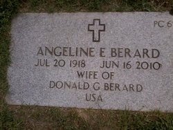
Angeline Elizabeth “Angie” Clukey Berard
| Birth | : | 20 Jul 1918 Dexter, Penobscot County, Maine, USA |
| Death | : | 16 Jun 2010 Waterville, Kennebec County, Maine, USA |
| Burial | : | Rehoboth Mission Cemetery, Rehoboth, McKinley County, USA |
| Coordinate | : | 35.5286640, -108.6540990 |
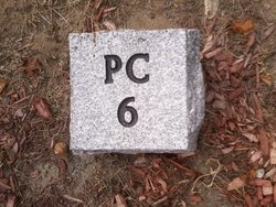
| Plot | : | SECTION PC ROW 6 SITE 24 |
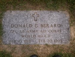
| Description | : | WATERVILLE - Angeline E. "Angie" Berard, 91, passed away June 16, 2010, at Mount St. Joseph Nursing home after a short illness. She was born in Dexter on July 20, 1918, the daughter of Thomas J. And Jennie M. (Pooler) Clukey. She grew up in Dexter and graduated from high school, class of 1936. She attended nursing school in Waterville after high school and worked as a nurse and laboratory technician before meeting her future husband Donald Berard of Waterville. She also worked at the Yardgoods Center in Waterville for many years prior to her retirement. Angeline was a wonderful cook... Read More |
frequently asked questions (FAQ):
-
Where is Angeline Elizabeth “Angie” Clukey Berard's memorial?
Angeline Elizabeth “Angie” Clukey Berard's memorial is located at: Rehoboth Mission Cemetery, Rehoboth, McKinley County, USA.
-
When did Angeline Elizabeth “Angie” Clukey Berard death?
Angeline Elizabeth “Angie” Clukey Berard death on 16 Jun 2010 in Waterville, Kennebec County, Maine, USA
-
Where are the coordinates of the Angeline Elizabeth “Angie” Clukey Berard's memorial?
Latitude: 35.5286640
Longitude: -108.6540990
Family Members:
Flowers:
Nearby Cemetories:
1. Rehoboth Mission Cemetery
Rehoboth, McKinley County, USA
Coordinate: 35.5286640, -108.6540990
2. Gallup State Veterans Cemetery
Gallup, McKinley County, USA
Coordinate: 35.5358950, -108.7086870
3. Cathedral of the Sacred Heart Crypt
Gallup, McKinley County, USA
Coordinate: 35.5258450, -108.7357330
4. Hillcrest Cemetery
Gallup, McKinley County, USA
Coordinate: 35.5214005, -108.7525024
5. Gallup City Cemetery
Gallup, McKinley County, USA
Coordinate: 35.5016320, -108.8400220
6. Sunset Memorial Park
Gallup, McKinley County, USA
Coordinate: 35.5028770, -108.8443640
7. Pinedale Cemetery
Pinedale, McKinley County, USA
Coordinate: 35.6113860, -108.4498390
8. Pinehaven Cemetery
Pinehaven, McKinley County, USA
Coordinate: 35.3518982, -108.7268982
9. Torreon Cemetery
McKinley County, USA
Coordinate: 35.3722000, -108.5250015
10. McGaffey Cemetery
McGaffey, McKinley County, USA
Coordinate: 35.3703003, -108.5224991
11. Pine Tree Cemetery
Vanderwagen, McKinley County, USA
Coordinate: 35.2658410, -108.7540080
12. Tohatchi Cemetery
Tohatchi, McKinley County, USA
Coordinate: 35.8626080, -108.7582670
13. Lone Pine Cemetery
Mexican Springs, McKinley County, USA
Coordinate: 35.8258018, -108.8771973
14. Standing Rock Cemetery
Standing Rock, McKinley County, USA
Coordinate: 35.8014560, -108.3614590
15. Family Cemeteries
Apache County, USA
Coordinate: 35.3595472, -109.0677722
16. Saint Michaels Cemetery
Saint Michaels, Apache County, USA
Coordinate: 35.6431900, -109.0986900
17. Navajo Veterans Cemetery
Fort Defiance, Apache County, USA
Coordinate: 35.7226600, -109.0553390
18. Thoreau Cemetery
Thoreau, McKinley County, USA
Coordinate: 35.4082450, -108.2066630
19. Bowman Memorial Park
Apache County, USA
Coordinate: 35.4192009, -109.1072006
20. Mormon Colony Cemetery
Cibola County, USA
Coordinate: 35.1730995, -108.4661026
21. Good Shepherd Mission Cemetery
Fort Defiance, Apache County, USA
Coordinate: 35.7429100, -109.0705680
22. Ramah Cemetery
Ramah, McKinley County, USA
Coordinate: 35.1258011, -108.4950027
23. Crownpoint Cemetery
Crownpoint, McKinley County, USA
Coordinate: 35.6757630, -108.1533320
24. Old Mission Cemetery
Zuni, McKinley County, USA
Coordinate: 35.0678960, -108.8492640


