
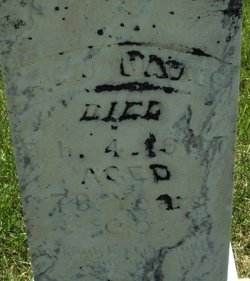

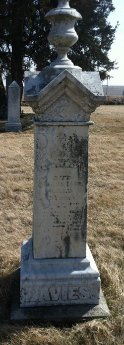
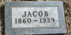
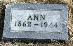
Ann “Ann” Powell Davies
| Birth | : | 1829 Wales |
| Death | : | 4 Feb 1907 Carroll County, Iowa, USA |
| Burial | : | Elba Cemetery, Templeton, Carroll County, USA |
| Coordinate | : | 41.9068985, -94.9131012 |
| Description | : | Per WPA Records |
frequently asked questions (FAQ):
-
Where is Ann “Ann” Powell Davies's memorial?
Ann “Ann” Powell Davies's memorial is located at: Elba Cemetery, Templeton, Carroll County, USA.
-
When did Ann “Ann” Powell Davies death?
Ann “Ann” Powell Davies death on 4 Feb 1907 in Carroll County, Iowa, USA
-
Where are the coordinates of the Ann “Ann” Powell Davies's memorial?
Latitude: 41.9068985
Longitude: -94.9131012
Family Members:
Spouse
Children
Flowers:


Nearby Cemetories:
1. Elba Cemetery
Templeton, Carroll County, USA
Coordinate: 41.9068985, -94.9131012
2. Sacred Heart Cemetery
Templeton, Carroll County, USA
Coordinate: 41.9138746, -94.9460994
3. Dedham Cemetery
Dedham, Carroll County, USA
Coordinate: 41.8993988, -94.8225021
4. Saint Josephs Cemetery
Dedham, Carroll County, USA
Coordinate: 41.8993988, -94.8210983
5. Cameron Cemetery
Audubon County, USA
Coordinate: 41.8236008, -94.9167023
6. Gray Cemetery
Gray, Audubon County, USA
Coordinate: 41.8414001, -94.9946976
7. Holy Angels Cemetery
Carroll County, USA
Coordinate: 42.0014000, -94.9141998
8. Saint Marys Catholic Cemetery
Willey, Carroll County, USA
Coordinate: 41.9783363, -94.8212204
9. Sacred Heart Cemetery
Manning, Carroll County, USA
Coordinate: 41.9132500, -95.0540000
10. Saint Augustine Cemetery
Halbur, Carroll County, USA
Coordinate: 42.0066986, -94.9744034
11. Manning Cemetery
Manning, Carroll County, USA
Coordinate: 41.8990000, -95.0620000
12. McCurdy Cemetery
Carroll County, USA
Coordinate: 41.9403000, -94.7649994
13. Lincoln Township Cemetery
Gray, Audubon County, USA
Coordinate: 41.8198130, -95.0154970
14. Viola Center Cemetery
Viola Center, Audubon County, USA
Coordinate: 41.8236008, -94.8016968
15. Old Carrollton Cemetery
Carrollton, Carroll County, USA
Coordinate: 41.9233017, -94.7403030
16. Oak Hill Cemetery
Coon Rapids, Carroll County, USA
Coordinate: 41.9053001, -94.7200012
17. Iowa Township Cemetery
Aspinwall, Crawford County, USA
Coordinate: 41.9216995, -95.1113968
18. Luccocks Grove Cemetery
Audubon County, USA
Coordinate: 41.7619019, -94.8653030
19. Mount Olivet Cemetery
Carroll, Carroll County, USA
Coordinate: 42.0536340, -94.8595510
20. Carroll City Cemetery
Carroll, Carroll County, USA
Coordinate: 42.0560963, -94.8599856
21. Douglas Township Cemetery
Audubon County, USA
Coordinate: 41.7611008, -95.0282974
22. Tuttles Grove Cemetery
Guthrie County, USA
Coordinate: 41.8130989, -94.7228012
23. Maple Grove Cemetery
Audubon, Audubon County, USA
Coordinate: 41.7289100, -94.9242700
24. Arlington Heights Cemetery
Audubon, Audubon County, USA
Coordinate: 41.7270000, -94.9240000