
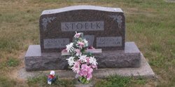
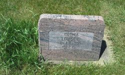
Anna B Kies Stoelk
| Birth | : | 1897 |
| Death | : | 1960 |
| Burial | : | Westside Cemetery, Westside, Crawford County, USA |
| Coordinate | : | 42.0602989, -95.0922012 |
frequently asked questions (FAQ):
-
Where is Anna B Kies Stoelk's memorial?
Anna B Kies Stoelk's memorial is located at: Westside Cemetery, Westside, Crawford County, USA.
-
When did Anna B Kies Stoelk death?
Anna B Kies Stoelk death on 1960 in
-
Where are the coordinates of the Anna B Kies Stoelk's memorial?
Latitude: 42.0602989
Longitude: -95.0922012
Family Members:
Parent

Spouse

Siblings

Children

Flowers:


Nearby Cemetories:
1. Westside Cemetery
Westside, Crawford County, USA
Coordinate: 42.0602989, -95.0922012
2. Saint Johns Catholic Cemetery
Arcadia, Carroll County, USA
Coordinate: 42.0855406, -95.0341577
3. Hayes Township Cemetery
Westside, Crawford County, USA
Coordinate: 42.0083199, -95.1216583
4. Saint Anns Cemetery
Vail, Crawford County, USA
Coordinate: 42.0513992, -95.1868973
5. Arcadia Cemetery
Arcadia Township, Carroll County, USA
Coordinate: 42.1000680, -95.0130550
6. Vail Cemetery
Vail, Crawford County, USA
Coordinate: 42.0647011, -95.2102966
7. Saint Augustine Cemetery
Halbur, Carroll County, USA
Coordinate: 42.0066986, -94.9744034
8. King Cemetery
Vail, Crawford County, USA
Coordinate: 42.1007996, -95.2319031
9. Saint Francis Cemetery
Maple River, Carroll County, USA
Coordinate: 42.0969009, -94.9372025
10. Wheatland Cemetery
Carroll County, USA
Coordinate: 42.1814003, -95.0582962
11. Iowa Township Cemetery
Aspinwall, Crawford County, USA
Coordinate: 41.9216995, -95.1113968
12. Holy Angels Cemetery
Carroll County, USA
Coordinate: 42.0014000, -94.9141998
13. Saint Bernards Cemetery
Breda, Carroll County, USA
Coordinate: 42.1786003, -94.9732971
14. Sacred Heart Cemetery
Manning, Carroll County, USA
Coordinate: 41.9132500, -95.0540000
15. Manning Cemetery
Manning, Carroll County, USA
Coordinate: 41.8990000, -95.0620000
16. Our Lady Of Mount Carmel Cemetery
Mount Carmel, Carroll County, USA
Coordinate: 42.1547012, -94.9088974
17. Deloit Cemetery
Deloit, Crawford County, USA
Coordinate: 42.1075325, -95.3136520
18. South Wall Lake Cemetery
Wall Lake, Sac County, USA
Coordinate: 42.2318993, -95.0911026
19. Carroll City Cemetery
Carroll, Carroll County, USA
Coordinate: 42.0560963, -94.8599856
20. Mount Olivet Cemetery
Carroll, Carroll County, USA
Coordinate: 42.0536340, -94.8595510
21. Saint John Lutheran Church Cemetery
Crawford County, USA
Coordinate: 42.1780000, -95.2650000
22. Old Catholic Cemetery
Denison, Crawford County, USA
Coordinate: 42.0043983, -95.3189011
23. Sacred Heart Cemetery
Templeton, Carroll County, USA
Coordinate: 41.9138746, -94.9460994
24. Immanuel Presbyterian Cemetery
Carnarvon, Sac County, USA
Coordinate: 42.2392006, -95.0224991