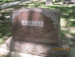
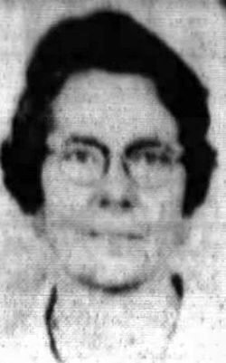
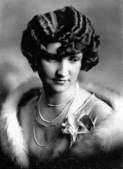
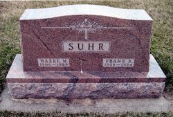
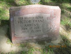
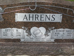
Anna Clara Sophie Suhr Ahrens
| Birth | : | 24 Jan 1898 Staplehurst, Seward County, Nebraska, USA |
| Death | : | 23 Feb 1944 Seward, Seward County, Nebraska, USA |
| Burial | : | Olive Lawn Memorial Park, La Mirada, Los Angeles County, USA |
| Coordinate | : | 33.9038700, -118.0114400 |
| Plot | : | Northwest Quarter |
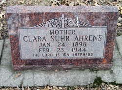
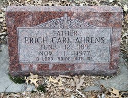
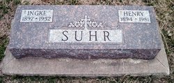
| Inscription | : | Mother Clara Suhr Ahrens Jan. 24, 1898 Feb. 23, 1944 The Lord is my shepherd |
| Description | : | Extract from the 1900 Census: Name: Clara Suhr Age at last birthday: 2 Date of birth: Jan 1898 Birthplace: Nebraska Race: white Sex: female Relationship to head-of-house: daughter Home in 1900: C Precinct, Seward, Nebraska Marital status: single Father's birthplace: Iowa Mother's birthplace: Nebraska Occupation: none Siblings living at home: Henry (age 4), Sophia (3), and Herbert (4/12) Census place: C Precinct, Seward, Nebraska; Roll: T623 940; Page: 7A; Enumeration District: 142 Date: 8 Jun 1900 Extract from the 1910 Census: Name: Clara Suhr Age in 1910: 12 Estimated birth year: 1898 Birthplace: Nebraska Race: white Sex: female Relationship to head of family: daughter Home in 1910: Precinct C, Seward, Nebraska Marital status: single Able to speak English: yes Able to read and write: yes Father's birthplace: Iowa Mother's... Read More |
frequently asked questions (FAQ):
-
Where is Anna Clara Sophie Suhr Ahrens's memorial?
Anna Clara Sophie Suhr Ahrens's memorial is located at: Olive Lawn Memorial Park, La Mirada, Los Angeles County, USA.
-
When did Anna Clara Sophie Suhr Ahrens death?
Anna Clara Sophie Suhr Ahrens death on 23 Feb 1944 in Seward, Seward County, Nebraska, USA
-
Where are the coordinates of the Anna Clara Sophie Suhr Ahrens's memorial?
Latitude: 33.9038700
Longitude: -118.0114400
Family Members:
Parent
Spouse
Siblings
Children
Flowers:
Nearby Cemetories:
1. Cinco Camp Burial Grounds
Cantil, Kern County, USA
Coordinate: 33.9277710, -118.0649960
2. Norwalk State Hospital Cemetery
Norwalk, Los Angeles County, USA
Coordinate: 33.9277710, -118.0649960
3. Olive Grove Cemetery
Whittier, Los Angeles County, USA
Coordinate: 33.9452300, -118.0511700
4. Little Lake Cemetery
Santa Fe Springs, Los Angeles County, USA
Coordinate: 33.9317900, -118.0779100
5. First Presbyterian Church Memorial Gardens
Fullerton, Orange County, USA
Coordinate: 33.8788600, -117.9417400
6. Saint Josephs Episcopal Church Columbarium
Buena Park, Orange County, USA
Coordinate: 33.8415590, -118.0280360
7. Paradise Memorial Park
Santa Fe Springs, Los Angeles County, USA
Coordinate: 33.9354540, -118.0869900
8. Artesia Cemetery
Cerritos, Los Angeles County, USA
Coordinate: 33.8717003, -118.0958023
9. Loma Vista Memorial Park
Fullerton, Orange County, USA
Coordinate: 33.9016991, -117.9167023
10. Forest Lawn Memorial Park
Cypress, Orange County, USA
Coordinate: 33.8339005, -118.0560989
11. Young Israel Cemetery
Norwalk, Los Angeles County, USA
Coordinate: 33.9071000, -118.1081300
12. Mount Olive Cemetery
Whittier, Los Angeles County, USA
Coordinate: 33.9869003, -118.0453033
13. Broadway Cemetery
Whittier, Los Angeles County, USA
Coordinate: 33.9868088, -118.0460434
14. Saint Andrews Episcopal Church Columbarium
Fullerton, Orange County, USA
Coordinate: 33.8745900, -117.9051200
15. Memory Garden Memorial Park
Brea, Orange County, USA
Coordinate: 33.9336014, -117.9024963
16. Holy Cross Cemetery
Anaheim, Orange County, USA
Coordinate: 33.8236885, -117.9422226
17. Long Beach Police Academy K-9 Cemetery
Long Beach, Los Angeles County, USA
Coordinate: 33.8274000, -118.0895300
18. Saint Marks Episcopal Church Columbarium
Downey, Los Angeles County, USA
Coordinate: 33.9491800, -118.1271200
19. Downey District Cemetery
Downey, Los Angeles County, USA
Coordinate: 33.9102783, -118.1399994
20. Rose Hills Memorial Park
Whittier, Los Angeles County, USA
Coordinate: 34.0139900, -118.0253400
21. Anaheim Cemetery
Anaheim, Orange County, USA
Coordinate: 33.8422012, -117.8981018
22. Queen of Heaven Cemetery
Rowland Heights, Los Angeles County, USA
Coordinate: 33.9818993, -117.9092026
23. El Campo Santo Cemetery
Industry, Los Angeles County, USA
Coordinate: 34.0182300, -117.9630500
24. Magnolia Memorial Park
Garden Grove, Orange County, USA
Coordinate: 33.7843895, -117.9755478

