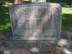
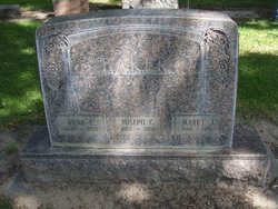
Anna E. Baker
| Birth | : | 1878 |
| Death | : | 9 Jun 1923 Boston, Suffolk County, Massachusetts, USA |
| Burial | : | Gap Hill Baptist Church Cemetery, Six Mile, Pickens County, USA |
| Coordinate | : | 34.8293991, -82.8613968 |
| Plot | : | Lot-923 Space-03 |
| Description | : | Buried-June 15,1923 Lot-923 Space-03 Anna E. Baker 1878-June 09,1923 The remains of Mrs. Joe Baker, who died Saturday at Boston, Mass., were brought to the city yesterday on Number 11. The funeral will be held this afternoon at 2:30 from the home at 109 East B Street. North Platte Trib., North Platte, Nebr., Fri., June 15,1923. |
frequently asked questions (FAQ):
-
Where is Anna E. Baker's memorial?
Anna E. Baker's memorial is located at: Gap Hill Baptist Church Cemetery, Six Mile, Pickens County, USA.
-
When did Anna E. Baker death?
Anna E. Baker death on 9 Jun 1923 in Boston, Suffolk County, Massachusetts, USA
-
Where are the coordinates of the Anna E. Baker's memorial?
Latitude: 34.8293991
Longitude: -82.8613968
Family Members:
Spouse
Flowers:
Nearby Cemetories:
1. Gap Hill Baptist Church Cemetery
Six Mile, Pickens County, USA
Coordinate: 34.8293991, -82.8613968
2. Stephens Family Cemetery
Pickens, Pickens County, USA
Coordinate: 34.8521060, -82.8735060
3. Cedar Hill Holiness Church Cemetery
Six Mile, Pickens County, USA
Coordinate: 34.8324530, -82.8202970
4. Keowee Baptist Church Cemetery
Six Mile, Pickens County, USA
Coordinate: 34.8613830, -82.8759000
5. Powers Family Cemetery
Pickens County, USA
Coordinate: 34.7966500, -82.8755170
6. Mount Olivet Wesleyan Church Cemetery
Six Mile, Pickens County, USA
Coordinate: 34.8121430, -82.8242680
7. Six Mile Baptist Church Cemetery
Six Mile, Pickens County, USA
Coordinate: 34.8074989, -82.8214035
8. Mile Creek Baptist Church Cemetery
Six Mile, Pickens County, USA
Coordinate: 34.8685989, -82.8469009
9. Rhonda Thigpen Gravesite
Six Mile, Pickens County, USA
Coordinate: 34.8575190, -82.8226080
10. Newton Family Cemetery
Six Mile, Pickens County, USA
Coordinate: 34.8667170, -82.8365170
11. Crow Creek Church of God Cemetery
Six Mile, Pickens County, USA
Coordinate: 34.8689700, -82.8392900
12. Old Pickens Cemetery
Old Pickens, Oconee County, USA
Coordinate: 34.7910995, -82.8867035
13. Craig Memorial Cemetery
Old Pickens, Oconee County, USA
Coordinate: 34.7914848, -82.8876801
14. Kings Grove Baptist Church Cemetery
Central, Pickens County, USA
Coordinate: 34.7829000, -82.8574000
15. Robert Morgan-Cannon Family
Central, Pickens County, USA
Coordinate: 34.7820850, -82.8521350
16. Little-Jenkins Cemetery
Oconee County, USA
Coordinate: 34.7883730, -82.8916650
17. Morgan Family Cemetery
Central, Pickens County, USA
Coordinate: 34.7825670, -82.8750170
18. Church of God of Prophecy Cemetery
Six Mile, Pickens County, USA
Coordinate: 34.7962860, -82.8183080
19. Mountain View Baptist Church Cemetery
Six Mile, Pickens County, USA
Coordinate: 34.8577995, -82.8080978
20. Stamp Creek Cemetery
Oconee County, USA
Coordinate: 34.8417015, -82.9250031
21. Isaqueena Church of God Cemetery
Oconee County, USA
Coordinate: 34.8645160, -82.9189680
22. Ellenburg-Holden Family Cemetery
Nine Times, Pickens County, USA
Coordinate: 34.8904260, -82.8667350
23. Hunnicutt Family Cemetery
Salem, Oconee County, USA
Coordinate: 34.8339350, -82.9378370
24. High Falls Cemetery
Oconee County, USA
Coordinate: 34.8013992, -82.9310989


