
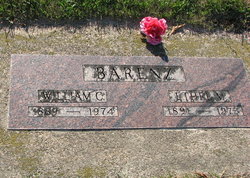
| Birth | : | 19 Nov 1887 Mitchell County, Iowa, USA |
| Death | : | 26 Jun 1905 Mitchell County, Iowa, USA |
| Burial | : | Penistone-Stottercliffe Cemetery, Penistone, Metropolitan Borough of Barnsley, England |
| Coordinate | : | 53.5276600, -1.6380900 |
| Description | : | Name: Anna K. Hawkins Death Date: 1905 Page #: 57 Birth Date: 1887 Cemetery: Wayne Town: McIntire Level Info: Mitchell County, Iowa Grave Records |
frequently asked questions (FAQ):
-
Where is Anna Kathryn Barenz Hawkins's memorial?
Anna Kathryn Barenz Hawkins's memorial is located at: Penistone-Stottercliffe Cemetery, Penistone, Metropolitan Borough of Barnsley, England.
-
When did Anna Kathryn Barenz Hawkins death?
Anna Kathryn Barenz Hawkins death on 26 Jun 1905 in Mitchell County, Iowa, USA
-
Where are the coordinates of the Anna Kathryn Barenz Hawkins's memorial?
Latitude: 53.5276600
Longitude: -1.6380900
Family Members:
Parent

Spouse
Siblings
Children
Flowers:


Nearby Cemetories:
1. Penistone-Stottercliffe Cemetery
Penistone, Metropolitan Borough of Barnsley, England
Coordinate: 53.5276600, -1.6380900
2. Netherfield Congregational Chapelyard
Penistone, Metropolitan Borough of Barnsley, England
Coordinate: 53.5313600, -1.6356700
3. St. John the Baptist Churchyard
Penistone, Metropolitan Borough of Barnsley, England
Coordinate: 53.5259280, -1.6296990
4. St. Saviours Churchyard
Thurlstone, Metropolitan Borough of Barnsley, England
Coordinate: 53.5268583, -1.6552996
5. Hoylandswaine Churchyard
Sheffield, Metropolitan Borough of Sheffield, England
Coordinate: 53.5431500, -1.6087800
6. St. John the Evangelist Churchyard
Denby Dale, Metropolitan Borough of Kirklees, England
Coordinate: 53.5608580, -1.6595360
7. St. James' Churchyard
Stocksbridge, Metropolitan Borough of Sheffield, England
Coordinate: 53.4919040, -1.6475040
8. Friends Meeting House
Penistone, Metropolitan Borough of Barnsley, England
Coordinate: 53.5627869, -1.6817849
9. Quaker Bottom Burial Ground
Huddersfield, Metropolitan Borough of Kirklees, England
Coordinate: 53.5633390, -1.6809182
10. Silkstone Cemetery
Barnsley, Metropolitan Borough of Barnsley, England
Coordinate: 53.5424410, -1.5629520
11. Holy Trinity Churchyard
Thurgoland, Metropolitan Borough of Barnsley, England
Coordinate: 53.5055900, -1.5669500
12. All Saints & St James Churchyard
Silkstone, Metropolitan Borough of Barnsley, England
Coordinate: 53.5485560, -1.5627890
13. Christ Church Churchyard
Stocksbridge, Metropolitan Borough of Sheffield, England
Coordinate: 53.4835600, -1.5975800
14. St. Nicholas' Churchyard
Upper Cumberworth, Metropolitan Borough of Kirklees, England
Coordinate: 53.5755000, -1.6827450
15. Cawthorne Cemetery
Barnsley, Metropolitan Borough of Barnsley, England
Coordinate: 53.5673699, -1.5713055
16. Skelmanthorpe Cemetery
Skelmanthorpe, Metropolitan Borough of Kirklees, England
Coordinate: 53.5884340, -1.6385120
17. Gatehead Methodist Chapelyard
Hepworth, Metropolitan Borough of Kirklees, England
Coordinate: 53.5497100, -1.7359500
18. St Augustine Churchyard
Scissett, Metropolitan Borough of Kirklees, England
Coordinate: 53.5896520, -1.6254190
19. Gatehead Primitive Methodist Chapelyard
Hepworth, Metropolitan Borough of Kirklees, England
Coordinate: 53.5494500, -1.7369400
20. Dodworth Cemetery
Barnsley, Metropolitan Borough of Barnsley, England
Coordinate: 53.5417500, -1.5331500
21. Skelmanthorpe Primitive Methodist Church Cemetery
Skelmanthorpe, Metropolitan Borough of Kirklees, England
Coordinate: 53.5928110, -1.6460640
22. St John the Baptist Church
Dodworth, Metropolitan Borough of Barnsley, England
Coordinate: 53.5410200, -1.5303300
23. St. Mary's Churchyard
Bolsterstone, Metropolitan Borough of Sheffield, England
Coordinate: 53.4673770, -1.5935860
24. All Saint's (Clayton West with High Hoyland)
Clayton West, Metropolitan Borough of Kirklees, England
Coordinate: 53.5946154, -1.6097522