
| Birth | : | 24 Oct 1876 Floyd County, Iowa, USA |
| Death | : | 2 Aug 1975 Charles City, Floyd County, Iowa, USA |
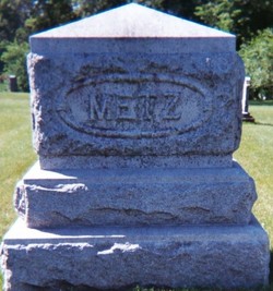
| Burial | : | Rudd Evergreen Cemetery, Rudd, Floyd County, USA |
| Coordinate | : | 43.1417007, -92.9214020 |
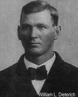
| Description | : | Married William Leo Birkholz on Oct 24, 1894. She married Wilhelm Louis Dieterichs after William passed away. She is buried next to William Birkholz. |
frequently asked questions (FAQ):
-
Where is Anna Marie Metz Dieterichs's memorial?
Anna Marie Metz Dieterichs's memorial is located at: Rudd Evergreen Cemetery, Rudd, Floyd County, USA.
-
When did Anna Marie Metz Dieterichs death?
Anna Marie Metz Dieterichs death on 2 Aug 1975 in Charles City, Floyd County, Iowa, USA
-
Where are the coordinates of the Anna Marie Metz Dieterichs's memorial?
Latitude: 43.1417007
Longitude: -92.9214020
Family Members:
Parent

Spouse

Siblings
Children
Flowers:


Nearby Cemetories:
1. Rudd Evergreen Cemetery
Rudd, Floyd County, USA
Coordinate: 43.1417007, -92.9214020
2. Rock Grove Township Cemetery
Nora Springs, Floyd County, USA
Coordinate: 43.1227989, -92.9880981
3. Ulsterville Cemetery
Ulster Township, Floyd County, USA
Coordinate: 43.0936012, -92.8842010
4. Park Cemetery
Nora Springs, Floyd County, USA
Coordinate: 43.1444016, -92.9982986
5. Eden Presbyterian Cemetery
Meroa, Mitchell County, USA
Coordinate: 43.2131004, -92.9103012
6. Spring Grove Cemetery
Nora Springs, Floyd County, USA
Coordinate: 43.1631012, -93.0211029
7. West End Cemetery
Meroa, Mitchell County, USA
Coordinate: 43.2216682, -92.9250031
8. Riverside Cemetery
Rockford, Floyd County, USA
Coordinate: 43.0578003, -92.9464035
9. Dudley Cemetery
Dudley (historical), Mitchell County, USA
Coordinate: 43.2252998, -92.8743973
10. Rock Creek Cemetery
Meroa, Mitchell County, USA
Coordinate: 43.2352791, -92.9225006
11. Calvary Cemetery
Osage, Mitchell County, USA
Coordinate: 43.2238998, -92.8300018
12. Flood Creek Cemetery
Floyd County, USA
Coordinate: 43.0391998, -92.8538971
13. Tucker Cemetery
Osage, Mitchell County, USA
Coordinate: 43.2494011, -92.8319016
14. West Saint Charles United Methodist Cemetery
Floyd County, USA
Coordinate: 43.0580597, -92.7897186
15. Orchard Cemetery
Orchard, Mitchell County, USA
Coordinate: 43.2249985, -92.7838898
16. Rock Falls Cemetery
Rock Falls, Cerro Gordo County, USA
Coordinate: 43.2122192, -93.0858307
17. Oakwood Cemetery
Floyd, Floyd County, USA
Coordinate: 43.1178017, -92.7307968
18. South Osage Mennonite Church Cemetery
Osage, Mitchell County, USA
Coordinate: 43.2544556, -92.7915573
19. Owens Grove Cemetery
Cerro Gordo County, USA
Coordinate: 43.0825005, -93.1144180
20. Saint Marys Catholic Cemetery
Roseville, Floyd County, USA
Coordinate: 43.0090000, -92.8134000
21. Sacred Heart Cemetery
Osage, Mitchell County, USA
Coordinate: 43.2742004, -92.7917023
22. Howardville Cemetery
Floyd, Floyd County, USA
Coordinate: 43.1866989, -92.7016983
23. Osage Cemetery
Osage, Mitchell County, USA
Coordinate: 43.2916700, -92.8201700
24. Oak Grove Cemetery
Mitchell, Mitchell County, USA
Coordinate: 43.3156013, -92.8707962