
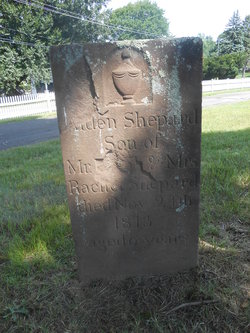
Ansel Penfield Shepard
| Birth | : | 12 Nov 1809 |
| Death | : | 20 Oct 1813 Portland, Middlesex County, Connecticut, USA |
| Burial | : | Saint John The Evangelist Cemetery, Enniskerry, Ottawa Municipality, Canada |
| Coordinate | : | 45.1995890, -75.5681330 |
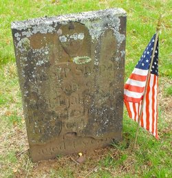
| Inscription | : | age 4 son of Elijah |
| Description | : | Elijah, son of Thomas and Mercy (Sears) Shepard, was born March 18, 1782, at Chatham ; married November 20, 1806, Rachel, daughter of Simeon and Penelope (Eddy) Penfield, of Chatham. She was born February 28, 1780. Simeon Penfield, father of Rachel, was born about 1755, at Chatham, was a soldier in the revolution, a pensioner on the list of 1832 and again in 1840, when his age was given as eighty-five. The Penfields were numerous in Chatham and gave their name to Penfield Hill, where they lived. The family of Elijah Shepard belonged to the Episcopal Church. He is said... Read More |
frequently asked questions (FAQ):
-
Where is Ansel Penfield Shepard's memorial?
Ansel Penfield Shepard's memorial is located at: Saint John The Evangelist Cemetery, Enniskerry, Ottawa Municipality, Canada.
-
When did Ansel Penfield Shepard death?
Ansel Penfield Shepard death on 20 Oct 1813 in Portland, Middlesex County, Connecticut, USA
-
Where are the coordinates of the Ansel Penfield Shepard's memorial?
Latitude: 45.1995890
Longitude: -75.5681330
Family Members:
Parent

Siblings
Flowers:


Nearby Cemetories:
1. Saint John The Evangelist Cemetery
Enniskerry, Ottawa Municipality, Canada
Coordinate: 45.1995890, -75.5681330
2. Jewish Memorial Gardens Osgoode Cemetery
Herbert Corners, Ottawa Municipality, Canada
Coordinate: 45.2138800, -75.5750100
3. Ottawa Muslim Cemetery
Ottawa, Ottawa Municipality, Canada
Coordinate: 45.2252810, -75.6147670
4. Prescott Road Union Cemetery
Osgoode, Ottawa Municipality, Canada
Coordinate: 45.1574840, -75.5709650
5. Saint Brigid Cemetery
Manotick, Ottawa Municipality, Canada
Coordinate: 45.1997980, -75.6381000
6. All Saints Anglican Cemetery
Greely, Ottawa Municipality, Canada
Coordinate: 45.2623530, -75.5616210
7. Springhill Cemetery
Spring Hill, Ottawa Municipality, Canada
Coordinate: 45.1926080, -75.4766540
8. Rideauvale Cemetery
Kars, Ottawa Municipality, Canada
Coordinate: 45.1545944, -75.6493225
9. Saint Catherine's Cemetery
Metcalfe, Ottawa Municipality, Canada
Coordinate: 45.2337900, -75.4684300
10. Elmview Cemetery
Kars, Ottawa Municipality, Canada
Coordinate: 45.1438890, -75.6463890
11. Metcalfe Union Cemetery
Metcalfe, Ottawa Municipality, Canada
Coordinate: 45.2377510, -75.4691650
12. Our Lady of the Visitation Roman Catholic Cemetery
South Gloucester, Ottawa Municipality, Canada
Coordinate: 45.2868850, -75.5745540
13. Johnston's Corners Community Cemetery
Johnston Corners, Ottawa Municipality, Canada
Coordinate: 45.2854600, -75.6028900
14. Reid's Mills Cemetery
Osgoode, Ottawa Municipality, Canada
Coordinate: 45.1036300, -75.5520500
15. Long Island Union United Church Cemetery
Manotick, Ottawa Municipality, Canada
Coordinate: 45.2465090, -75.6933150
16. Presbyterian Cemetery
Gloucester, Ottawa Municipality, Canada
Coordinate: 45.2965700, -75.6099030
17. Wesleyan Methodist Cemetery
Manotick, Ottawa Municipality, Canada
Coordinate: 45.2480780, -75.6958780
18. Metcalfe burial grounds
Kenmore, Ottawa Municipality, Canada
Coordinate: 45.2259300, -75.4214100
19. Capital Memorial Gardens
Ottawa, Ottawa Municipality, Canada
Coordinate: 45.2559830, -75.7087930
20. Moodie Cemetery
Gloucester Glen, Ottawa Municipality, Canada
Coordinate: 45.2709330, -75.7009320
21. United Church Cemetery
Ottawa Municipality, Canada
Coordinate: 45.3241610, -75.5951953
22. Holy Trinity Anglican Church Cemetery
North Gower, Ottawa Municipality, Canada
Coordinate: 45.1261110, -75.7155560
23. Hope Cemetery
Gloucester, Ottawa Municipality, Canada
Coordinate: 45.3257300, -75.5984400
24. North Gower Union Cemetery
North Gower, Ottawa Municipality, Canada
Coordinate: 45.1313890, -75.7219440